Wokha
| Wokha | |
|---|---|
| city | |
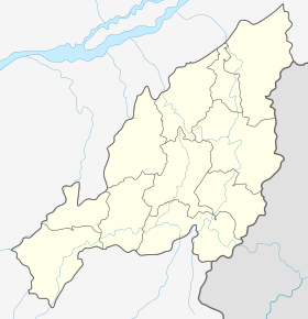 Wokha Location in Nagaland, India | |
| Coordinates: 26°06′N 94°16′E / 26.1°N 94.27°ECoordinates: 26°06′N 94°16′E / 26.1°N 94.27°E | |
| Country |
|
| State | Nagaland |
| District | Wokha |
| Elevation | 1,313 m (4,308 ft) |
| Population (2011)[1] | |
| • Total | 70,008 |
| • Rank | 3rd in Nagaland |
| Languages | |
| • Official | English |
| Time zone | IST (UTC+5:30) |
Wokha is a town and a town area committee in Wokha district in the Indian state of Nagaland. It is the third largest town in Nagaland. The word Wokha is derived from the Lotha language word for census. It is the district headquarters of Lotha Nagas, who commonly call themselves Kyong. Wokha is situated just below the legendary Naga Mountain peak of Mount Tiyi (elevation 1968 m).
History
In 1876 the British Government occupied Wokha as the district headquarters of the Naga Hills under Assam. By 1878 the headquarters was shifted to Kohima, but Wokha remained a subdivision. Later in 1889 the subdivision was shifted to Mokokchung. In 1957 Wokha became a subdivision again.
Geography and climate
Wokha is located at 26°06′N 94°16′E / 26.1°N 94.27°E[2] at an average elevation of 1,313 metres (4,793 feet). It has a warm temperate climate (classified as Cwa by Köppen and Geiger). The summer temperature of Wokha ranges from 16.1 °C to 32 °C. The winter temperature reaches a minimum of 2 °C. The average annual temperature in Wokha is 17.8 °C. The average annual rainfall is 1940 mm.
Demographics
Wokha is the third largest town in Nagaland after Dimapur and Kohima. According to the 2011 census, the population is 70,004. Wokha has an average literacy rate of 85.67%; male literacy is 86.98%, while female literacy is 84.26%. In Wokha, 10.57% of the population is under 6 years of age. Kyong (Lotha) is the most widely used language for communication, while Nagamese (broken Assamese) and English are also used with non-locals. The majority of the population is Christian, mostly adhering to the Baptist denomination.
Tourism

Wokha's agglomeration consists of Wokha town, Longsa village, Wokha village and Vakhosung. It has a combined population of over 80,000. Wokha is on the main route from Kohima to Mokokchung and was one of the earliest locations of the Assam Rifles. The Government of Nagaland constructed a tourist lodge in Wokha Town. The annual Amur falcon migration passes Doyang Dam, which is a 2 hour drive away. It also hosts the oldest cricket tournament in North East India, The Winter Cricket Challenge. The nearest railhead is Furkating Railway Station in Golaghat, Assam and the nearest airport is Dimapur Airport (IATA: DMU, ICAO: VEMR). Taxis and buses are available from every district headquarter in Nagaland to Wokha. There is a helicopter service from Dimapur.
Myths
Mount Tiyi is a hill which has supernatural legends associated with it. Most Nagas believe that this mountain is the abode of departed souls. According to local Lotha folklore, the mountain had an orchard that could only be found by the 'lucky ones.' Rhododendrons are common on Mount Tiyi.
References
- ↑ "Census of India: Search Details". Censusindia.gov.in. Retrieved 20 October 2014.
- ↑ "Falling Rain Genomics, Inc - Wokha". Fallingrain.com. Retrieved 20 October 2014.