Wittmann, Arizona
| Wittmann, Arizona | |
|---|---|
| Census-designated place | |
|
Wittmann Fire Station at Pattton Road | |
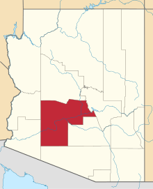
 Location in Maricopa County and the state of Arizona | |
| Coordinates: 33°46′35″N 112°31′43″W / 33.77639°N 112.52861°WCoordinates: 33°46′35″N 112°31′43″W / 33.77639°N 112.52861°W | |
| Country | United States |
| State | Arizona |
| County | Maricopa |
| Population (2010) | |
| • Total | 763 |
| Time zone | Mountain (MST) (UTC-7) |

Wittmann is a census-designated place in Maricopa County, Arizona, United States. It is located along U.S. Route 60 in the central part of Arizona, about 35 miles northwest of central Phoenix, and while technically located within the city's metropolitan area it is generally regarded by locals to be just outside of it. As of the 2010 census, there were 763 people living in the CDP.
Wittmann is located in an area of rapid growth and the locale has suffered from numerous growing pains. The Nadaburg Elementary School District located in Wittmann, which had long been considered a small, rural school, was forced to construct a larger, modernized school in 2004 to accommodate the influx of students and the district is already planning for a second school nearby. Increased traffic along Highway 60 necessitated a widening of the highway. The highway's location parallel to the BNSF railway unfortunately meant that the widening would claim a number of homes and local businesses, including the only prominent service station between Phoenix and Wickenburg, as well as the community's landmark overpass footbridge servicing the elementary school.
Past efforts to incorporate the community failed largely due to opposition from local landowners and thus there has been no real local government or planning agency. The nearby city of Surprise has in recent years annexed much of the land near and around the town, and has included it as part of the city's general plan. This has effectively removed any chance that the town might incorporate at some point in the future.
The summer of 2010 looked promising for the town of Wittmann when the new Shell Gas station was opened along US 60 near 211th Ave. This has brought an increasing volume of traffic through the area.
Demographics
As of the census[1] of 2010, there were 763 people residing in the CDP. The population density was 803.8 people per square mile. The racial makeup of the CDP was 81.91% White, 0.13% Black or African American, 1.70% Native American, 0.66% Asian, 0.52% Pacific Islander, 12.98% from other races, and 2.10% from two or more races. 39.19% of the population were Hispanic or Latino of any race.
| |||||||||||||||||||||||||||||||||||||