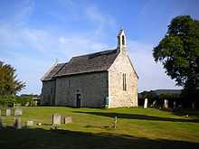
Wiston, West Sussex
| Wiston | |
 Wiston |
|
| Area | 13.60 km2 (5.25 sq mi) [1] |
|---|---|
| Population | 221 [1] 2001 Census |
| – density | 16/km2 (41/sq mi) |
| OS grid reference | TQ143142 |
| – London | 42 miles (68 km) NNE |
| Civil parish | Wiston |
| District | Horsham |
| Shire county | West Sussex |
| Region | South East |
| Country | England |
| Sovereign state | United Kingdom |
| Post town | STEYNING |
| Postcode district | BN44 |
| Dialling code | 01903 |
| Police | Sussex |
| Fire | West Sussex |
| Ambulance | South East Coast |
| EU Parliament | South East England |
| UK Parliament | Arundel and South Downs |
|
|
Coordinates: 50°54′58″N 0°22′26″W / 50.91613°N 0.37401°W
Wiston is a scattered village and civil parish in the Horsham District of West Sussex, England. It lies on the A283 road 2.8 miles (4.5 km) northwest of Steyning.
The parish covers an area of 1,360 hectares (3,400 acres). In the 2001 census 221 people lived in 86 households, of whom 120 were economically active.[1]
Landmarks
Chanctonbury Ring, a hill fort based ring of trees atop Chanctonbury Hill on the South Downs, lies on the border of the parish and the neighbouring parish of Washington. Chanctonbury Hill is a Site of Special Scientific Interest as an uncommon woodland type on a chalk escarpment, providing habitat for many species including the protected Great Crested Newt.[2]
Notes
- ↑ 1.0 1.1 1.2 "2001 Census: West Sussex – Population by Parish" (PDF). West Sussex County Council. Retrieved 12 April 2009.
- ↑ "SSSI Citation — Chanctonbury Hill" (PDF). Natural England. Retrieved 4 April 2009.
 |
Ashington | Dial Post | Ashurst | |
| Rock, Washington | |
across the River Adur Small Dole | ||
| ||||
| | ||||
| Findon, West Sussex | Buncton | Steyning /stɛnɪŋ/ |
References
| Wikimedia Commons has media related to Wiston, West Sussex. |
| ||||||||||||||