Winterborne Stickland
| Winterborne Stickland | |
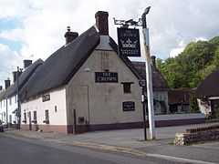 The Crown Inn, Winterborne Stickland |
|
 Winterborne Stickland |
|
| Population | 520 |
|---|---|
| OS grid reference | ST835046 |
| District | North Dorset |
| Shire county | Dorset |
| Region | South West |
| Country | England |
| Sovereign state | United Kingdom |
| Police | Dorset |
| Fire | Dorset |
| Ambulance | South Western |
| EU Parliament | South West England |
Coordinates: 50°50′26″N 2°14′07″W / 50.8405°N 2.2353°W
Winterborne Stickland is a village and civil parish in the county of Dorset in southern England. It lies within the North Dorset administrative district, about 4 miles (6.4 km) west of the town of Blandford Forum. In 2013 the civil parish had an estimated population of 520.[1] In the 2011 census the parish, combined with the smaller neighbouring parishes of Winterborne Clenston to the south and Turnworth to the north, recorded a population of 653.[2]
Winterborne Stickland is sited in a winterbourne valley in the Dorset Downs, which gives rise to the first part of its name. The second part "Stickland" is derived from sticol, Old English for "steep".[3]
To the north of the village is a children's playground, cricket pitch and football pitch with clubhouse. To the north of that a small orchard of apple, pear and plum trees has been planted.
References
- ↑ "Parish Population Data". Dorset County Council. 20 January 2015. Retrieved 8 February 2015.
- ↑ "Neighbourhood Statistics. Area: Winterborne Stickland (Parish). Key Figures for 2011 Census: Key Statistics". Office for National Statistics. Retrieved 18 November 2013.
- ↑ Roland Gant (1980). Dorset Villages. Robert Hale Ltd. p. 78. ISBN 0 7091 8135 3.
External links
| Wikimedia Commons has media related to Winterborne Stickland. |
