Winston, Missouri
| Winston, Missouri | |
|---|---|
| Village | |
 Location of Winston, Missouri | |
| Coordinates: 39°52′15″N 94°8′28″W / 39.87083°N 94.14111°WCoordinates: 39°52′15″N 94°8′28″W / 39.87083°N 94.14111°W | |
| Country | United States |
| State | Missouri |
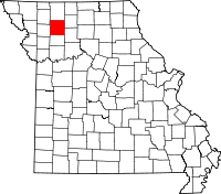
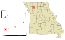
| County | Daviess |
| Area[1] | |
| • Total | 0.31 sq mi (0.80 km2) |
| • Land | 0.31 sq mi (0.80 km2) |
| • Water | 0 sq mi (0 km2) |
| Elevation | 1,050 ft (320 m) |
| Population (2010)[2] | |
| • Total | 259 |
| • Estimate (2012[3]) | 253 |
| • Density | 835.5/sq mi (322.6/km2) |
| Time zone | Central (CST) (UTC-6) |
| • Summer (DST) | CDT (UTC-5) |
| ZIP code | 64689 |
| Area code(s) | 660 |
| FIPS code | 29-80548[4] |
| GNIS feature ID | 0730251[5] |

Winston is a village in Daviess County, Missouri. The population was 259 at the 2010 census.
History
The village of Winston is named for General Joseph W. Winston, son of Colonel Joseph Winston, an American Revolutionary War soldier and patriot for whom the city of Winston-Salem, North Carolina, is partly named. Major Winston's son Joseph W. served in the War of 1812 and was later appointed a Major General in the North Carolina militia forces. He came to the Platte Purchase territory in Missouri in 1838, where he and his wife settled seven miles southeast of Platte City.[6]
The town of Winston had its start in the year 1871 by the building of the railroad through that territory.[7]
Geography
Winston is located at 39°52′15″N 94°08′28″W / 39.870925°N 94.141014°W.[8]
According to the United States Census Bureau, the village has a total area of 0.31 square miles (0.80 km2), all of it land.[1]
Demographics
2010 census
As of the census[2] of 2010, there were 259 people, 95 households, and 69 families residing in the village. The population density was 835.5 inhabitants per square mile (322.6/km2). There were 111 housing units at an average density of 358.1 per square mile (138.3/km2). The racial makeup of the village was 97.3% White, 1.2% African American, 0.4% Native American, 0.8% from other races, and 0.4% from two or more races. Hispanic or Latino of any race were 0.8% of the population.
There were 95 households of which 40.0% had children under the age of 18 living with them, 49.5% were married couples living together, 11.6% had a female householder with no husband present, 11.6% had a male householder with no wife present, and 27.4% were non-families. 24.2% of all households were made up of individuals and 5.3% had someone living alone who was 65 years of age or older. The average household size was 2.73 and the average family size was 3.04.
The median age in the village was 35.5 years. 30.9% of residents were under the age of 18; 5.3% were between the ages of 18 and 24; 24.7% were from 25 to 44; 27.4% were from 45 to 64; and 11.6% were 65 years of age or older. The gender makeup of the village was 50.6% male and 49.4% female.
2000 census
As of the census[4] of 2000, there were 247 people, 97 households, and 67 families residing in the village. The population density was 798.8 people per square mile (307.6/km²). There were 111 housing units at an average density of 359.0 per square mile (138.2/km²). The racial makeup of the village was 97.98% White and 2.02% Native American. Hispanic or Latino of any race were 1.62% of the population.
There were 97 households out of which 32.0% had children under the age of 18 living with them, 53.6% were married couples living together, 14.4% had a female householder with no husband present, and 30.9% were non-families. 27.8% of all households were made up of individuals and 13.4% had someone living alone who was 65 years of age or older. The average household size was 2.55 and the average family size was 3.06.
In the village the population was spread out with 27.5% under the age of 18, 11.3% from 18 to 24, 23.5% from 25 to 44, 25.5% from 45 to 64, and 12.1% who were 65 years of age or older. The median age was 37 years. For every 100 females there were 79.0 males. For every 100 females age 18 and over, there were 79.0 males.
The median income for a household in the village was $30,125, and the median income for a family was $32,917. Males had a median income of $28,125 versus $19,375 for females. The per capita income for the village was $13,283. About 7.7% of families and 8.9% of the population were below the poverty line, including 8.5% of those under the age of eighteen and 7.1% of those sixty five or over.
References
- ↑ 1.0 1.1 "US Gazetteer files 2010". United States Census Bureau. Retrieved 2012-07-08.
- ↑ 2.0 2.1 "American FactFinder". United States Census Bureau. Retrieved 2012-07-08.
- ↑ "Population Estimates". United States Census Bureau. Retrieved 2013-05-30.
- ↑ 4.0 4.1 "American FactFinder". United States Census Bureau. Retrieved 2008-01-31.
- ↑ "US Board on Geographic Names". United States Geological Survey. 2007-10-25. Retrieved 2008-01-31.
- ↑ William McClung Paxton (1897). Annals of Platte County, Missouri, From Its Exploration Down to June 1, 1897. Hudson-Kimberly Publishing Co.
- ↑ Earngey, Bill (1995). Missouri Roadsides: The Traveler's Companion. University of Missouri Press. p. 99.
- ↑ "US Gazetteer files: 2010, 2000, and 1990". United States Census Bureau. 2011-02-12. Retrieved 2011-04-23.
| |||||||||||||||||||||||||||||