Wingfield Township, Geary County, Kansas
| Wingfield Township | |
|---|---|
| Township | |
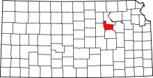
 Location in Geary County | |
| Coordinates: 39°00′55″N 096°39′01″W / 39.01528°N 96.65028°WCoordinates: 39°00′55″N 096°39′01″W / 39.01528°N 96.65028°W | |
| Country | United States |
| State | Kansas |
| County | Geary |
| Area | |
| • Total | 47.61 sq mi (123.32 km2) |
| • Land | 47.61 sq mi (123.32 km2) |
| • Water | 0 sq mi (0 km2) 0% |
| Elevation | 1,368 ft (417 m) |
| Population (2000) | |
| • Total | 139 |
| • Density | 2.9/sq mi (1.1/km2) |
| GNIS feature ID | 0476722 |
Wingfield Township is a township in Geary County, Kansas, USA. As of the 2000 census, its population was 139.
Geography
Wingfield Township covers an area of 47.61 square miles (123.3 km2) and contains no incorporated settlements. According to the USGS, it contains two cemeteries: Humboldt and Saint Marys.
The streams of East McDowell Creek, MacArthur Branch, Pressee Branch, Swede Creek, Thierer Branch and West McDowell Creek run through this township.
References
External links
| |||||||||||||||||||||||||||||