Wilmington, North Carolina
| Wilmington, North Carolina | |||
|---|---|---|---|
| City | |||
|
Downtown Wilmington from across the Cape Fear River | |||
| |||
 Location of Wilmington | |||
| Coordinates: 34°13′24″N 77°54′44″W / 34.22333°N 77.91222°WCoordinates: 34°13′24″N 77°54′44″W / 34.22333°N 77.91222°W | |||
| Country | United States | ||
| State | North Carolina | ||
| County | New Hanover | ||
| Incorporated | February 20, 1739/40 | ||
| Government | |||
| • Mayor | Bill Saffo | ||
| Area | |||
| • City | 41.5 sq mi (107.4 km2) | ||
| • Land | 41.0 sq mi (106.2 km2) | ||
| • Water | 0.5 sq mi (1.2 km2) | ||
| Elevation | 30 ft (9 m) | ||
| Population (2012) | |||
| • City | 112,067 (US: 243th) | ||
| • Density | 1,849.8/sq mi (714.2/km2) | ||
| • Urban | 219,957 (US: 161th) | ||
| • Metro | 263,429 (US: 175th) | ||
| Demonym | Wilmingtonian | ||
| Time zone | Eastern (EST) (UTC-5) | ||
| • Summer (DST) | EDT (UTC-4) | ||
| ZIP codes | 28401-28412 | ||
| Area code(s) | 910 | ||
| FIPS code | 37-74440 | ||
| GNIS feature ID | 1023269[1] | ||
| Sister cities |
Dandong, Liaoning, China Doncaster, South Yorkshire, United Kingdom Bridgetown, Barbados San Pedro Town, Belize | ||
| Website | http://www.wilmingtonnc.gov/ | ||


Wilmington is a port city in — and is the county seat of — New Hanover County in coastal southeastern North Carolina, United States.[2] The population is 112,067; according to the 2010 Census it is the eighth most populous city in the state. Wilmington is the principal city of the Wilmington Metropolitan Statistical Area, a metropolitan area that includes New Hanover and Pender counties in southeastern North Carolina,[3] which has a population of 263,429 as of the 2012 Census Estimate.
Wilmington was settled by European Americans along the Cape Fear River. Its historic downtown has a one-mile-long Riverwalk, originally developed as a tourist attraction, and in 2014 Wilmington's riverfront was named the "Best American Riverfront" by USA Today.[4] It is minutes away from nearby beaches. The National Trust for Historic Preservation named Wilmington, North Carolina, as one of its 2008 Dozen Distinctive Destinations.[5] City residents live between the river and the ocean, with four nearby beach communities: Fort Fisher, Wrightsville Beach, Carolina Beach, and Kure Beach, all within half-hour drives from downtown Wilmington.
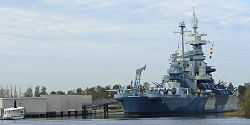
In 2003 the city was designated by the US Congress as a "Coast Guard City".[6] It is home port for the USCGC Diligence, a United States Coast Guard medium endurance cutter.[7] The World War II battleship USS North Carolina is held as a war memorial. Located across from the downtown port area, the ship is open to public tours. Other attractions include the Cape Fear Museum, the Wilmington Hammerheads United Soccer Leagues soccer team, and the training camp site for the Charlotte Hornets. The University of North Carolina Wilmington (UNCW) provides a wide variety of programs for undergraduates, graduate students, and adult learners, in addition to cultural and sports events open to the community.
Wilmington is the home of EUE Screen Gems Studios, the largest domestic television and movie production facility outside of California. "Dream Stage 10," the facility's newest sound stage, is the third-largest in the US. It houses the largest special-effects water tank in North America. Since the studio's opening in 1984, Wilmington has become a major center of American film and television production. Numerous movies in a range of genres and several television series, including Iron Man 3, Fox's Sleepy Hollow and NBC's Revolution, have been produced there.
History
Colonial beginnings

The area had long been inhabited by various cultures of indigenous peoples; at the time of European encounter, historic Native Americans were tribes belonging to the Algonquian languages family.
The ethnic European and African history of Wilmington spans more than two and a half centuries. Giovanni da Verrazano is reportedly the first European to observe the area, including the city's present site, in the early 16th century. The first permanent European settlement in the area came in the 1720s when English colonists began settling the area. In September 1732, a community was founded on land owned by John Watson on the Cape Fear River, at the confluence of its northwest and northeast branches.[8] The settlement, founded by the first royal governor, George Burrington, was called "New Carthage," and then "New Liverpool;" it gradually took on the name "New Town" or "Newton".[9] Governor Gabriel Johnston soon after established his provincial government there for the North Carolina colony. In 1739 or 1740, the town was incorporated with a new name, Wilmington, in honor of Spencer Compton, Earl of Wilmington.[10]
Some early settlers of Wilmington came from the Albemarle and Pamlico regions, as well as from the colonies of Virginia and South Carolina, but most new settlers arrived from the northern colonies, the West Indies, and the British Isles.[11] Many of the settlers were indentured servants, mainly from the British Isles and northern Europe. As the indentured servants gained their freedom, the colonists imported an increasing number of (permanent and much less expensive) African slaves as laborers into the port city.[9] By 1767, slaves accounted for more than 62% of the population of the Lower Cape Fear region.[12] Many worked in the port as laborers, and some in ship-related trades.
Naval stores and lumber fueled the region's economy, both before and after the American Revolution. During the Revolutionary War, the British maintained a garrison at Fort Johnson near Wilmington.
Revolutionary era
Wilmington's commercial importance as a major port afforded it a critical role in opposition to the British in the years leading up to the Revolution. Additionally, the city was home to outspoken political leaders who influenced and led the resistance movement in North Carolina. The foremost of these was Wilmington resident Cornelius Harnett, who served in the General Assembly at the time, where he rallied opposition to the Sugar Act in 1764. When the British Parliament passed the Stamp Act the following year, designed to raise revenue for the Crown with a kind of tax, Wilmington was the site of an elaborate demonstration against it.
On October 19, 1765, several hundred townspeople gathered in protest of the new law, burned an effigy of one town resident who favored the act, and toasted to "Liberty, Property, and No Stamp Duty." On October 31, another crowd gathered in a symbolic funeral of "Liberty". But before the effigy was buried, it was found that Liberty still had a pulse, and celebration ensued.[13][14]
Dr. William Houston of Duplin County was appointed Stamp Receiver for Cape Fear. When Houston visited Wilmington on business, still unaware of his appointment, he recounted,
"The Inhabitants immediately assembled about me & demanded a Categorical Answer whether I intended to put the Act relating [to] the Stamps in force. The Town Bell was rung[,] Drums [were] beating, Colours [were] flying and [a] great concourse of People [were] gathered together." For the sake of his own life, and "to quiet the Minds of the inraged [sic] and furious Mobb...," Houston resigned his position at the courthouse.[13][15]
Governor William Tryon made attempts to mitigate the opposition to no avail. On November 18, 1765, he pled his case directly to prominent residents of the area. They said the law restricted their rights. When the stamps arrived on November 28 on the H.M. Sloop Diligence, Tryon ordered them to be kept on board. Shipping on the Cape Fear River was stopped, as were the functions of the courts.[13]
Tryon, after having received his official commission as governor (a position he had only assumed after the death of Arthur Dobbs), was brought to Wilmington by Captain Constantine Phipps on a barge from the Diligence, and "was received cordially by the gentlemen of the borough." He was greeted with the firing of seventeen pieces of artillery, and the New Hanover County regiment of militia who had lined the streets. This "warm welcome" was spoiled, however, after a dispute arose between Captain Phipps and captains of ships in the harbor regarding the display of their colors. The townspeople became infuriated with Phipps and threats were made against both sides. After Tryon harangued them for their actions, the townspeople gathered around the barrels of punch and ox he had brought as refreshments. The barrels were broken open, letting the punch spill into the streets; they threw the head of the ox into the pillory, and gave its body to the slaves. Tryon moved his seat of government to New Bern instead of Wilmington.[9][16]
On February 18, 1766, two merchant ships arrived at Brunswick Town, without stamped papers. Each ship provided signed statements from the collectors at their respective ports of origin that there were no stamps available, but Captain Jacob Lobb of the British cruiser Viper seized the vessels. In response, numerous residents from southern counties met in Wilmington. The group organized as the Sons of Liberty and pledged to block implementation of the Stamp Act. The following day, as many as a thousand men, including the mayor and aldermen of Wilmington, were led by Cornelius Harnett to Brunswick to confront Tryon. The governor was unyielding to their defiance but a mob retrieved the seized ships. They forced royal customs officers and public officials in the region to swear never to issue stamped paper. Parliament repealed the Stamp Act in March 1766.
Antebellum period
In the 1830s, citizens of Wilmington became eager to take advantage of railroad transportation. Plans were developed to build a railroad line from the capital of Raleigh to Wilmington. This was later changed when the citizens of Raleigh did not care to make the venture of a stock subscription to secure the railroad. The end point was changed to Weldon. When construction of the railroad line was finally completed in 1840, it was the longest single line of railroad track in the world. The railroad also controlled a line of steamboats that ran from Wilmington to Charleston; it was widely used for passenger travel and transportation of freight. Regular boat lines served Fayetteville, and packet lines traveled to northern ports. The city was a main stop-over point, contributing greatly to its commerce.[9]
By mid-century, the churchyard of St. James Episcopal Church and other town cemeteries had become filled with graves. On November 16, 1853, a group of citizens, organized as "The Proprietors of the Wilmington Cemetery," was formed to develop a new cemetery. Sixty-five acres of land around Burnt Mill Creek was chosen as the site for what would be called Oakdale Cemetery. It was the first rural cemetery in North Carolina. The cemetery's first interment, on February 6, 1855, was six-year-old Annie deRosset.[17] Many remains from St. James churchyard were relocated to the new cemetery.
The Wilmington Gas Light Company was established in 1854. Soon after, street lights were powered by gas made from lightwood and rosin, replacing the old street oil lamps. On December 27, 1855, the first cornerstone was laid and construction began on a new City Hall. A grant from the Thalian Association funded the attached opera house, named Thalian Hall. The city opened its first public school, named the "Union Free School", in 1857 on 6th Street between Nun and Church Streets.[18]

Civil War

During the Civil War, the port was the major and busiest base for Confederate and privately owned blockade runners delivering badly needed supplies from England. It was captured by Union forces in the Battle of Wilmington in February 1865, approximately one month after the fall of Fort Fisher had closed the port. As nearly all the military action took place some distance from the city, a number of antebellum houses and other buildings survived the war years.
Wilmington Insurrection of 1898
The Wilmington Insurrection of 1898 (formerly called a race riot) occurred as a result of the racially charged political conflict that had occurred in the decades after the Civil War and efforts to establish white supremacy. In the 1870s, the Red Shirts, a white paramilitary organization, used violence and intimidation to suppress black voting, helping Democrats to regain power in the state legislature and end Reconstruction. In 1898, a cadre of white Democrats, professionals and businessmen, planned to overthrow the city government if their candidates were not elected. Two days after the election, more than 1500 white men attacked and burned the only black newspaper in the state and ran off the white Republican mayor and aldermen (both white and black), overthrowing the legitimately elected municipal government. This is the only such coup d'état in United States history.[19]
On November 10, 1898, nearly 1500 white men, led by the Democrat Alfred M. Waddell, an unsuccessful gubernatorial candidate in 1896, marched to the offices of the Daily Record, as they had been angered by its publisher Alex Manly. The mob broke out of control, shattering windows and setting fire to the building. Violence later broke out across town in Brooklyn, the black neighborhood that was attacked by mobs of whites. Waddell and his men forced the elected Republican city officials to resign at gunpoint and replaced them with men selected by leading white Democrats. Waddell was elected mayor by the newly seated board of aldermen that day. Prominent African Americans and white Republicans were banished from the city in the following days.[19]
Whites attacked and killed an estimated 10-100 blacks. No whites died in the violence. As a result of the attacks, more than 2100 blacks permanently left the city, leaving a hole among its professional and middle class. It became majority white, rather than the majority black it was before the white Democrats' coup.[19]
Following these events, the North Carolina legislature passed a new constitution with voter registration requirements for poll taxes and literacy tests that effectively disfranchised black voters, following the example of the state of Mississippi. Blacks were essentially disfranchised until after Congressional passage of the civil rights acts of the mid-1960s.[19]
20th century


World War II
During World War II, Wilmington was the home of the North Carolina Shipbuilding Company. The shipyard was created as part of the U.S. government's Emergency Shipbuilding Program. Workers built 243 ships in Wilmington during the five years the company operated.
The city was the site of three prisoner-of-war (POW) camps from February 1944 through April 1946. At their peak, the camps held 550 German prisoners. The first camp was located on the corner of Shipyard Boulevard and Carolina Beach Road; it was moved downtown to Ann Street, between 8th and 10th avenues, when it outgrew the original location. A smaller contingent of prisoners was assigned to a third site, working in the officers’ mess and doing grounds keeping at Bluethenthal Army Air Base, which is now Wilmington International Airport.
National Register of Historic Places
The Audubon Trolley Station, Brookwood Historic District, Carolina Heights Historic District, Carolina Place Historic District, City Hall/Thalian Hall, Delgrado School, Federal Building and Courthouse, Fort Fisher, Gabriel's Landing, William Hooper School (Former), Market Street Mansion District, Masonboro Sound Historic District, Moores Creek National Battlefield, Sunset Park Historic District, USS NORTH CAROLINA (BB-55) National Historic Landmark, James Walker Nursing School Quarters, Westbrook-Ardmore Historic District, Wilmington Historic District, and Wilmington National Cemetery are listed on the National Register of Historic Places.[20]
Geography

Wilmington is located at 34°13′24″N 77°54′44″W / 34.22333°N 77.91222°W (34.223232, −77.912122).[21] It is the Eastern Terminus of a major East-West Interstate 40 which ends at Barstow, California, where it joins I-15, the Gateway to Southern California, some 2,554 miles away, passing through many major cities and state capitals along the way.
According to the United States Census Bureau, the city has a total area of 41.5 square miles (107 km2). 41.0 square miles (106 km2) of it is land and 0.5 square miles (1.3 km2) of it (1.16%) is water.
Climate
Wilmington has a humid subtropical climate (Köppen Cfa), with the following characteristics:
- Winters are generally mild with January highs in the mid 50s °F (11–14 °C) and lows in the mid 30s °F (1–3 °C). Snowfall does not occur in most years, and when it does, is generally light.
- Spring is reasonably lengthy, beginning in late February and lasting to early May. The presence of abundant dense vegetation in the area causes significant pollen dusting in the springtime that tends to turn rooftops and cars yellow.
- Summer brings high humidity, with daily high temperatures usually ranging from the upper 80s to lower 90s °F (31–34 °C), and daily low temperatures usually from 70 to 75 °F. Heat indices can easily break the 100 °F (38 °C) mark, though the actual temperature does not in most years. Due to the proximity of warm Atlantic Ocean waters and prevailing tropical-system tracks, the Wilmington area is subject to hurricane or tropical storm activity, mostly from August to early October, with an average frequency of once every seven years. Such tropical systems can bring high winds and very heavy rains, sometimes 4 or more inches in a single tropical system. Precipitation in Wilmington occurs year round, but with April the driest month, with less than 3 inches of rain on average, and July to September the wettest months, with over 7 inches of rain each, on average. In an average year, the July to September period delivers about 40% of annual rainfall.
- Autumn is also generally humid at the beginning, with the threat from tropical weather systems (hurricanes, tropical storms and tropical depressions) peaking in September. Some of the deciduous trees may lose their leaves; however most trees in the area are evergreens and therefore remain green year-round.
| Climate data for Wilmington Int'l, North Carolina (1981–2010 normals, extremes 1870–present)[lower-alpha 1] |
|---|
- Normal January mean temperature: 46.0 °F (7.8 °C). The coldest month in recorded history was January 1977, averaging 35.7 °F (2.1 °C). However, January 1981 had a colder average minimum of 25.8 °F (−3.4 °C).
- Normal July mean temperature: 81.1 °F (27.3 °C). The hottest month in recorded history was July 2012, averaging 84.7 °F (29.3 °C). However, July 1993 had a hotter average maximum of 94.0 °F (34.4 °C).
- Average nights ≤ 32 °F (0 °C): 39
- First and last freezes of the season: November 18 and March 20, allowing a growing season of 244 days
- Average days ≥ 90 °F (32 °C): 43, but historically as low as 9 in 1909 and as high as 71 in 1980.
- First and last 90 °F highs: May 15, September 15
- Highest recorded temperature: 104 °F (40 °C) on June 27, 1952[24]
- Lowest daily maximum temperature: 16 °F (−9 °C) on February 13, 1899 and December 30, 1917[24]
- Highest daily minimum temperature: 83 °F (28 °C) on August 1, 1999 and August 9, 2007[24]
- Lowest recorded temperature: 0 °F (−18 °C) on December 25, 1989[24]
- Normal annual precipitation: 57.6 inches (1,460 mm), but historically ranging from 27.68 in (703 mm) in 1909 to 83.65 in (2,125 mm) in 1877.
- Wettest day: 13.38 in (339.9 mm) on September 15, 1999[24]
- Driest month: 0.16 in (4.1 mm) in April 1995[22]
- Wettest month: 23.41 in (594.6 mm) in September 1999[22]
- Winter average snowfall: 1.7 inches (4.3 cm) (the median amount is 0)[25]
- Snowiest day (midnight-to-midnight): 11.1 in (28.2 cm) on December 18, 1896[22]
- Snowiest month: 15.3 in (38.9 cm) in December 1989, making the winter of 1989–90 the snowiest[22]
Cityscape


Wilmington boasts a large historic district encompassing nearly 300 blocks. Old abandoned warehouses on downtown's northern end have been recently demolished making room for multi-million dollar projects such as PPD's World Headquarters and a state of the art convention center.
Downtown/Old Wilmington
| Downtown Monuments and Historic Buildings |
|---|
| The George Davis Monument |
| The Confederate Memorial |
| The Bellamy Mansion |
| Cotton Exchange of Wilmington |
| The Temple of Israel |
| The Murchison Building |
Economy
Wilmington's industrial base includes electrical, medical, electronic and telecommunications equipment; clothing and apparel; food processing; paper products; nuclear fuel; and pharmaceuticals. Wilmington is part of North Carolina's Research coast, adjacent to the Research Triangle Park in Raleigh, NC.
Also important to Wilmington's economy is tourism due to its close proximity to the ocean and vibrant nightlife. Film production has grown to play an important role in the city's economy. Wilmington North Carolina was #2 in the Nation in a national study for 2007 projected job growth. This list of 25 top cities, compiled by the Milken Institute, an Economic "Think Tank" based in California, also included the NC cities of Charlotte and Raleigh.
Crime
| Wilmington | |
| Crime rates (2012) | |
| Crime type | Rate* |
|---|---|
| Homicide: | 8 |
| Robbery: | 261 |
| Aggravated assault: | 326 |
| Total Violent crime: | 618 |
| Burglary: | 1,694 |
| Larceny-theft: | 3,843 |
| Motor vehicle theft: | 373 |
| Arson: | 9 |
| Total Property crime: | 5,910 |
| Notes * Number of reported crimes per 100,000 population. 2012 population: 109,370 |
|
| Source: 2012 FBI UCR Data | |
Between 2006 and 2008, crime rates, as reported through the Federal Bureau of Investigation's Uniform Crime Reports, decreased in 6 of the 8 reported categories.
| Year | Murder | Rape | Robbery | Assault | Burglary | Larceny | MVT | Arson |
|---|---|---|---|---|---|---|---|---|
| 2006 | 7.4 | 65.4 | 431.5 | 398.8 | 1,787.0 | 4,078.2 | 682.5 | 23.2 |
| 2007 | 10.4 | 60.3 | 358.9 | 424.4 | 1,703.8 | 3,761.2 | 667.8 | 16.6 |
| 2008 | 12.2 | 49.8 | 324.2 | 404.5 | 1,489.0 | 3,511.5 | 535.6 | 15.2 |
Wilmington has an increasing problem with gang violence [26] and on October 15, 2013 the WPD and NHC Sheriffs department created a joint task force to combat gang violence.[27] Just a day later the city council approved $142,000 in funding for a gang investigative unit.[28]
Demographics
| Historical population | |||
|---|---|---|---|
| Census | Pop. | %± | |
| 1800 | 1,689 | — | |
| 1820 | 2,633 | — | |
| 1830 | 3,791 | 44.0% | |
| 1840 | 5,335 | 40.7% | |
| 1850 | 7,264 | 36.2% | |
| 1860 | 9,552 | 31.5% | |
| 1870 | 13,446 | 40.8% | |
| 1880 | 17,350 | 29.0% | |
| 1890 | 20,056 | 15.6% | |
| 1900 | 20,976 | 4.6% | |
| 1910 | 25,748 | 22.7% | |
| 1920 | 33,372 | 29.6% | |
| 1930 | 32,270 | −3.3% | |
| 1940 | 33,407 | 3.5% | |
| 1950 | 45,043 | 34.8% | |
| 1960 | 44,013 | −2.3% | |
| 1970 | 46,169 | 4.9% | |
| 1980 | 44,000 | −4.7% | |
| 1990 | 55,530 | 26.2% | |
| 2000 | 75,838 | 36.6% | |
| 2010 | 106,476 | 40.4% | |
| Est. 2012 | 109,922 | 3.2% | |
| U.S. Decennial Census[29] 2012 Estimate[30] | |||
According to 2013 census estimates,[31] there were 112,067 people and 47,003 households in the city. The population density was 2,067.8 people per square mile (714.2/km²)and there were 53,400 housing units. The racial composition of the city was: 73.5% White, 19.9% Black or African American, 6.1% Hispanic or Latino American, 1.2% Asian American, 0.5% Native American, 0.1% Native Hawaiian or other Pacific Islander.
There were 34,359 households out of which 20.4% had children under the age of 18 living with them, 33.5% were married couples living together, 14.0% had a female householder with no husband present, and 49.5% were non-families. 36.6% of all households were made up of individuals and 11.3% had someone living alone who was 65 years of age or older. The average household size was 2.10 and the average family size was 2.77.
In the city the population was spread out with 18.4% under the age of 18, 17.2% from 18 to 24, 28.5% from 25 to 44, 20.6% from 45 to 64, and 15.3% who were 65 years of age or older. The median age was 34 years. For every 100 females there were 87.5 males. For every 100 females age 18 and over, there were 85.0 males.
The median income for a household in the city was $31,099, and the median income for a family was $41,891. Males had a median income of $30,803 versus $23,423 for females. The per capita income for the city was $21,503. About 13.3% of families and 19.6% of the population were below the poverty line, including 25.9% of those under age 18 and 12.0% of those age 65 or over.
Religion
Less than half of Wilmington's population is religiously affiliated (47.30%), with the majority of practitioners being Christian. The largest Christian denomination in Wilmington is Baptist (14.66%) followed by Methodist (8.29%) and Roman Catholic (7.42%). There is also a significant number of Presbyterians (3.19%), Episcopalians (2.30%), Pentecostals (1.45%), and Lutherans (1.32%). Latter-Day Saints make up 0.90%, and the remaining Christians are affiliated with other Christian denominations (7.02%). The second largest religion in Wilmington after Christianity is Islam (0.46%), followed by Judaism (0.25%). There is also a small percentage of people who practice Eastern religions (0.04%).[32]
Wilmington is home to some significant historical religious buildings, such as the Basilica Shrine of St. Mary and the Temple of Israel.
Transportation
Airport
The Wilmington International Airport (ILM) serves the area with commercial air service provided by Delta Air Lines and US Airways. US Airways carries a large share of the airport's traffic, and therefore flies the largest of the aircraft in and out of the airport. The airport serves over 800,000 travelers per year. The airport is also home to two fixed base operations (FBO's) which currently house over 100 private aircraft. The airport maintains a separate International Terminal providing a full service Federal Inspection Station to clear international flights. This includes U.S. Customs and Border Protection, U.S. Dept of Agriculture and the U.S. Dept of Immigration. The airport is 4 miles from downtown.
Interstate highways

 Interstate 40 (eastern terminus is in Wilmington)
U.S. Routes
North Carolina state highways
Alternate transportation options
Public transit in the area is provided by the Cape Fear Public Transportation Authority,[33] which operates fixed bus routes, shuttles, and a free downtown trolley under the brand name Wave Transit. A daily intercity bus service to Raleigh is provided by Greyhound Lines.
The NC-DOT Cape Fear Run bicycle route connects Apex to Wilmington and closely parallels the RUSA 600 km brevet route.[34]
The City of Wilmington offers transient docking facilities[35] in the center of Downtown Wilmington along the Cape Fear River approximately 12.5 miles from the Intracoastal Waterway. The river depth in the run up from the ICW is in excess of 40 feet. Taxicab service is available from several vendors, however, as the price of fuel rises, yet the City's Taxi Commission keeps meter rates artificially low, there is a real likelihood that no drivers will continue to work, as their income, before taxes, now averages 30% of what it was in 1998.
The Gary Shell Cross City trail is currently under construction. The Gary Shell Cross-City Trail is primarily a multi-use trail which will provide bicycle and pedestrian access to numerous recreational, cultural and educational destinations in Wilmington. The Gary Shell Cross-City Trail will provide a future bicycle and pedestrian connection from Wade Park, Halyburton Park and Empie Park to the Heide-Trask Drawbridge at the Intracoastal Waterway.[36]
Business
Wilmington experienced staggering growth in the 1990s, ranking at one point as the second fastest growing city in the country, behind only Las Vegas, Nevada. Economists have forecast growth in the Greater Wilmington area to be the fastest in the state between 2004 and 2010, averaging 7%.
Wilmington Ranks #32nd in the nation on Forbes Magazine's "Best Places for Business and Careers" 2010.
Wilmington Ranks #14 in the nation on Fortune Small Business Magazine's "Best Places for a Start-Up"


Located on the Cape Fear River, which flows into the Atlantic Ocean, Wilmington is a sizable seaport, including private marine terminals and the North Carolina State Ports Authority's Port of Wilmington.
Wilmington is home to the Greater Wilmington Chamber of Commerce, the oldest Chamber in North Carolina, organized in 1853.
Top employers
According to the City's 2010 Comprehensive Annual Financial Report, the top employers in the city are:[37]
| # | Employer | # of Employees |
|---|---|---|
| 1 | New Hanover Health Network | 4,890 |
| 2 | New Hanover County Schools | 4,130 |
| 3 | General Electric | 3,000 |
| 4 | University of North Carolina Wilmington | 1,810 |
| 5 | Pharmaceutical Product Development | 1,800 |
| 6 | New Hanover County | 1,670 |
| 7 | Cape Fear Community College | 1,260 |
| 8 | Verizon Wireless | 1,200 |
| 9 | City of Wilmington | 1,075 |
| 10 | Corning | 1,000 |
Education
Universities and colleges
- University of North Carolina at Wilmington
- Cape Fear Community College
- Shaw University satellite campus
- University of Mount Olive satellite campus
Schools
Public Schools in Wilmington are operated by the New Hanover County School System.
High schools
- Eugene Ashley High School
- John T. Hoggard High School
- Isaac Bear Early College High School
- Emsley A. Laney High School
- New Hanover High School
- Mosley Performance Learning Center
- Wilmington Early College High School
Middle schools
- Holly Shelter Middle School
- Murray Middle School.
- Myrtle Grove Middle School
- Noble Middle School
- Roland-Grise Middle School
- Trask Middle School
- Williston Middle School
- Lake Forest Academy School
- Friends School of Wilmington
- St. Mark Catholic School (Wilmington, North Carolina)
Elementary schools
- Walter L. Parsley Elementary School
- Alderman
- Anderson
- Bellamy
- Blair
- Bradley Creek
- Castle Hayne
- Codington
- College Park
- Eaton
- Forest Hills
- Freeman School of Engineering
- Gregory School of Science, Mathematics, and Technology
- Holly Tree
- Lake Forest Academy
- Mary C. Williams
- Murrayville
- New Horizons Elementary School (private)
- Ogden
- Pine Valley
- Snipes Academy of Arts and Design
- Sunset Park
- Winter Park
- Wrightsboro
- Wrightsville Beach
- Friends School of Wilmington
- St. Mark Catholic School (Wilmington, North Carolina)
Academies and alternate schools
- Cape Fear Academy
- The Lyceum Academy
- Wilmington Christian Academy
- Coastal Christian High School
- St. Mark Catholic School (Wilmington, North Carolina)
- St. Mary Catholic Church (Wilmington, North Carolina)
- Friends School of Wilmington
- Cape Fear Center for Inquiry
- Wilmington Preparatory Academy
- Wilmington Academy of Arts and Sciences
Culture
Performing arts
The city supports a very active calendar with its showcase theater, Thalian Hall, hosting about 250 events annually. The complex has been in continuous operation since it opened in 1858 and houses three performance venues, the Main Stage, the Grand Ballroom, and the Studio Theater.[38]
The Hannah Block Historic USO/Community Arts Center,[39] 120 S. Second Street in historic downtown Wilmington, is a multiuse facility owned by the City of Wilmington and managed by the Thalian Association,[40] the Official Community Theater of North Carolina.[41] Here, five studios are available to nonprofit organizations for theatrical performances, rehearsals, musicals, recitals and art classes. For more than half a century, the Hannah Block Historic USO Building has facilitated the coming together of generations, providing children with programs that challenge them creatively, and enhance the quality of life for residents throughout the region.
The Hannah Block Second Street Stage is home to the Thalian Association Children's Theater.[42] It is one of the main attractions at the Hannah Block Community Arts Center. The theater seats 200 and is a popular performance venue for many community theater groups and other entertainment productions.
The University of North Carolina at Wilmington College of Arts and Science Departments of Theatre, Music and Art share a state-of-the-art, $34 million Cultural Arts Building which opened in December 2006. The production area consists of a music recital hall, art gallery, and two theaters. Sponsored events include 4 theater productions a year.[43]
Film
Wilmington, otherwise knowns as Hollywood East, is home to EUE/Screen Gems Studios. Popular televisions series' like Sleepy Hollow, Dawson's Creek, One Tree Hill and Under The Dome[44] used the stages, and multiple locations throughout the city, as well as popular movies like Iron Man 3.[45]
Since 1995, Wilmington hosts an annual, nationally recognized, independent film festival, the "Cucalorus".[46] It is the keystone event of The Cucalorus Film Foundation, a 501(c)3 non-profit organization. The Foundation also sponsors weekly screenings, several short documentary projects and the annual Kids Festival, with hands on film-making workshops.
The Cape Fear Independent Film Network also hosts a film festival annually.
Literature
Birthplace of Johnson Jones Hooper (1815-1862), Author of the Simon Suggs Series.
Birthplace of Robert Ruark (1915-1965)
Music
The Wilmington Symphony Orchestra was established in 1971 and offers throughout the year a series of five classical performances, and a Free Family Concert.[47] Wilmington is also home to numerous music festivals.
One of the largest DIY festivals, the Wilmington Exchange Festival, occurs over a period of 5 days around Memorial Day each year. It is currently in its 13th year.[48]
Celebrating its 29th year, the North Carolina Jazz Festival is a three-day traditional jazz festival which features world-renowned jazz musicians.[49]
The Cape Fear Blues Society is a driving force behind blues music in Wilmington, N.C. The organization manages, staffs and sponsors weekly Cape Fear Blues Jams and the annual Cape Fear Blues Challenge talent competition (winners travel to Memphis TN for the International Blues Challenge). Its largest endeavor is the Cape Fear Blues Festival, an annual celebration that showcases local, regional and national touring blues artists performing at a variety of events and venues, including the Cape Fear Blues Cruise, Blues Workshops, an All-Day Blues Jam, and numerous live club shows. Membership in the CFBS is open to listeners and musicians alike.[50]


Museums and historic areas
- Cameron Art Museum [51]
- The Bellamy Mansion
- The Confederate Memorial, Wilmington
- Cape Fear Museum of History and Science [52]
- The Children's Museum of Wilmington [53]
- First Baptist Church (founded 1808)
- Fort Fisher Historic Area
- Grace United Methodist Church (founded 1797)
- St. James Episcopal Church - the oldest church in Wilmington
- St. Mary Catholic Church - historic Roman Catholic church in Wilmington
- First Presbyterian Church - historic Presbyterian church
- Latimer House Museum
- Sunset Park Historic District
- Temple of Israel - the oldest synagogue in North Carolina
- USS North Carolina Memorial
- Wilmington Railroad Museum
- Hannah Block Historic USO
The Second and Orange Street USO Club was erected by the Army Corps of Engineers at a cost of $80,000. Along with an identical structure on Nixon Street for African-American servicemen, it opened in December 1941, the same month that the Japanese attacked Pearl Harbor. From 1941 to 1945, the USO hosted 35,000 uniformed visitors a week. Recently renovated with sensitivity to its historic character, the Hannah Block Historic USO (HBHUSO) lobby serves as a museum where World War II memorabilia and other artifacts are displayed. The building itself was rededicated in Ms. Block’s name in 2006 and restored to its 1943 wartime character in 2008. The building is listed in the National Register of Historic Places. The World War II Wilmington Home Front Heritage Coalition,[54] an all volunteer 501(c)(3) preservation organization, is the de facto preservationist of the building's history and maintains the home front museum.
Media
Newspapers
The Star-News is Wilmington's daily newspaper; read widely throughout the Lower Cape Fear region and now owned by the Halifax Media Group. A daily online newspaper, Port City Daily (portcitydaily.com), is owned by Local Voice Media. Two historic black newspapers are distributed and published weekly -- The Wilmington Journal and The Challenger Newspapers. Encore Magazine is a weekly arts and entertainment publication.
Television stations
| ||||||||||||||||||
Broadcast
The Wilmington television market is ranked 133 in the United States, and is the smallest DMA in North Carolina. The broadcast stations are as follows:
- WTMV, Channel (29), (Antenna TV) : licensed to Ogden, owned by Tutt Media Group Inc.
- WWAY, Channel (3), (ABC affiliate): licensed to Wilmington, owned by Morris Multimedia
- WECT, Channel (6), (NBC affiliate): licensed to Wilmington, owned by Raycom Media
- WILM-LD, Channel (10), (CBS affiliate): licensed to Wilmington, owned by the Capitol Broadcasting Company
- WSFX-TV, Channel (26), (Fox affiliate): licensed to Wilmington, owned by Raycom Media
- WUNJ-TV, Channel (39), (PBS member station, part of the UNC-TV Network)
- W47CK, Channel (47), (MyNetworkTV affiliate, uses fictional WMYW calls on-air): licensed to Shallotte
- W51CW-D, Channel (51), (TBN affiliate)
Subscriber
The region is also served by a cable-only affiliate of The CW, WBW (channel 20 on Time Warner Cable and channel 17 on Charter Communications). Cable news station News 14 Carolina also maintains its coastal bureau in Wilmington.
On September 8, 2008, at 12 noon, WWAY, WECT, WSFX, WILM-LP and W51CW all turned off their analog signals, making Wilmington the first market in the nation to go digital-only as part of a test by the Federal Communications Commission (FCC) to iron out transition and reception concerns before the nationwide shutoff. Wilmington was chosen as the test market because the area's digital channel positions will remain unchanged after the transition.[55] As the area's official conduit of emergency information, WUNJ did not participate in the early analog switchoff, and kept their analog signal on until the national digital switchover date of June 12, 2009.[56] W47CK did not participate due to its low-power status; FCC rules currently exempt low-powered stations from the 2009 analog shutdown.[57] WILM-LP and W51CW chose to participate, even though they are exempt as LPTV stations.
Despite Tropical Storm Hanna making landfall southwest of Wilmington two days before (September 6), the switchover continued as scheduled. The ceremony was marked by governmental and television representatives flipping a large switch (marked with the slogan "First in Flight, First in Digital") from analog to digital.[58]
Broadcast radio
- 88.1 FM WGHW - Christian Programs from Church Planters Of America
- 91.3 FM WHQR - Public Radio
- 93.1 FM WBPL - Wilmington Catholic Radio
Public and listener-supported
- 88.9 FM WKVC - Contemporary Christian ("K-LOVE")
- 89.7 FM WDVV - Worship & Praise Music ("The Dove, 89.7")
- 90.5 FM WWIL - Christian Music ("Life 90.5")
- 92.3 FM WQSL - Country ("92.3, The Wolf)
- 93.7 FM WNTB - Country Radio ("The Dude FM")
- 94.5 FM WKXS - Classic Hits ("94.5, The Hawk")
- 95.5 FM W238AV - Contemporary Christian ("K-LOVE")
- 95.9 FM W240AS - Talk Radio ("Port City Radio"),
- 97.3 FM WMNX - Hip Hop/R & B ("Coast 97.3")
- 98.3 FM WUIN - AAA ("The Penguin")
- 98.7 FM WRMR - Modern Rock
- 99.9 FM WKXB - Oldies ("Jammin' 99.9")
- 100.5 FM W263BA - Contemporary Christian ("K-LOVE")
- 101.3 FM WWQQ- Country ("Double Q, 101")
- 102.7 FM WGNI - Hot AC ("102.7 GNI")
- 103.7 FM WBNE - Classic Rock (103.7,"The Bone")
- 104.5 FM WILT - Adult Contemporary ("Sunny 104.5")
- 105.5 FM WXQR - Rock ("Rock 105")
- 106.3 FM WUDE - Country Radio ("The Dude FM")
- 106.7 FM WMYT - Talk Radio ("My Talk 106.7")
- 107.5 FM WAZO - Top 40 ("Z 107.5")
- 630 AM WMFD - Sports ("ESPN Radio, AM 630")
- 980 AM WAAV - News, Talk, Sports ("News, Talk, & Sports 980 The Wave")
- 1180 AM WLTT - Christian Teaching & Talk ("The Word, 1180 AM")
- 1340 AM WLSG - Southern Gospel ("God's Country, 1340")
- 1490 AM WWIL - Urban Gospel ("Gospel Joy, 1490")
Sports
| Club | League | Venue | Founded | Titles |
|---|---|---|---|---|
| Wilmington Sharks | CPL, Baseball | Buck Hardee Field at Legion Stadium | 1997 | 2 |
| Wilmington Sea Dawgs | PBL, Basketball | Joe and Barbara Schwartz Center | 2006 | 0 |
| Wilmington Hammerheads | USL Pro, Soccer | Legion Stadium | 1996 | 1 |
The Wilmington Sharks are a Coastal Plain League (CPL) baseball team in Wilmington that was founded in 1997 and was among the charter organizations when the CPL was formed that same year. The roster is made up of top collegiate baseball players fine-tuning their skills using wood bats to prepare for professional baseball. Their stadium is located at Buck Hardee Field at Legion Stadium in Wilmington. The Wilmington Sea Dawgs are a Premier Basketball League (PBL) team in Wilmington that began its inaugural season with the American Basketball Association (ABA) in November 2006.
The Wilmington Hammerheads are a professional soccer team based in Wilmington. They were founded in 1996 and played in the United Soccer Leagues Second Division. Their stadium was the Legion Stadium. After the 2009 season, the USL discontinued their relationship with the franchise owner Chuck Sullivan. The Hammerheads franchise returned in 2011.
The University of North Carolina Wilmington sponsors 19 intercollegiate sports and has held Division 1 membership in the NCAA since 1977. UNCW competes in the Colonial Athletic Association and has been a member since 1984.
The University of North Carolina Wilmington is also home to the Seamen Ultimate Frisbee team. The team won the National Championship in 1993 and most recently qualified for the USA Ultimate College Nationals tournament in 2014
The Cape Fear Rugby Football Club is an amateur rugby club playing in USA Rugby South Division II. They were founded in 1974 and hosts the annual Cape Fear Sevens Tournament held over 4 July weekend; hosting teams from all over the world. They own their own rugby pitch located at 21st and Chestnut St.[59]
In 1914 the Philadelphia Phillies held spring training in Wilmington.[60]
Shopping complexes
- Independence Mall
- Cotton Exchange of Wilmington
- Mayfaire Town Center
- Hanover Center Shopping Mall
- Long Leaf Mall
- Chandler's Wharf
- Front Street Center
Local destinations
 |
Elizabethtown | Burgaw | Hampstead | |
| Leland | |
Wrightsville Beach | ||
| ||||
| | ||||
| Southport | Carolina Beach | Myrtle Grove |
Sister cities
Wilmington is a sister city with the following cities:
 Dandong, Liaoning, China — 1986
 Doncaster, South Yorkshire, United Kingdom — 1989
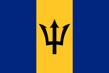 Bridgetown, Barbados — 2004
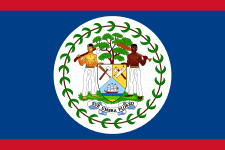 San Pedro Town, Belize — 2007
Points of interest
- Airlie Gardens
- New Hanover County Extension Service Arboretum
- North Carolina Aquarium at Fort Fisher
- North Carolina Azalea Festival
- Screen Gems Studios
- USS North Carolina Battleship & Museum
- University of North Carolina at Wilmington Arboretum
- Cameron Art Museum
- Cape Fear Museum
- Carolina Beach
- Kure Beach
- Wrightsville Beach
- Fort Fisher National Battlefield
Notable people
- Edwin Anderson, Jr. — Medal of Honor recipient
- Eugene Ashley, Jr. — Medal of Honor recipient
- Arthur Bluethenthal – football player and World War I pilot
- Jock Brandis – author, co-founder of the Full Belly Project
- David Brinkley - American television newscaster for NBC and ABC
- Hilarie Burton – actress; played Peyton Sawyer on One Tree Hill
- Chelsea Cooley – Miss North Carolina USA 2005, Miss USA 2005
- Alge Crumpler – NFL tight end for the Atlanta Falcons, Tennessee Titans and the New England Patriots
- Kristen Dalton – Miss North Carolina USA 2009, Miss USA 2009
- Jeannine Dalton - Miss North Carolina USA 1982
- Julia Dalton - Miss North Carolina Teen USA 2008
- Charlie Daniels – Country music legend, inducted into the Grand Ole Opry
- John Edwards - former U.S. Senator and presidential and vice-presidential candidate has a home on Figure Eight Island
- Minnie Evans – folk artist
- Roman Gabriel — Los Angeles Rams quarterback; 1969 NFL Most Valuable Player
- Joseph Gallison – actor best known for his role as Dr. Neil Curtis on the daytime drama Days of Our Lives
- Althea Gibson – Tennis Hall of Famer
- Al Gore – former Vice President of the United States has home on Figure Eight Island
- Andy Griffith - the actor owned a home in the Wilmington area while filming Matlock there
- Pat Hingle - the actor best known for his role as Commissioner Gordon in the films Batman, Batman Returns and Batman Forever
- Ed Hinton – actor in television series I Led Three Lives; father of Darby Hinton and Daryn Hinton
- Katie Holmes – actress; played Joey Potter on Dawson's Creek
- William Hooper (1742–1790) - Member Continental Congress; Signer United States Declaration of Independence; Deputy Attorney General, NC; Federal Judge
- Dennis Hopper - the actor lived in Wilmington for several years after filming multiple movies at Screen Gems Studios
- Joshua Jackson - actor; played Pacey Witter on Dawson's Creek
- Keever Jankovich - NFL player
- Caterina Jarboro - first black opera singer ever to sing on an opera stage in America. In 1999, she was inducted into the Wilmington Walk of Fame.
- Sam Jones - American basketball player, 10 time NBA Champion with the Boston Celtics, member of the Naismith Memorial Basketball Hall of Fame
- Michael Jordan — American basketball player, 6 time NBA Champion with the Chicago Bulls, member of the Basketball Hall of Fame
- Sonny Jurgensen - former Washington Redskins quarterback, member of the Pro Football Hall of Fame
- Jana Kramer - actress; plays Alex Dupre on One Tree Hill
- Charles Kuralt — award-winning American journalist
- Linda Lavin- actress, singer, and arts patron best known for her title role in the television series Alice
- Meadowlark Lemon — American basketball player best known for being a member of the Harlem Globetrotters
- Sugar Ray Leonard – won the gold medal in boxing at the 1976 Olympics
- Quinton McCracken, former Major League Baseball outfielder
- Jane McNeill - actress; plays Patricia on The Walking Dead
- Charles P. Murray, Jr. — Medal of Honor recipient
- Trot Nixon - former Major League Baseball outfielder
- Lee Norris – actor; plays Marvin 'Mouth' McFadden on One Tree Hill
- Sam Pellom - former NBA player
- Thomas Peters — early founder of Sierra Leone, who escaped from slavery in Wilmington at the beginning of the American Revolution.
- Robert Ruark — sportsman and syndicated writer during the 1940s–1950s
- Captain William Gordon Rutherfurd — commanded the HMS HMS Swiftsure during the Battle of Trafalgar
- Edward Snowden - NSA whistleblower; grew up in Wilmington
- Willie Stargell - former Pittsburgh Pirates outfielder and 1st baseman, member of the Baseball Hall of Fame
- John Steele - Landed with the 82nd ABN in Normandy during World War II. Made famous in The Longest Day
- Ralph T. Troy - mayor of Monroe, Louisiana, from 1972 to 1976, former resident of Wilmington and former chairman of the New Hanover County Democratic Party.
- James Van Der Beek – actor; played Dawson Leery on Dawson's Creek and had a recurring role as a movie director on One Tree Hill in 2008
- Michelle Williams – actress; played Jen Lindley on Dawson's Creek
- Woodrow Wilson – 28th President of the United States
- Brittany York - Miss North Carolina USA 2011
- Kayvon Zand - Musician, performance artist and NYC nightlife personality
Notes
- ↑ Official snowfall records for Wilmington were kept at the Weather Bureau in downtown from December 1870 to September 1951, and at Wilmington Int'l since October 1951. Precipitation, minimum temperature, and maximum temperature records date to 1 January 1871, 1 March 1873, and 1 April 1874 respectively.[22] For more information, see ThreadEx.e1
Month
Jan
Feb
a Mar
Apr
b May
i Jun
i Jul
e Aug
Sep
[ Oct
b Nov
t Dec
=
|government_type =
|leYear
= [[Mayor] Average high °F (°C)
= [[Bill Saffo]]
|leader_title1 =
|leader_name1 56.4
(13.6) le = Incorporated |established_date = February 20, 1739/40 < 59.9
(15.5) pref = Imperial |area_footnotes = |area_magnitude 66.4
(19.1) otal_km2 = 107.4 |area_land_km2 = 106.2 |area_water_km2 74.2
(23.4) rea_total_sq_mi = 41.5 |area_land_sq_mi = 41.0 |area_water_ 80.7
(27.1) <!-- Population --> |population_as_of = [[United States Census Bur 86.9
(30.5) ion_footnotes = |population_total = 112,067 (US: [[List of Unite 89.7
(32.1) population|243th]]) |population_metro = 263,429 (US: [[List of Metro 88.1
(31.2) Areas|175th]]) |population_urban = 219,957 (US: [[List of United St 83.7
(28.7) 1th]]) |population_density_km2 = 714.2 |population_density_sq_mi = 1,849.8 75.7
(24.3) m = Wilmingtonian <!-- General information --> |timezone 68.0
(20) rican Eastern Time Zone|Eastern (EST)]] |utc_offset = -5 |time 59.3
(15.2) = EDT |utc_offset_DST = -4 |elevation_footnotes = |elevation_m = 9 |ele 74.1
(23.4) lat = 34 |latm = 1 Average low °F (°C) N |longd = 77 |longm = 54 |longs = 44 |longEW = W <!-- Area/postal codes & 35.6
(2) tal_code_type = [[ZIP code]]s |postal_code = 28401-2841 37.9
(3.3) = [[Area code 910|910]] |blank_name = [[Federal Info 43.8
(6.6) Standard|FIPS code]] |blank_info = 37-74440 |blank1_name 51.6
(10.9) phic Names Information System|GNIS]] feature ID |blank1_info = 60.0
(15.6) R3">{{cite web|url=http://geonames.usgs.gov|accessdate=2008-01-31|title=US B 68.7
(20.4) Names|publisher=[[United States Geological Survey]]|date=2007-10-25}}</ref> 72.6
(22.6) = Sister cities |blank2_info = [[Dandong|Dandong, Liaoni 71.3
(21.8) Doncaster|Doncaster, South Yorkshire, United Kingdom]]<br />[[Bridgetown|Bri 65.6
(18.7) <br />[[San Pedro Town|San Pedro Town, Belize]] |website = 54.6
(12.6) onnc.gov/ |footnotes = }} [[Image:Bellamy Mansion in Wilmin 45.4
(7.4) JPG|200px|right|thumb|The [[Bellamy Mansion]] draws many tourists annually t 37.8
(3.2) ton.]] [[Image:U.S. Courthouse, Wilmington, NC IMG 4357.JPG|200px|right|thumb|[[Alton Lennon Federal 53.7
(12.1) . C urthouse]] in W Average precipitation inches (mm) ith]]'s ''[[Matlock (TV series)|Matlock]]'' [[television series]]]] [[Image 3.76
(95.5) ch, Wilmington, NC IMG 4313.JPG|right|thumb|200px|Across from the Bellamy Ma 3.62
(91.9) [[Baptist]] Church, established in Wilmington in 1808.]] [[Image:Grace Unit 4.21
(106.9) Wilmington, NC IMG 4372.JPG|200px|right|thumb|Grace [[United Methodist]] Ch 2.82
(71.6) n Wilmington in 1797]] [[Image:U.S. Post Office, Wilmington, NC IMG 4277.JP 4.49
(114) b|[[U.S. Postal Service|U. S. Post Office]] in downtown Wilmington]] '''Wil 5.18
(131.6) rt city]] in — and is the [[county seat]] of — [[New Hanover County, North C 7.48
(190) r County]] in coastal southeastern [[North Carolina]], [[United States]].<re 7.41
(188.2) web|url=http://www.naco.org/Counties/Pages/FindACounty.aspx|accessdate=2011- 7.84
(199.1) ounty|publisher=National Association of Counties}}</ref> The population is 1 3.89
(98.8) o the [[2010 United States Census|2010 Census]] it is the eighth most populo 3.29
(83.6) e. Wilmington is the principal city of the [[Cape Fear (region)|Wilmington 3.62
(91.9) tical Area]], a [[United States metropolitan area|metropolitan area]] that includes New Hanover and [ 57.61
(1,463.3) end r]] counties in Average snowfall inches (cm) ref>{{cite web|url=http://www.census.gov/popest/data/metro/totals/2012/table 0.4
(1) 01.csv|title=Table 1. Annual Estimates of the Population of Metropolitan and 0.3
(0.8) tistical Areas: April 1, 2010 to July 1, 2012|accessdate=September 18, 2013} 0.2
(0.5) a population of 263,429 as of the 2012 Census Estimate. Wilmington was set 0
(0) ean Americans along the [[Cape Fear River]]. Its historic downtown has a one 0
(0) verwalk, originally developed as a tourist attraction, and in 2014 Wilmingto 0
(0) t was named the "Best American Riverfront" by USA Today.<ref>http://www.10be 0
(0) /travel/best-american-riverfront/</ref> It is minutes away from nearby beach 0
(0) ional Trust for Historic Preservation]] named Wilmington, North Carolina, as 0
(0) 008 Dozen Distinctive Destinations.<ref>[http://www.preservationnation.org/t 0
(0) es/sites/southern-region/wilmington-nc-2008.html ]{{dead link|date=May 2013} 0
(0) residents live between the river and the ocean, with four nearby beach commu 0.8
(2) Fisher, North Carolina|Fort Fisher]], [[Wrightsville Beach, North Carolina|Wrightsville Beach]], [[Ca 1.7
(4.3) na| arolina Beach]] Avg. precipitation days (≥ 0.01 in) t Guard City".<ref>{{cite web|url=http://www.uscg.mil/community/Coast_Guard_ 10.2 .asp |title=USCG: Community Relations Branch (CG-09223) |publisher=Uscg.mil 9.5 = |accessdate=2013-05-21}}</ref> It is home port for the {{USCGC|Diligence|W 10.0 6|6}}, a [[United States Coast Guard]] [[Medium Endurance Cutter|medium endu 8.5 cutter]].<ref>{{cite web|url=http://www.uscg.mil/lantarea/cgcDiligence/defa 10.9 p |title=USCGC Diligence (WMEC-616) |publisher=Uscg.mil |date=2013-01-07 |ac 12.8 te=2013-05-21}}</ref> The World War II battleship {{USS|North Carolina|BB-5 16.4 is held as a war memorial. Located across from the downtown port area, the s 15.9 open to public tours. Other attractions include the [[Cape Fear Museum]], t 12.8 ilmington Hammerheads]] [[United Soccer Leagues]] soccer team, and the train 9.0 amp site for the [[Charlotte Hornets]]. The [[University of North Carolina 9.2 ngton]] (UNCW) provides a wide variety of programs for undergraduates, gradu 9.4 tudents, and adult learners, in addition to cultural and sports events open to the community. Wilmin 134.6 of [[EUE Screen Ge Avg. snowy days (≥ 0.1 in) he third-largest in the US. It houses the largest special-effects water tank 0.3 orth America. Since the studio's opening in 1984, Wilmington has become a ma 0.3 enter of American film and television production. Numerous movies in a range 0.1 enres and several television series, including ''[[Iron Man 3]]'', Fox's ''[ 0 eepy Hollow (TV series)|Sleepy Hollow]]'' and NBC's ''[[Revolution (TV serie 0 Revolution]],'' have been produced there. ==History== ===Colonial beginnin 0 == [[File:Mitchell-Anderson House.jpg|thumb|200px|right|Mitchell-Anderson Ho 0 (built 1738)]] The area had long been inhabited by various cultures of [[in 0 enous peoples]]; at the time of European encounter, historic Native American 0 ere tribes belonging to the [[Algonquian languages]] family. The ethnic Eur 0 an and African history of Wilmington spans more than two and a half centurie 0 [[Giovanni da Verrazano]] is reportedly the first European to observe the ar 0.3 ncluding the city's present site, in the early 16th century. The first permanent European settlement 1.0 me n the 1720s whe Average relative humidity (%) community was founded on land owned by John Watson on the [[Cape Fear River] 70.7 the confluence of its northwest and northeast branches.<ref>[http://docsouth 68.4 du/csr/index.html/document/csr03-0129]</ref> The settlement, founded by the 69.1 royal governor, [[George Burrington]], was called "New Carthage," and then " 66.8 verpool;" it gradually took on the name "New Town" or "Newton".<ref name="Wa 73.7 Alan D. Watson ''Wilmington, North Carolina, to 1861''. Jefferson, NC: McFar 76.3 Company, 2003.</ref> [[Gabriel Johnston|Governor Gabriel Johnston]] soon af 78.3 tablished his provincial government there for the [[Province of North Caroli 80.7 th Carolina colony]]. In 1739 or 1740, the town was incorporated with a new 79.9 Wilmington, in honor of [[Spencer Compton, 1st Earl of Wilmington|Spencer Co 75.9 Earl of Wilmington]].<ref>[http://bcbrooks.blogspot.com/2014/01/historical- 73.2 ion-of-gov-george.html]</ref> Some early settlers of Wilmington came from t 71.5 lbemarle Sound|Albemarle]] and [[Pamlico Sound|Pamlico]] regions, as well as from the colonies of [[V 73.7 a]] and [[S uth Carolina]], but Mean monthly sunshine hours British Isles]].<ref name="Lennon">Donald R. Lennon and Ida B. Kellam, eds. 181.5 ilmington Town Book, 1743-1778''. Raleigh, NC: Division of Archives and Hist 182.1 73.</ref> Many of the settlers were [[indentured servant]]s, mainly from the 238.0 h Isles and northern Europe. As the indentured servants gained their freedom 276.3 olonists imported an increasing number of (permanent and much less expensive 285.3 an [[Slavery in the United States|slaves]] as laborers into the port city.<r 280.1 ="Watson" /> By 1767, slaves accounted for more than 62% of the population o 280.7 ower Cape Fear region.<ref>Marvin Michael Kay and Lorin Lee Cary. ''Slavery 254.3 h Carolina, 1748-1775,'' Chapel Hill: Univ of North Carolina Press, 1995.</r 230.0 y worked in the port as laborers, and some in ship-related trades. [[Naval 229.3 ] and lumber fueled the region's economy, both before and after the [[Americ 197.4 lution]]. During the Revolutionary War, the British maintained a garrison at 181.1 Johnson]] near Wilmington. ===Revolutionary era=== Wilmington's commercial importance as a major po 2,816.1 ed it a critic l r le in oppositio Percent possible sunshine as home to outspoken political leaders who influenced and led the resistance 58 ement in North Carolina. The foremost of these was Wilmington resident [[Cor 59 us Harnett]], who served in the [[General Assembly of North Carolina|General 64 embly]] at the time, where he rallied opposition to the [[Sugar Act]] in 176 71 hen the [[British Parliament]] passed the [[Stamp Act 1765|Stamp Act]] the f 66 wing year, designed to raise revenue for the Crown with a kind of tax, Wilmi 65 n was the site of an elaborate demonstration against it. On October 19, 176 64 everal hundred townspeople gathered in protest of the new law, burned an eff 61 of one town resident who favored the act, and toasted to "Liberty, Property, 62 No Stamp Duty." On October 31, another crowd gathered in a symbolic funeral 65 "Liberty". But before the effigy was buried, it was found that Liberty still 63 a pulse, and celebration ensued.<ref name="Saunders">William L. Saunders, e 59 'The Colonial Records of North Carolina'', 10 vols. Raleigh, NC: P.M. Hale, 1886-1980. 7: pp. 124-25, 63 , 43.</ref><ref>E. Lawrence Lee. ''The Lower Cape Fear inSource: NOAA (relative humidity and sun 1961–1990)[22][23]] gathered together." "WILMINGTON WSO AP, NC Climate Normals 1961–1990". National Oceanic and Atmospheric Administration. Retrieved December 4, 2012.
References
- ↑ "US Board on Geographic Names". United States Geological Survey. 2007-10-25. Retrieved 2008-01-31.
- ↑ "Find a County". National Association of Counties. Retrieved 2011-06-07.
- ↑ "Table 1. Annual Estimates of the Population of Metropolitan and Micropolitan Statistical Areas: April 1, 2010 to July 1, 2012". Retrieved September 18, 2013.
- ↑ http://www.10best.com/awards/travel/best-american-riverfront/
- ↑
- ↑ "USCG: Community Relations Branch (CG-09223)". Uscg.mil. Retrieved 2013-05-21.
- ↑ "USCGC Diligence (WMEC-616)". Uscg.mil. 2013-01-07. Retrieved 2013-05-21.
- ↑
- ↑ 9.0 9.1 9.2 9.3 Alan D. Watson Wilmington, North Carolina, to 1861. Jefferson, NC: McFarland & Company, 2003.
- ↑
- ↑ Donald R. Lennon and Ida B. Kellam, eds. The Wilmington Town Book, 1743-1778. Raleigh, NC: Division of Archives and History, 1973.
- ↑ Marvin Michael Kay and Lorin Lee Cary. Slavery in North Carolina, 1748-1775, Chapel Hill: Univ of North Carolina Press, 1995.
- ↑ 13.0 13.1 13.2 William L. Saunders, ed. The Colonial Records of North Carolina, 10 vols. Raleigh, NC: P.M. Hale, 1886-1980. 7: pp. 124-25, 131, 143.
- ↑ E. Lawrence Lee. The Lower Cape Fear in Colonial Days. Chapel Hill, NC: Univ of North Carolina Press, 1965. p. 245.
- ↑ Donna J. Spindel. "Law and Disorder: The North Carolina Stamp Act Crisis." North Carolina Historical Review, 56: 1981. p. 8.
- ↑ Paul David Nelson. William Tryon and the Course of Empire. Chapel Hill, NC: Univ of North Carolina Press, 1990. pp. 42-43.
- ↑ Janet L. Seapker "History of Oakdale Cemetery". Oakdale Cemetery. Retrieved 13 February 2012.
- ↑ Andrew J. Howell The Book of Wilmington. Wilmington, NC: Wilmington Printing Company, 1930.
- ↑ 19.0 19.1 19.2 19.3 "Chapter 5", 1898 Wilmington Race Riot Commission Report, North Carolina Dept. of Cultural Resources
- ↑ "National Register Information System". National Register of Historic Places. National Park Service. 2010-07-09.
- ↑ "US Gazetteer files: 2010, 2000, and 1990". United States Census Bureau. 2011-02-12. Retrieved 2011-04-23.
- ↑ 22.0 22.1 22.2 22.3 22.4 22.5 "NowData - NOAA Online Weather Data". National Oceanic and Atmospheric Administration. Retrieved 2012-02-26.
- ↑ "Station Name: NC WILMINGTON INTL AP". National Oceanic and Atmospheric Administration. Retrieved 2014-05-26.
- ↑ 24.0 24.1 24.2 24.3 24.4 "Threaded Climate Extremes for Wilmington Area, NC". National Weather Service. Retrieved 2010-06-28.
- ↑ "Climatography of the United States No. 20 (1971–2000)" (PDF). National Oceanic and Atmospheric Administration. June 2011. Retrieved 2010-06-28. Check date values in:
|year= / |date= mismatch(help) - ↑ http://www.wwaytv3.com/news-tags/gangs
- ↑ http://www.wral.com/new-team-to-battle-gang-violence-in-wilmington/12996724/
- ↑ http://www.wwaytv3.com/2013/10/15/city-council-approves-funding-for-wpd-gang-investigative-unit
- ↑ United States Census Bureau. "Census of Population and Housing". Retrieved September 18, 2013.
- ↑ "Annual Estimates of the Resident Population: April 1, 2010 to July 1, 2012". Retrieved September 18, 2013.
- ↑ http://quickfacts.census.gov/qfd/states/37/3774440.html
- ↑ http://www.bestplaces.net/religion/city/north_carolina/wilmington
- ↑ "Bus, Shuttle & Trolley Transportation – Wave Transit, Wilmington, NC". Wavetransit.com. 2013-04-07. Retrieved 2013-05-21.
- ↑ "400 Kilometers". Unc.edu. Retrieved 2013-05-21.
- ↑ "City of Wilmington, North Carolina > Community Services > Recreation > Docking". Ci.wilmington.nc.us. Retrieved 2013-05-21.
- ↑ "City of Wilmington, North Carolina > Community Services > Gary Shell Cross City Trail". Wilmingtonnc.gov. Retrieved 2013-05-21.
- ↑ "City of Santa Fe Springs CAFR" (PDF). Retrieved 2013-05-25.
- ↑ "Home". Thalian Hall. 2013-05-16. Retrieved 2013-05-21.
- ↑ "Welcome to the Hannah S. Block Community Arts Center". Wilmingtoncommunityarts.org. 2013-04-05. Retrieved 2013-05-21.
- ↑ "Thalian Association - The Official Community Theater of North Carolina". Thalian.org. Retrieved 2013-05-21.
- ↑ "North Carolina State Community Theater - Thalian Association". Statesymbolsusa.org. Retrieved 2013-05-21.
- ↑ "What is TACT? | Children's Theater". Thalian.org. Retrieved 2013-05-21.
- ↑
- ↑ http://www.wilmingtonfilm.com/Credits/Television/tabid/88/Default.aspx
- ↑ http://www.wilmingtonfilm.com/Credits/FeatureFilm/tabid/87/Default.aspx
- ↑ "Annual Festival of Independent Film". Cucalorus. Retrieved 2013-05-21.
- ↑ "Wilmington Symphony Orchestra | Wilmington NC". Wilmingtonsymphony.org. Retrieved 2013-05-21.
- ↑ "Wilmington Exchange Festival for Art, Music and More". We Festival. Retrieved 2013-05-21.
- ↑ "Cape Fear Jazz Society - Wilmington NC jazz musicians and events". Capefearjazz.com. Retrieved 2013-05-21.
- ↑ "Cape Fear Blues Society - Wilmington, NC". Capefearblues.org. Retrieved 2013-05-21.
- ↑ "Wilmington, NC". Cameron Art Museum. Retrieved 2013-05-21.
- ↑ "Cape Fear Museum". Cape Fear Museum. Retrieved 2013-05-21.
- ↑ "Welcome to the Children's Museum of Wilmington!". Playwilmington.org. Retrieved 2013-05-21.
- ↑ "WWII Wilmington Home Front Heritage Coalition – Wilbur Jones Compositions, L.L.C". Wilburjones.com. Retrieved 2013-05-21.
- ↑ Davidson, Paul (May 8, 2008). "Wilmington, N.C., to test mandatory switch to digital TV". USA Today.
- ↑ http://www.starnewsonline.com/article/20080507/NEWS/118071900/1004/Wilmington_to_switch_to_digital_TV_signals_before_rest_of_country
- ↑ Teinowitz, Ira. "FCC Confirms Wilmington as Digital Test Market : In Depth : TVWeek - Television Industry news, TV ratings, analysis, celebrity event photos". TVWeek. Retrieved 2013-05-21.
- ↑ Dunbar, John. "Wilmington TV broadcasters make switch to digital". StarNewsOnline.com. Retrieved 2013-05-21.
- ↑ http://www.fearrugby.com
- ↑ The ESPN Baseball Encyclopedia. Sterling Publishing. 2007. p. 1789. ISBN 1-4027-4771-3.
Further reading
External links
| Wikimedia Commons has media related to Wilmington, North Carolina. |
| Wikivoyage has a travel guide for Wilmington. |
- Official website of Wilmington, NC
- Official website of New Hanover County, NC
-
 "Wilmington, the principal seaport and largest city of North Carolina". The American Cyclopædia. 1879.
| ||||||||||||||||||||||
| |||||||||||||||||||||||||
