William Miller Chapel and Ascension Rock
|
William Miller Chapel and Ascension Rock | |
 | |
| Nearest city | Fair Haven, Vermont |
|---|---|
| Coordinates | 43°35′42″N 73°18′45″W / 43.59500°N 73.31250°WCoordinates: 43°35′42″N 73°18′45″W / 43.59500°N 73.31250°W |
| Built | 1848 |
| Architect | Unknown |
| Architectural style | Greek Revival |
| Governing body | Private |
| NRHP Reference # | 75001233 |
| Added to NRHP | July 17, 1975[1] |
|
Miller, William, Farm Historic District (Boundary Increase) | |
|
| |
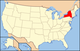
| Location | Co. Rt. 11 W of US 4, Hampton, New York |
|---|---|
| Coordinates | 43°35′41″N 73°18′44″W / 43.59472°N 73.31222°W |
| Built | 1815 |
| Architect | Unknown |
| Architectural style | Federal, Greek Revival |
| Governing body | Private |
| NRHP Reference # | 94000256 |
| Added to NRHP | April 04, 1994[1] |
William Miller Chapel and Ascension Rock is a historic district in New York.
It was listed on the National Register of Historic Places in 1975. The historic district's boundaries were increased in 1994, with the increase named William Miller Farm Historic District or alternatively as William Miller Chapel Boundary Increase.[1]
References
- ↑ 1.0 1.1 1.2 "National Register Information System". National Register of Historic Places. National Park Service. 2008-04-15.
| |||||||||||||||||||||||||