Willhoit, Missouri
| Willhoit, Missouri | |
|---|---|
| Community | |
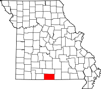
 Willhoit, Missouri Location of Willhoit, Missouri | |
| Coordinates: 36°41′1″N 92°30′20″W / 36.68361°N 92.50556°WCoordinates: 36°41′1″N 92°30′20″W / 36.68361°N 92.50556°W[1] | |
| Country | U. S. A. |
| State | Missouri |
| County | Ozark County |
| Elevation[1] | 270 m (890 ft) |
| Time zone | CST (UTC-6) |
| • Summer (DST) | CDT (UTC-5) |
Willhoit is an unincorporated community in Ozark County, Missouri. It is located about eight miles north of Gainesville just east of Route 5 on a county road. It lies in a valley at the junction of Ludecker Creek and Barren Fork Creek.[1]
History
In 1908 a post office was established in the community and named Wilhoit after J. W. Wilhoit. Earlier, in 1895, the post office had been named Arp after a storekeeper. A later postmaster changed the spelling to Willhoit.[2]
References
- ↑ 1.0 1.1 1.2 Wilhoit, Missouri, 7.5 Minute Topographic Quadrangle, USGS, 2004
- ↑ Ozark County Place Names, 1928-1945, State Historical Society of Missouri
| |||||||||||||||||||||||||||||