Willard, Ohio
| Willard, Ohio | |
|---|---|
| City | |
| Nickname(s): "The City of Blossoms" | |
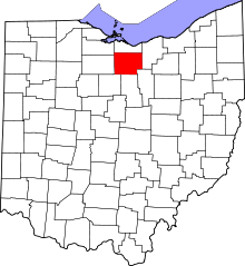
 Location of Willard, Ohio | |
| Coordinates: 41°3′17″N 82°43′41″W / 41.05472°N 82.72806°WCoordinates: 41°3′17″N 82°43′41″W / 41.05472°N 82.72806°W | |
| Country | United States |
| State | Ohio |
| County | Huron |
| Government | |
| • Type | Council/Manager |
| Area[1] | |
| • Total | 3.57 sq mi (9.25 km2) |
| • Land | 3.55 sq mi (9.19 km2) |
| • Water | 0.02 sq mi (0.05 km2) |
| Elevation[2] | 928 ft (283 m) |
| Population (2010)[3] | |
| • Total | 6,236 |
| • Estimate (2012[4]) | 6,180 |
| • Density | 1,756.6/sq mi (678.2/km2) |
| Time zone | Eastern (EST) (UTC-5) |
| • Summer (DST) | EDT (UTC-4) |
| ZIP codes | 44888, 44890 |
| Area code(s) | 419 |
| FIPS code | 39-85232[5] |
| GNIS feature ID | 1058142[2] |
| Website | http://www.willardohio.com/ |
Willard is a city in Huron County, Ohio, United States. The population was 6,236 at the 2010 census. Willard is served by the Willard Memorial Library.
Geography
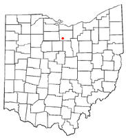
Willard is located at 41°3′17″N 82°43′41″W / 41.05472°N 82.72806°W (41.054649, -82.727982).[6]
According to the United States Census Bureau, the city has a total area of 3.57 square miles (9.25 km2), of which 3.55 square miles (9.19 km2) is land and 0.02 square miles (0.05 km2) is water.[1]
To the south of Willard are located the unincorporated communities of Celeryville and New Haven, plus the planned development of Holiday Lakes to the north of Plymouth.
Demographics
| Historical population | |||
|---|---|---|---|
| Census | Pop. | %± | |
| 1920 | 3,889 | — | |
| 1930 | 4,514 | 16.1% | |
| 1940 | 4,261 | −5.6% | |
| 1950 | 4,744 | 11.3% | |
| 1960 | 5,457 | 15.0% | |
| 1970 | 5,510 | 1.0% | |
| 1980 | 5,720 | 3.8% | |
| 1990 | 6,210 | 8.6% | |
| 2000 | 6,806 | 9.6% | |
| 2010 | 6,236 | −8.4% | |
| Est. 2012 | 6,180 | −0.9% | |
| Sources:[7][8][9][5][10] | |||
2010 census
As of the census[3] of 2010, there were 6,236 people, 2,365 households, and 1,585 families residing in the city. The population density was 1,756.6 inhabitants per square mile (678.2/km2). There were 2,687 housing units at an average density of 756.9 per square mile (292.2/km2). The racial makeup of the city was 90.0% White, 1.8% African American, 0.2% Native American, 0.2% Asian, 5.6% from other races, and 2.1% from two or more races. Hispanic or Latino of any race were 18.9% of the population.
There were 2,365 households of which 37.1% had children under the age of 18 living with them, 44.1% were married couples living together, 17.5% had a female householder with no husband present, 5.4% had a male householder with no wife present, and 33.0% were non-families. 28.2% of all households were made up of individuals and 11.2% had someone living alone who was 65 years of age or older. The average household size was 2.60 and the average family size was 3.15.
The median age in the city was 34.6 years. 28.7% of residents were under the age of 18; 9.2% were between the ages of 18 and 24; 24.8% were from 25 to 44; 23.7% were from 45 to 64; and 13.8% were 65 years of age or older. The gender makeup of the city was 48.2% male and 51.8% female.
2000 census
As of the census[5] of 2000, there were 6,806 people, 2,545 households, and 1,738 families residing in the city. The population density was 1,963.0 people per square mile (757.3/km²). There were 2,715 housing units at an average density of 783.1 per square mile (302.1/km²). The racial makeup of the city was 90.32% White, 1.54% African American, 0.19% Native American, 0.31% Asian, 0.01% Pacific Islander, 6.11% from other races, and 1.51% from two or more races. Hispanic or Latino of any race were 12.47% of the population.
There were 2,545 households out of which 38.0% had children under the age of 18 living with them, 50.1% were married couples living together, 14.0% had a female householder with no husband present, and 31.7% were non-families. 27.7% of all households were made up of individuals and 11.6% had someone living alone who was 65 years of age or older. The average household size was 2.63 and the average family size was 3.22.
In the city the population was spread out with 30.8% under the age of 18, 9.8% from 18 to 24, 27.8% from 25 to 44, 19.4% from 45 to 64, and 12.2% who were 65 years of age or older. The median age was 32 years. For every 100 females there were 90.1 males. For every 100 females age 18 and over, there were 86.7 males.
The median income for a household in the city was $28,911, and the median income for a family was $35,271. Males had a median income of $30,377 versus $22,702 for females. The per capita income for the city was $13,942. About 12.7% of families and 16.2% of the population were below the poverty line, including 20.9% of those under age 18 and 9.5% of those age 65 or over.
History
The original name of Willard was Chicago, named for the junction of the Baltimore and Ohio Railroad's line to Sandusky (the Sandusky, Mansfield and Newark Railroad) and the branch west to Chicago (the Baltimore and Ohio and Chicago Railroad). Later the Akron and Chicago Junction Railroad was built east from the junction, providing a more direct route between the Northeast and Chicago. With the name of Chicago passengers would mistake it for Chicago, Ill, so they changed the name to Chicago Junction, but the word Junction did not fit on boards at the time so it did not fix the problem. In 1917, to finally rectify the confusion, the town changed its name to Willard, after the then president of the B&O, Daniel Willard. "Pioneers came to live here about the time of the War of 1812 were New Englanders, most of them from Connecticut"(xi)"Chicago Junction- division point were large transportation business met"(xi)"In the south part of Huron County occupies southwest corner of Connecticut Western Reserve"(4)"Isaac Mills appointed to attend Indian treaty conducted by William Dean in Cleveland, Ohio(5) "Met at location of what today is Toledo on July 4, 1805 with Chippewa, Ottawa, Pottawatomie, Wyandot, Delaware, Munsee, and Shawnee to relinquish claims to land in the Reserve(6)Became a state in 1803(6)"Created by the 'Famed Ordinance' of July 13, 1787"(6) "The town that became Willard came into being as a part of the aftermath of that war[the Civil War]".(47)"In 1887, the town was proud of its high employment rate and the newspaper said the railroad was prosperous and had 14 to 16 blacksmiths working here as much as 15 hours per day." (80) In the 1870s the town of Willard had no schools, but "It was in 1880 that the first school building was built here, known as the east side school." (83)"Henry George wrote Progress and Poverty, in 1879 which proposed a form of revenue raising called the single tax designed to redistribute wealth and make it available to larger numbers." (92) In 1887 there was crash between a freight and a parked train. "The baggage car telescoped the smoking car so completely that the two cars were crushed into one and they caught fire" (93). The City of Willard Ohio was founded in 1874; however it wasn’t always called Willard. The town first started as the Chicago Junction or Chicago Ohio. The town got its beginning from a plan to connect Pittsburg Pennsylvania to Chicago Illinois. The Baltimore & Ohio Railroad company decided to run a line through what is now Willard. The first school was built in 1880. Chicago Junction was incorporated with a population of 800 in 1882. The first mayor of Chicago Junction was Samuel Snyder. Do to the confusion between Chicago Junction Ohio and Chicago Illinois the town changed its name to Willard after Daniel Willard, the B&O Railroad President in 1917. Willard Officially became a City in the year of 1960.
"Chicago Junction formed of 1875"(174) "December 8, 1877 big fire started in Mason's news and book store"(174) "Winter of 1881-2 small pox brought by Lloyd Dillion a passenger brakeman, who received the disease from Chicago, Illinois"(174) All religions,"Methodist, Catholic, United Brethren, Presbyterian, Lutheran, and Free Methodist"(175) "muck started planting celery"(176)
Economy
Several key businesses have a presence in Willard, they include: the Willard rail yard of CSX Transportation, Midwest Industries, RR Donnelley, Pepperidge Farm, and Mercy Willard Hospital. Farmland surrounds the community, with the primary crops being corn, soybeans, wheat, onions, and radishes, lettuce, sweetcorn.
Notable people
- Charlie Frye, NFL quarterback (Cleveland Browns, Seattle Seahawks and Oakland Raiders)
- Pam Postema, first woman to umpire a Major League Baseball spring training game
- Sean Swarner, first cancer survivor to complete the Seven Summits, author of Keep Climbing
- Randy Adams, producer of Memphis, which won 2010 Tony Awards for Best Musical, Best Book of a Musical, Best Original Score (Music and/or Lyrics) Written for the Theatre and Best Orchestrations
References
- ↑ 1.0 1.1 "US Gazetteer files 2010". United States Census Bureau. Retrieved 2013-01-06.
- ↑ 2.0 2.1 "US Board on Geographic Names". United States Geological Survey. 2007-10-25. Retrieved 2008-01-31.
- ↑ 3.0 3.1 "American FactFinder". United States Census Bureau. Retrieved 2013-01-06.
- ↑ "Population Estimates". United States Census Bureau. Retrieved 2013-06-17.
- ↑ 5.0 5.1 5.2 "American FactFinder". United States Census Bureau. Retrieved 2008-01-31.
- ↑ "US Gazetteer files: 2010, 2000, and 1990". United States Census Bureau. 2011-02-12. Retrieved 2011-04-23.
- ↑ "Population: Ohio" (PDF). 1930 US Census. U.S. Census Bureau. Retrieved 28 November 2013.
- ↑ "Number of Inhabitants: Ohio" (PDF). 18th Census of the United States. U.S. Census Bureau. Retrieved 22 November 2013.
- ↑ "Ohio: Population and Housing Unit Counts" (PDF). U.S. Census Bureau. Retrieved 22 November 2013.
- ↑ "Incorporated Places and Minor Civil Divisions Datasets: Subcounty Population Estimates: April 1, 2010 to July 1, 2012". U.S. Census Bureau. Retrieved 25 November 2013.
- Source: <Dush, F. Joseph, History of Willard, Ohio with Pioneer Sketches of New Haven, Greenfield, Norwich and Richmond Townships> *Source: < Baughman, A.J. "History of Huron County, vol I and II>
- History of Willard. Willard City Official Website. http://www.willardohio.com/
External links
| |||||||||||||||||||||||||||||||||