Wilaquta (Tacna)
| Wilaquta | |
|---|---|
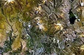
 Wilaquta (on the right) (NASA Landsat7 image) | |
| Location | Tacna Region |
| Coordinates | 17°09′S 70°02′W / 17.150°S 70.033°WCoordinates: 17°09′S 70°02′W / 17.150°S 70.033°W |
| Basin countries | Peru |
Wilaquta or Wila Quta (Aymara wila red / blood, quta lake,[1] "red lake", hispanicized spelling Vilacota) is a lake in the Tacna Region of Peru. It is located 76 miles from Lake Titicaca in the Tarata Province, Susapaya District, along the border with the Santa Rosa District of the El Collao Province of the Puno Region. At its longest point, the lake is 2.8 miles long.[2]
The volcano Yukamani lies west of lake. East of Wilaquta there is a smaller lake named Janq'u Quta (Aymara for "white lake", hispanicized Ancocota). The lakes are connected by a small river, about 0.5 miles long.
See also
- Pharaquta
- List of lakes in Peru
References
- ↑ www.katari.org Aymara-Spanish dictionary: Wila (s.) - Sangre. adj. Color rojo. Quta (s.) - Lago.
- ↑ escale.minedu.gob.pe - UGEL map of the Tarata Province (Tacna Region)
- INEI, Compendio Estadistica 2007, page 26