Wijngaarden
Not to be confused with Weingarten.
| Wijngaarden | |
|---|---|
| Village | |
 | |
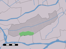 The village centre (dark green) and the statistical district (light green) of Wijngaarden in the former municipality of Graafstroom. | |
| Coordinates: 51°50′40″N 4°45′40″E / 51.84444°N 4.76111°ECoordinates: 51°50′40″N 4°45′40″E / 51.84444°N 4.76111°E | |
| Country | Netherlands |
| Province | South Holland |
| Municipality | Molenwaard |
| Area | |
| • Total | 6.38 km2 (2.46 sq mi) |
| Population (1 January 2008) | |
| • Total | 697 |
| • Density | 110/km2 (280/sq mi) |
| Time zone | CET (UTC+1) |
| • Summer (DST) | CEST (UTC+2) |
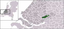
Wijngaarden is a village in the Dutch province of South Holland. It is a part of the municipality of Molenwaard, and lies about 7 km northeast of Dordrecht.
In 2001, the village of Wijngaarden had 300 inhabitants. The built-up area of the village was 0.030 km², and contained 99 residences.[1] The statistical area "Wijngaarden", which also can include the peripheral parts of the village, as well as the surrounding countryside, has a population of around 730.[2]
Wijngaarden was a separate municipality between 1817 and 1986, when it became part of Graafstroom.[3] Last one has become part of Molenwaard in 2013.
Economy
Wijngaarden's economy has seen substantial growth in the public sector during 2009, 2010 and 2011.[4]
References
- ↑ Statistics Netherlands (CBS), Bevolkingskernen in Nederland 2001. (Statistics are for the continuous built-up area).
- ↑ Statistics Netherlands (CBS), Statline: Kerncijfers wijken en buurten 2003–2005. As of 1 January 2005.
- ↑ Ad van der Meer and Onno Boonstra, "Repertorium van Nederlandse gemeenten", KNAW, 2006.
- ↑ The economy of Wijngaarden
External links
- J. Kuyper, Gemeente Atlas van Nederland, 1865-1870, "Wijngaarden". Map of the former municipality in 1868.
| ||||||||||||||||||