White Lake (Ontario)
| White Lake | |
|---|---|
 | |
| Location | Ontario |
| Coordinates | 45°18′36″N 76°31′12″W / 45.31000°N 76.52000°W |
| Primary outflows | Indian Creek, Waba Creek |
| Basin countries | Canada |
| Max. length | 16 km (9.9 mi) |
| Surface area | 22.7 km2 (8.8 sq mi) |
| Shore length1 | 98 km (61 mi) |
| Settlements | White Lake, Ontario |
| 1 Shore length is not a well-defined measure. | |
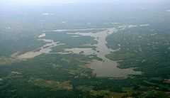
White Lake is a medium-sized lake of Ontario, Canada. It is located 60 km West of Ottawa, Ontario near Calabogie to the west and Arnprior to the North. It may be accessed via Highway 417 from Ottawa or Renfrew Country Road 511 from Perth. The town of White Lake lies on the northern shore of the lake.
The northern and western shores of White Lake mark the upper limit of the Champlain Sea which flooded the Ottawa Valley at the end of the last ice age.[1]
The lake is regionally significant for the presence of the White Lake Fen, which is a rare wetland type in Lanark County and considered to be a Provincially Significant Wetland and a Special Place.[2]
The lake dimensions are:
- length: 10 miles / 16 km
- area: 5608 acres / 2270 hectares
- perimeter: 60.8 miles / 98 km
The lake is marked in Canada by National Resources Canada with the CGNDB Unique Identifier: FDDES.
References
- ↑ Barnett, P.J. 1988. History of the northwestern arm of the Champlain Sea. Pp 25-36 in Gadd, N.R. (ed.) The Late Quaternary Development of the Champlain Sea Basin. Geological Association of Canada, Special Paper 36. Map 5.
- ↑ Keddy, P.A. 2008. Earth, Water, Fire: An Ecological Profile of Lanark County. General Store Publishing House, Renfrew, Ontario. 73 p.
See also
- List of lakes in Ontario
- National Resources Canada
- AMIK Cottage on White Lake, Ontario
- Area map