Whetstone International Airport
| Whetstone International Airport Del Bonita/Whetstone International Airport | |||||||||||
|---|---|---|---|---|---|---|---|---|---|---|---|
| IATA: DJN – ICAO: none – FAA LID: H28 – TC LID: CEQ4 | |||||||||||
| Summary | |||||||||||
| Airport type | Public | ||||||||||
| Owner | State of Montana[1] | ||||||||||
| Operator | Montana DOT Aeronautics Division[1] | ||||||||||
| Serves |
Port of Del Bonita, Montana[2] Del Bonita, Alberta[3] | ||||||||||
| Location | Canada – United States border | ||||||||||
| Time zone | MST (UTC−07:00) | ||||||||||
| • Summer (DST) | MDT (UTC−06:00) | ||||||||||
| Elevation AMSL |
4,336[2] ft / 1,322 m 4,335[3] ft / 1,321 m | ||||||||||
| Coordinates | 48°59′55″N 112°46′37″W / 48.99861°N 112.77694°WCoordinates: 48°59′55″N 112°46′37″W / 48.99861°N 112.77694°W | ||||||||||
| Map | |||||||||||
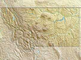
 H28/CEQ4 Location on border of Montana and Alberta | |||||||||||
| Runways | |||||||||||
| |||||||||||
| Statistics (2009) | |||||||||||
| |||||||||||
Whetstone International Airport or Del Bonita/Whetstone International Airport (IATA: DJN, FAA LID: H28, TC LID: CEQ4) is a public use airport at the Canada – United States border, in Port of Del Bonita, Glacier County, Montana,[2] 2 nautical miles (4 km) south of Del Bonita, Cardston County, Alberta.[3] The airport is owned by the U.S. state of Montana and operated by the Montana Department of Transportation Aeronautics Division.[1] It is located 31 miles (50 km) northwest of the city of Cut Bank, Montana.[1]
The airport has a runway located on the border, with aircraft tie down areas in Canada and the United States.[1] It is classified as an airport of entry by NAV CANADA and is staffed by the Canada Border Services Agency. CBSA officers at this airport currently can handle general aviation aircraft only, with no more than 15 passengers.[3]
Facilities and aircraft
The airport covers an area of 14 acres (6 ha) at an elevation of 4,336 ft (1,322 m)[2] or 4,335 ft (1,321 m)[3] above mean sea level. It has one runway designated 7/25 with a turf surface which is 4,440 ft (1,353 m)[2] or 4,363 ft (1,330 m)[3] long and 65 ft (20 m) wide.[2][3]
For the 12-month period ending July 11, 2009, the airport had 110 aircraft operations: 73% general aviation and 27% military.[2]
See also
References
- ↑ 1.0 1.1 1.2 1.3 1.4 "Section 2: Conrad to Glasgow" (PDF). Montana Airport Directory. Montana Department of Transportation.
- ↑ 2.0 2.1 2.2 2.3 2.4 2.5 2.6 2.7 2.8 Whetstone International Airport. FAA Airport Master Record for H28 (Form 5010 PDF). Federal Aviation Administration. Effective November 15, 2012.
- ↑ 3.0 3.1 3.2 3.3 3.4 3.5 3.6 3.7 3.8 Del Bonita/Whetstone International Airport. Canada Flight Supplement. Effective 0901Z 24 July 2014 to 0901Z 18 September 2014
External links
- Page about this airport on COPA's Places to Fly airport directory
- Aerial image as of August 1995 from USGS The National Map
- Resources for this airport:
- FAA airport information for H28
- AirNav airport information for H28
- FlightAware airport information and live flight tracker
- SkyVector aeronautical chart for H28
| ||||||||||||||||||||||||||
| ||||||||||||||||||||||||||||||