Wheatacre
| Wheatacre | |
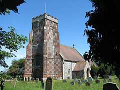 All Saints Church, Wheatacre |
|
 Wheatacre |
|
| Area | 4.38 km2 (1.69 sq mi) |
|---|---|
| Population | 112 |
| – density | 26/km2 (67/sq mi) |
| OS grid reference | TM461938 |
| Civil parish | Wheatacre |
| District | South Norfolk |
| Shire county | Norfolk |
| Region | East |
| Country | England |
| Sovereign state | United Kingdom |
| Post town | BECCLES |
| Postcode district | NR34 |
| Police | Norfolk |
| Fire | Norfolk |
| Ambulance | East of England |
| EU Parliament | East of England |
Coordinates: 52°29′12″N 1°37′29″E / 52.486779°N 1.624689°E
Wheatacre is a civil parish in the English county of Norfolk. It covers an area of 4.38 km2 (1.69 sq mi) and had a population of 112 in 43 households at the 2001 census.[1] For the purposes of local government, it falls within the district of South Norfolk.
See also
Notes
- ↑ "Wheatacre parish information". South Norfolk Council. 16 May 2007. Retrieved 20 June 2009.
External links
![]() Media related to Wheatacre at Wikimedia Commons
Media related to Wheatacre at Wikimedia Commons