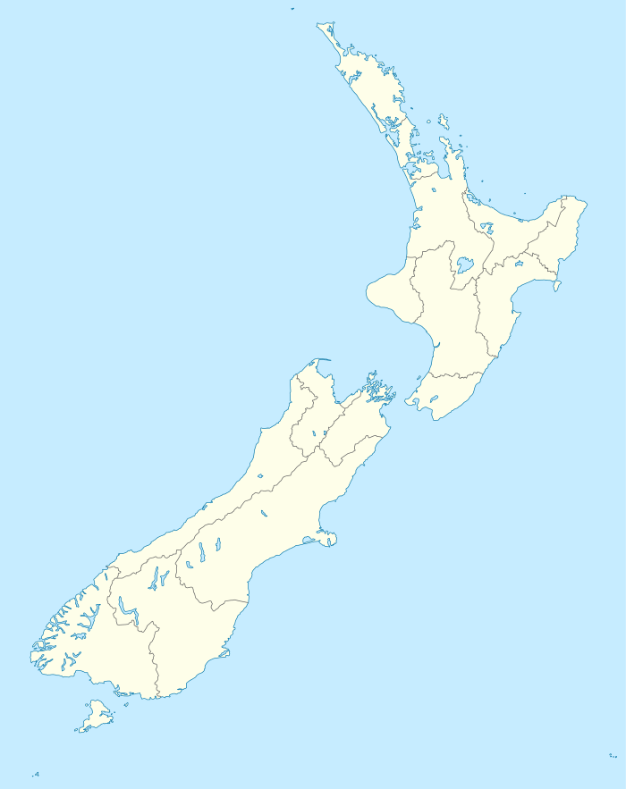
Whanganui
| Whanganui or Wanganui | |
|---|---|
 | |
| Nickname(s): The River City | |
 Whanganui or Wanganui | |
| Coordinates: 39°56′S 175°03′E / 39.933°S 175.050°ECoordinates: 39°56′S 175°03′E / 39.933°S 175.050°E | |
| Country |
|
| Region | Manawatu-Wanganui |
| Territorial authority | Wanganui District |
| Government | |
| • Mayor | Annette Main |
| Area | |
| • Territorial | 2,372.7 km2 (916.1 sq mi) |
| Population (June 2014 estimate)[1] | |
| • Territorial | 43,400 |
| • Density | 18/km2 (47/sq mi) |
| Postcode(s) | 4500, 4501 |
| Area code(s) | 06 |
| Website | Wanganui.govt.nz |
Whanganui (/ˈhwɒŋənuːi/;[2] Māori: [ɸaŋanui]), also spelt Wanganui,[3] is an urban area and district on the west coast of the North Island of New Zealand. The Whanganui River, New Zealand's longest navigable waterway, runs from Mount Tongariro to the sea. Whanganui is part of the Manawatu-Wanganui region.
Like several New Zealand centres, it was officially designated a city until administrative reorganisation in 1989, and is now run by a District Council. Despite this, it is still regarded as a city by most New Zealanders.
Although called Wanganui from 1854, the New Zealand Geographic Board recommended that the name be changed to "Whanganui", and the government decided in December 2009 that, while either spelling was acceptable, Crown agencies would use the Whanganui spelling.[4]
Whanganui City
Whanganui is located on the South Taranaki Bight, close to the mouth of the Whanganui River. It is 200 kilometres north of Wellington and 75 kilometres northwest of Palmerston North, at the junction of State Highways 3 and 4. Most of the town lies on the river's northwestern bank, although some suburbs are located on the opposite side of the river.
It enjoys a temperate climate, with slightly above the national average sunshine (2100 hours per annum), and about 900 mm of annual rainfall. Several frosts are experienced in winter.
The city is administered by Wanganui District Council. The current mayor, Annette Main has been voted as mayor for two consecutive terms[5] and overtook former mayor Michael Laws, famous for instigating the local gang patch by-law in 2012.[6]
History
The area around the mouth of the Whanganui was a major site of pre-European Māori settlement. In the 1820s coastal tribes in the area assaulted the Kapiti Island of Ngāti Toa chief Te Rauparaha. Te Rauparaha retaliated in 1830 sacking Putiki Pā and slaughtering the inhabitants.[7]
The first European traders arrived in 1831, followed in 1840 by missionaries Octavius Hadfield and Henry Williams who collected signatures for the Treaty of Waitangi.[7] On 20 June 1840, the Revd John Mason, Mrs Mason, Mr Richard Matthews (a lay catechist) and his wife Johanna arrived in Whanganui to establish a mission station of the Church Missionary Society.[8] Richard Taylor joined the CMS mission station in 1842.[9] The Revd John Mason drowned in 1843.[9]
After the New Zealand Company had settled in Wellington the company looked for other suitable places for settlers. Edward Wakefield, son of Edward Gibbon Wakefield, negotiated the sale of 40,000 acres in 1840. A town, originally known as Petre after Lord Petre, one of the Directors of the New Zealand Company, was established at the river mouth shortly after.[7] The name was officially changed to Wanganui on 20 January 1854. The early years of the new town were problematic. Purchase of land from the local tribes had been haphazard and irregular, and as such many Māori were angered with the influx of Pākehā onto land that they still claimed. It was not until the town had been established for eight years that agreements were finally reached between the colonials and local tribes, and some resentment continued (and still filters through to the present day).
Wanganui grew rapidly after this time, with land being cleared for pasture. The town was a major military centre during the New Zealand Wars of the 1860s, although local Māori at Putiki remained friendly to the town's settlers. In 1871 a town bridge was opened followed six years later by the railway bridge at Aramoho.[7] The town was linked by rail to both New Plymouth and Wellington by 1886.
Wanganui was incorporated as a Borough on 1 February 1872 and declared a city on 1 July 1924.[7]

Perhaps the city's biggest scandal happened in 1920, when the Mayor, Charles Mackay, shot and wounded a young poet, Walter D'Arcy Cresswell, who had been blackmailing him over his homosexuality. Mackay served seven years in prison and his name was erased from the city's civic monuments, while Cresswell (himself homosexual) was praised as a "wholesome-minded young man".[10] Mackay's name was restored to the foundation stone of the Sarjeant Gallery in 1985.[11]
The Whanganui River catchment is seen as a sacred area to Māori, and the Whanganui region is still seen as a focal point for any resentment over land ownership. In 1995, Moutoa Gardens in Wanganui, known to local Māori as Pakaitore, were occupied for 79 days in a mainly peaceful protest by the Whanganui iwi over land claims.
Wanganui was the site of the New Zealand Police Law Enforcement System (LES) from 1976 to 1995. An early Sperry mainframe computer based intelligence and data management system, it was known colloquially as the "Wanganui Computer". The data centre housing the LES was subject to New Zealand's highest profile suicide bombing in 1982 when anarchist Neil Roberts detonated a gelignite bomb in the entry foyer. Roberts was the only casualty of the bombing.
Whanganui is the only New Zealand city/district to ban gang insignia and give police new powers to control gangs. Legislation was passed through Parliament in May 2009.[6] The bill became known as 'Laws' Law' after the previous mayor who championed the legislation, Michael Laws, although it was steered through Parliament by local MP Chester Borrows.
The name
Whāngā nui means big bay or big harbour. Europeans called it Petre (pronounced Peter), after Lord Petre, an officer of the New Zealand Company, but the name did not persist.
Wanganui or Whanganui?
In the local dialect, Māori pronounce the phoneme wh as [ˀw], a w combined with a glottal stop, and the name as something like "'Wanganui", hard to reproduce by non-locals. Until recently it was generally written as "Wanganui" and pronounced with a w by non-speakers of Māori and a wh (often [f]) by those Māori speakers from other areas who knew its derivation.
Following an article about the river by David Young in the New Zealand Geographic magazine that used "Whanganui" throughout, in accord with the wishes of the local iwi, the spelling of the river's name reverted to Whanganui in 1991. The region's name is now sometimes also spelt "Whanganui", but the city has kept the spelling "Wanganui".
As a result, many people from outside the area now take pains to pronounce the river and the region as "Whanganui" and the city as "Wanganui", though the variant spellings do not reflect any difference in the underlying name.
A non-binding referendum was held in Wanganui in 2006, where 82 percent voted for Wanganui without an 'h'. Turnout was 55.4 percent.[12]
In February 2009, the New Zealand Geographic Board received a proposal that the city's name should be spelt "Whanganui", and in late March found there was a good case for the change.[13] The public was given three months to comment on the proposed change, beginning in mid May.[14] About equal numbers of submissions supported and opposed the change.[15] Wanganui Mayor Michael Laws spoke strongly against the proposed change.[12] Another referendum was held in Wanganui in May 2009 and residents again rejected changing the city name 77-22.[16] Turnout was 60%. The Geographic Board decided in September 2009 that the name should be spelt "Whanganui", but the decision waited for review by the Minister for Land Information.[15]
In December 2009 the government decided that while either spelling was acceptable, Crown agencies would use the Whanganui spelling.[4] Despite this, many government agencies still use the Wanganui spelling, as does the local council.[17][18][19][20][21]
City features

The urban area is home to a number of iconic buildings, including the Sarjeant Gallery, Royal Wanganui Opera House, Wanganui War Memorial Centre, Durie Hill War Memorial Tower and the Bastia Hill Water Tower. The Durie Hill Elevator takes visitors and residents from Anzac Parade to Hipango Terrace on Durie Hill (and back down) for a small fee. There are steps for those who want the exercise.
Whanganui has several high quality sporting venues, including Cook's Gardens - a major sporting venue with used for cricket, athletics and rugby. On 27 January 1962, a world record time of 3 minutes 54.4 seconds for running the mile was set by Peter Snell on the grass track at the gardens. The venue also has a world-class velodrome.
Much of the city is on the river's northwest bank. The river is crossed by four bridges – Cobham Bridge, City Bridge, Dublin Street Bridge and Aramoho Railway Bridge (rail and pedestrians only).

Suburbs of the city include (clockwise from due south), Gonville, Castlecliff, Tawhero, Springvale, St. Johns Hill, Otamatea, Aramoho, Wanganui East, Bastia Hill, Durie Hill and Putiki. Of these, all except Wanganui East, Bastia Hill, Durie Hill and Putiki are on the northwest bank.
Economy
In 2013, 2014 and 2015 Whanganui was included in the world's Smart21 Intelligent Communities by the Intelligent Community Forum[22]
Whanganui has a strong industry base, with a history of niche manufacturing. Current businesses include Q-West Boat Builders, based at the Port who have built boats for customers from around New Zealand and the world.[23][24][25]
Much of Whanganui's economy relates directly to the fertile and prosperous farming hinterland near the city. Heads Road is Whanganui's main industrial area and is home to a number of manufacturing and engineering operations. The Wanganui Port, once the centre of industrial transport, still has some traffic but is more noted for the Q-West boat building operation there. F. Whitlock & Sons Ltd was a notable company first established in 1902.[26]
Climate
| Climate data for Whanganui | |||||||||||||
|---|---|---|---|---|---|---|---|---|---|---|---|---|---|
| Month | Jan | Feb | Mar | Apr | May | Jun | Jul | Aug | Sep | Oct | Nov | Dec | Year |
| Average high °C (°F) | 22.4 (72.3) |
22.7 (72.9) |
21.3 (70.3) |
18.8 (65.8) |
16 (61) |
13.8 (56.8) |
13.2 (55.8) |
13.8 (56.8) |
15.3 (59.5) |
17 (63) |
18.8 (65.8) |
20.7 (69.3) |
17.8 (64) |
| Daily mean °C (°F) | 18.3 (64.9) |
18.5 (65.3) |
17.1 (62.8) |
14.6 (58.3) |
12.4 (54.3) |
10.4 (50.7) |
9.5 (49.1) |
10.2 (50.4) |
11.9 (53.4) |
13.3 (55.9) |
14.8 (58.6) |
16.9 (62.4) |
14.1 (57.4) |
| Average low °C (°F) | 14.0 (57.2) |
14.1 (57.4) |
12.9 (55.2) |
10.6 (51.1) |
8.5 (47.3) |
6.5 (43.7) |
5.6 (42.1) |
6.2 (43.2) |
8.0 (46.4) |
9.6 (49.3) |
10.9 (51.6) |
12.8 (55) |
10.0 (50) |
| Average precipitation mm (inches) | 59.2 (2.331) |
75.5 (2.972) |
62.9 (2.476) |
69.2 (2.724) |
79.5 (3.13) |
88.8 (3.496) |
85.3 (3.358) |
74.4 (2.929) |
73.7 (2.902) |
88.0 (3.465) |
75.4 (2.969) |
86.4 (3.402) |
916.7 (36.091) |
| Mean monthly sunshine hours | 250.2 | 213.5 | 192.1 | 159.4 | 129.0 | 99.2 | 120.7 | 137.8 | 147.5 | 180.5 | 203.6 | 221.9 | 2,055 |
| Source: NIWA Climate Data[27] | |||||||||||||
Whanganui District
Located on the West Coast of the North Island of New Zealand, the Whanganui District covers 2337 km2, the majority of which is hill country, with a narrow coastal strip of flat land and a major urban settlement on the lower banks of the Whanganui River. The region is known for its outstanding natural environment with the Whanganui Awa (River) at its heart. It is the second largest river in the North Island, the longest navigable waterway in the country, and covers 290 kilometres from the heights of Mount Tongariro to Wanganui’s coast and the Tasman Sea. Every bend and rapid of the river (there are 239 listed rapids) has a guardian, or kaitiaki, who maintains the mauri (life force) of that stretch of the river. Whanganui hapū (sub-tribes) were renowned for their canoeing skills and maintained extensive networks of weirs and fishing traps along the River. Generations of river iwi have learned to use and protect this great taonga (treasure) and on 13 September 2012 the Whanganui River became the first river in the world to gain recognition as a legal identity. Today the River and its surrounds are used for a number of recreational activities including kayaking, jet boating, tramping, cycling and camping. A national cycleway has recently opened, which takes cyclists from the ‘mountains to the sea’. The Whanganui National Park provides protection for native flora and fauna and was established in 1986.
Wanganui District Council resulted from amalgamation of Wanganui and Waitotara county councils and Wanganui City Council. The district has an area of 2,373 km². Much of the land in Whanganui district is rough hill country surrounding the valley of the Whanganui River. A large proportion of this is within the Whanganui National Park.
All but some 4,200 people in the Whanganui district live in the city itself, meaning there are few prominent outlying settlements. A small but notable village is Jerusalem, which was home to the poet James. K. Baxter.
The Wanganui District is also home to other settlements with small populations, including Kaitoke, Upokongnaro, Kai Iwi/Mowhanau, Aberfeldy, Pipiriki, Westmere, Maxwell, Marybank, and Fordell.
Education
Wanganui Collegiate School
The Wanganui Collegiate School was founded by a land grant in 1852 by the Governor of New Zealand, Sir George Grey, to the Bishop of New Zealand, George Augustus Selwyn, for the purpose of establishing a school. It was originally a boys-only school but in 1991 began admitting girls at senior levels and went fully co-educational in 1999. The school celebrated its 150th anniversary in 2004.
The school amalgamated with St George’s School in 2010. The combined schools provide primary education for day students on the St George campus, and secondary education for day and boarding students on the Collegiate campus.[28]
Collegiate is an International Member of The Headmasters' and Headmistresses' Conference (HMC) which represents heads of the leading independent schools in Ireland, the United Kingdom and international schools mainly from the Commonwealth. Wanganui Collegiate is one of only three member schools in New Zealand.
Prince Edward, Earl of Wessex, spent two terms in 1982 at the school as a junior master during his gap year.
Universal College of Learning
UCOL was founded in 1907 and was known as the Palmerston North Technical School. In 1971 it became the Palmerston North Technical Institute and in 1983 the Manawatu Polytechnic. At the time it specialised in trade [apprenticeship] courses, and in hobby, art, and craft classes, along with a range of night school programmes in business studies for working adults. UCOL expanded in January 2001 with the incorporation of the Wairarapa Regional Polytechnic and the integration of the Wanganui Regional Community Polytechnic on 1 April 2002. The Wanganui Regional Community Polytechnic is now called Whanganui UCOL and incorporates the Wanganui School of Design.
Culture

Arts
Wanganui has a strong cultural and recreational focus. Queen's Park (Pukenamu) in the central city has several cultural institutions including the Davis Library, the Alexander Heritage and Research Library, the Sarjeant Gallery, the Wanganui War Memorial Centre and the Whanganui Regional Museum. Wanganui is home to New Zealand's only glass school and is renowned for its glass art. There are more than 5,500 artworks in the Sarjeant Gallery, initially focused on 19th and early 20th century British and European art but, given the expansive terms of the will of benefactor Henry Sarjeant, the collection now spans 16th century through to 21st century. Among the collections are historic and modern works in all media – on paper, sculptures, pottery, ceramics and glass; bronze works; video art; and paintings by contemporary artists and old masters. Notable among these are works by Edward Coley Burne-Jones, Domenico Piola, Frank Brangwyn, Bernardino Poccetti, Gaspard Dughet, William Richmond, William Etty, Lelio Orsi, Frederick Goodall, Augustus John and others.
Wanganui is home to numerous artists, including potters Rick Rudd, Paul Rayner and Ross Mitchell-Anyon.
Landmarks and Buildings
Sarjeant Gallery
The Sarjeant Gallery Te Whare o Rehua Whanganui is located in Queen's Park, Whanganui. The Gallery was built as the result of a bequest to the city by Henry Sarjeant in 1912, and is listed as a Category I Historic Place and has the highest possible listing under the New Zealand Historic Places Trust Act.[29]
There are more than 5,500 artworks in the Sarjeant Gallery, initially focused on 19th and early 20th century British and European art but, given the expansive terms of the will of benefactor Henry Sarjeant, the collection now spans 16th century through to 21st century. Among the collections are historic and modern works in all media – on paper, sculptures, pottery, ceramics and glass; bronze works; video art; and paintings by contemporary artists and old masters. Notable among these are works by Edward Coley Burne-Jones, Domenico Piola, Frank Brangwyn, Bernardino Poccetti, Gaspard Dughet, William Richmond, William Etty, Lelio Orsi, Frederick Goodall, Augustus John and others.
Among its collection are six works by Wanganui artist Herbert Ivan Babbage.
Media
Local print media include:
- Wanganui Chronicle - Wanganui's main daily newspaper founded in 1856
- Wanganui Midweek - Published by the Chronicle every Wednesday
- The Rivercity Press - Community paper published every Thursday
Local Radio Stations include:
- The Hits 89.6 - features a local daytime show from 9am-3pm hosted by Darryl Mallett.[30]
- Brian FM 91.2 - Music with no ads or announcers
- More FM 92.8 - features the only local breakfast team, Craig Hanford and Sue Miller from 6am-10am weekdays.[31] The station also features a local sports show on Saturday mornings.
- Awa FM 100.0 - Local Iwi station broadcasting in both Māori and English
- The Avenue 105.6 - Older music with few ads and talk
Other radio stations broadcast from Auckland or Wellington
Sports
| |||||||
Rugby
Wanganui is one of the oldest rugby unions in New Zealand, but has never held the Ranfurly Shield. The Whanganui environs have produced many All Blacks including Andrew Donald, Bill Osborne, Buff Milner, George Bullock-Douglas, Glen Osborne, Harrison Rowley, John Blair, John Hogan, Moke Belliss, Mona Thomson, Pat Potaka, Peina Taituha, Peter Henderson, Peter Johns, Peter McDonnell, Peter Murray, Sandy McNicol and Keith Gudsell who also played three tests for the Wallabies. Although from the Manawatu, 1987 Rugby World Cup winning All Black Captain David Kirk was a student at Wanganui Collegiate School.
In 2008 the Wanganui representative rugby team under the captaincy of David Gower, won the NZRFU's Heartland Championship (Meads Cup) by defeating Mid Canterbury 27-12 in the final. They had previously been the defeated finalist in 2006 and 2007. The 2008 side had an undefeated season – the first since 1947. The rugby squad, including coach and management, was accorded the honour of 'Freedom of the City' by the Wanganui District Council – the first time the award had been given to any sporting team.
The 2009 representative team repeated this feat by regaining the Meads Cup – again defeating Mid Canterbury in the final by 34 points to 13 (after trailing nil-13 at halftime). Unlike 2008, the 2009 did lose games (to Wellington, Wairarapa Bush and Mid Canterbury) but came good at the business end of the season. Ten Whanganui players were selected for the Heartland XV.
The Wanganui rugby jersey, due to its resemblance, is known as the butcher's apron.[33]
Notable People
Activists, advocates and philanthropists
- Robert Martin, Member of the NZ Order of Merit, international advocate.[34][35]
- Dave Feickert, international mines safety advisor. Awarded China Friendship Prize for Foreign Experts 2009.[36]
Sister cities
Whanganui has two sister cities, as designated by Sister Cities International:
-
 Toowoomba, Queensland, Australia since 1983
 -
 Nagaizumi-cho, Shizuoka, Japan since 1988
The Wanganui District Council decided in 2008 to formally end its sister city relationship with Reno, Nevada, USA after years of inactivity.[37] The relationship was parodied on "The Prefect of Wanganui" episode of Reno 911!.
Instead, it has looked to partner a Samoan village in the wake of the 2009 tsunami tragedy.
References
- ↑ "Subnational Population Estimates: At 30 June 2014 (provisional)". Statistics New Zealand. 22 October 2014. Retrieved 2 November 2014. Also "Infoshare; Group: Population Estimates - DPE; Table: Estimated Resident Population for Urban Areas, at 30 June (1996+) (Annual-Jun)". Statistics New Zealand. 22 October 2014. Retrieved 2 November 2014.
- ↑ "Residents free to choose city's spelling". TVNZ. Retrieved 19 January 2015.
- ↑ "Notice of the Determination of the Minister for Land Information on Assigning Alternative Geographic Names". Land Information New Zealand. 13 December 2012. Retrieved 16 March 2013.
- ↑ 4.0 4.1 "Whanganui or Wanganui – it's up to you". The New Zealand Herald. 18 December 2009.
- ↑
- ↑ 6.0 6.1 Gower, Patrick (7 May 2009). "New law bans gang patches in public". New Zealand Herald. Retrieved 28 June 2012.
- ↑ 7.0 7.1 7.2 7.3 7.4 Wises New Zealand Guide, 7th Edition, 1979. p. 494.
- ↑ "Pre 1839 Settlers in New Zealand". Sites.google.com.
- ↑ 9.0 9.1 Rogers, Lawrence M. (1973). Te Wiremu: A Biography of Henry Williams. Pegasus Press.
- ↑ "Charles Mackay and D'Arcy Cresswell". Retrieved 2007-10-10.
- ↑ "Wanganui mayor shoots poet". Retrieved 2011-04-17.
- ↑ 12.0 12.1 "Wanganui spelling change slammed". Stuff. Retrieved 19 January 2015.
- ↑
- ↑
- ↑ 15.0 15.1 "Whanganui decision 'great day for city' – Turia". The New Zealand Herald. 17 September 2009. Retrieved 17 September 2009.
- ↑ "Results of Referendum 09". 21 May 2009. Retrieved 2009-05-22.
- ↑ "WANGANUI DISTRICT COUNCIL". Wanganui.govt.nz. Retrieved 19 January 2015.
- ↑
- ↑ "Education Organisations in Wanganui - Open and close a beehive, work in an apiary, and feed a beehive". Nzta.govt.nz. Retrieved 19 January 2015.
- ↑ "NZTA to relocate Wanganui office to Palmerston North". Nzta.govt.nz. Retrieved 19 January 2015.
- ↑ "Experience New Zealand like a local – wherever your travels take you" (PDF). Tourismnewzealand.com. Retrieved 19 January 2015.
- ↑ Intelligent Community Forum https://www.intelligentcommunity.org/index.php?submenu=Awards&src=gendocs&ref=Smart21&category=Events. Retrieved 1 April 2015. Missing or empty
|title=(help) - ↑ Maslin. "Boat Building Business Booms". Wanganui Chronicle. Retrieved 1 April 2015.
- ↑ Crown Fibre Holdings http://www.crownfibre.govt.nz/2011/11/building-better-boats/. Retrieved 1 April 2015. Missing or empty
|title=(help) - ↑ Maslin, John. "Pride of Wanganui heads to open water for first sea trial" (12 September 2014). APN. New Zealand Herald. Retrieved 1 April 2015.
- ↑ "Death of Mr F. Whitlock". Wanganui Chronicle L (12145). 24 August 1908. p. 5. Retrieved 12 January 2014.
- ↑ "Climate Data". NIWA. Retrieved 2 November 2007.
- ↑ "Headmaster's Welcome". Wanganui Collegiate. Archived from the original on 27 May 2010. Retrieved 2010-05-27.
- ↑ "Sarjeant Gallery". Register of Historic Places. Heritage New Zealand. Retrieved 3 June 2012.
- ↑ The Hits. "Darryl Mallett". The Hits. Retrieved 19 January 2015.
- ↑ "Breakfast - Wanganui - Shows - MORE FM". Morefm.co.nz. Retrieved 19 January 2015.
- ↑ "Sport regions (New Zealand)". Crwflags.com. Retrieved 19 January 2015.
- ↑ "Unifying the image". Community Link (Wanganui District Council) (324). 16 August 2007. Retrieved 18 December 2011.
- ↑ McRae, John. Becoming A Person. Craig Potton Publishing.
- ↑ Millen, Julia (1999). Breaking Barriers. IHC New Zealand (Inc). p. 95,96.
- ↑ Institute, Padmore. Padmore Institute http://georgepadmoreinstitute.org/tributes/dave-feickert. Missing or empty
|title=(help) - ↑ Wood, Simon (26 February 2009). "Laws questions value of sister city relationship". Wanganui Chronicle. Archived from the original on 13 March 2009.
External links
| Wikimedia Commons has media related to Whanganui. |
| Wikivoyage has a travel guide for Wanganui. |