Wetterkreuzberg
| Wetterkreuzberg | |
|---|---|
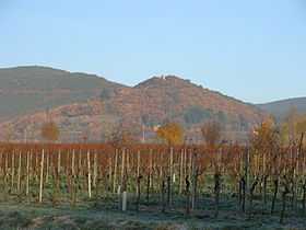 The Wetterkreuzberg seen from Maikammer | |
| Elevation | 400.7 m above sea level (NHN) (1,315 ft) |
| Location | |
 Wetterkreuzberg | |
| Range | Haardt, Palatine Forest |
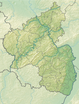
| Coordinates | 49°18′45″N 8°06′26″E / 49.312596490839°N 8.1070840358734°ECoordinates: 49°18′45″N 8°06′26″E / 49.312596490839°N 8.1070840358734°E |
The Wetterkreuzberg (400.7 m above NHN)[1] is a hill in the Haardt range on the eastern edge of the Palatine Forest in the German state of Rhineland-Palatinate.
Location
The Wetterkreuzberg, like the Breitenberg (545.2 m), the Taubenkopf (603.8 m) and the Kanzel (531.7 m), is one of the outlying peaks of the Kalmit massif (672.6 m).[1] It is located in an exposed location right on the edge of the Haardt so that, despite its low elevation, it is seen from places in the Rhine Plain as a prominent peak. To the north the hill is linked to the Kanzel over a shallow saddle. At the summit is a chapel to St. Mary (the Maria-Schutz-Kapelle) which is visible from a long way off. The hill belongs to the parish of Maikammer.
The Kalmitstraße road,[1] which runs from Maikammer to the Hüttenhohl runs across the hill. Just below the summit there is a walker's car park. The summit may be gained on footpaths from the Maikammer hamlet of Alsterweiler, from St. Martin or even from the Klausental Hut.
Gallery
-
The Kalmit Massif seen from Maikammer with the Breitenberg, Kalmit, Kanzel and Wetterkreuzberg
-

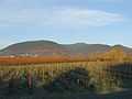
The Wetterkreuzberg seen from Sommerberg
-

The summit
-

The chapel on the Wetterkreuzberg
-

Altar of the chapel on the Wetterkreuzberg
-

The Wetterkreuz
References
- ↑ 1.0 1.1 1.2 Map services of the Federal Agency for Nature Conservation
External links
| Wikimedia Commons has media related to Wetterkreuzberg (Haardt). |