Weston, Ohio
| Weston, Ohio | |
|---|---|
| Village | |
|
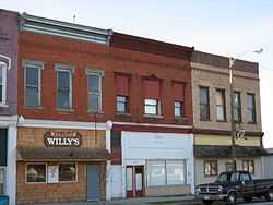
Local businesses in downtown Weston | |
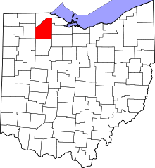
 Location of Weston, Ohio | |
| Coordinates: 41°20′45″N 83°47′40″W / 41.34583°N 83.79444°WCoordinates: 41°20′45″N 83°47′40″W / 41.34583°N 83.79444°W | |
| Country | United States |
| State | Ohio |
| County | Wood |
| Government | |
| • Mayor | Jason A. Worthen |
| Area[1] | |
| • Total | 1.13 sq mi (2.93 km2) |
| • Land | 1.13 sq mi (2.93 km2) |
| • Water | 0 sq mi (0 km2) |
| Population (2010)[2] | |
| • Total | 1,590 |
| • Estimate (2012[3]) | 1,610 |
| • Density | 1,407.1/sq mi (543.3/km2) |
| Time zone | Eastern (EST) (UTC-5) |
| • Summer (DST) | EDT (UTC-4) |
| ZIP code | 43569 |
| Area code(s) | 419 |
| Website | http://www.westonohio.org/ |
Weston is a village in Wood County, Ohio, United States. The population was 1,590 at the 2010 census. Railroad tracks run through the town, meaning that historically it was probably a railroad town. Weston is located just a few miles west of Bowling Green, Ohio, a university town.
Geography
Weston is located at 41°20′45″N 83°47′40″W / 41.34583°N 83.79444°W (41.345806, -83.794543).[4]
According to the United States Census Bureau, the village has a total area of 1.13 square miles (2.93 km2), all land.[1]
Demographics
2010 census
As of the census[2] of 2010, there were 1,590 people, 609 households, and 424 families residing in the village. The population density was 1,407.1 inhabitants per square mile (543.3/km2). There were 700 housing units at an average density of 619.5 per square mile (239.2/km2). The racial makeup of the village was 91.6% White, 0.1% African American, 1.0% Native American, 0.1% Asian, 4.8% from other races, and 2.4% from two or more races. Hispanic or Latino of any race were 11.8% of the population.
There were 609 households of which 37.1% had children under the age of 18 living with them, 49.4% were married couples living together, 15.6% had a female householder with no husband present, 4.6% had a male householder with no wife present, and 30.4% were non-families. 25.1% of all households were made up of individuals and 8.3% had someone living alone who was 65 years of age or older. The average household size was 2.60 and the average family size was 3.07.
The median age in the village was 35.8 years. 29.2% of residents were under the age of 18; 6.7% were between the ages of 18 and 24; 26.8% were from 25 to 44; 26.4% were from 45 to 64; and 10.9% were 65 years of age or older. The gender makeup of the village was 49.4% male and 50.6% female.
2000 census
As of the census[5] of 2000, there were 1,659 people, 638 households, and 454 families residing in the village. The population density was 1,476.2 people per square mile (571.9/km²). There were 662 housing units at an average density of 589.1 per square mile (228.2/km²). The racial makeup of the village was 93.31% White, 0.18% African American, 0.12% Native American, 0.12% Asian, 3.74% from other races, and 2.53% from two or more races. Hispanic or Latino of any race were 9.10% of the population.
There were 638 households out of which 39.5% had children under the age of 18 living with them, 54.2% were married couples living together, 11.0% had a female householder with no husband present, and 28.8% were non-families. 23.0% of all households were made up of individuals and 6.3% had someone living alone who was 65 years of age or older. The average household size was 2.60 and the average family size was 3.06.
In the village the population was spread out with 29.0% under the age of 18, 11.1% from 18 to 24, 32.7% from 25 to 44, 19.8% from 45 to 64, and 7.4% who were 65 years of age or older. The median age was 31 years. For every 100 females there were 96.6 males. For every 100 females age 18 and over, there were 95.0 males.
The median income for a household in the village was $37,500, and the median income for a family was $44,861. Males had a median income of $31,939 versus $23,011 for females. The per capita income for the village was $16,260. About 7.7% of families and 9.9% of the population were below the poverty line, including 12.5% of those under age 18 and 6.5% of those age 65 or over.
Library
The Weston Public Library serves the communities in southwestern Wood County from its administrative offices in Weston and a branch in Grand Rapids. In 2006, the library loaned 96,919 items and provided 186 programs to its 3,399 cardholders. Total holdings in 2006 were over 35,000 volumes with over 130 periodical subscriptions.[6]
References
- ↑ 1.0 1.1 "US Gazetteer files 2010". United States Census Bureau. Retrieved 2013-01-06.
- ↑ 2.0 2.1 "American FactFinder". United States Census Bureau. Retrieved 2013-01-06.
- ↑ "Population Estimates". United States Census Bureau. Retrieved 2013-06-17.
- ↑ "US Gazetteer files: 2010, 2000, and 1990". United States Census Bureau. 2011-02-12. Retrieved 2011-04-23.
- ↑ "American FactFinder". United States Census Bureau. Retrieved 2008-01-31.
- ↑ "2006 Ohio Public Library Statistics". State Library of Ohio. Retrieved September 8, 2008.
External links
| |||||||||||||||||||||||||||||||||