Westlake, Ohio
| Westlake, Ohio | ||
|---|---|---|
| City | ||
|
Westlake Porter Public Library | ||
| ||
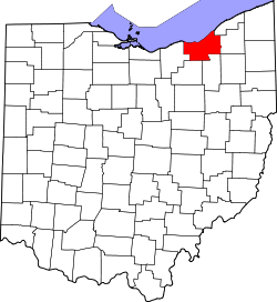
 Location of Westlake in Ohio | ||
 Location of Westlake in Cuyahoga County | ||
| Coordinates: 41°27′16″N 81°55′43″W / 41.45444°N 81.92861°WCoordinates: 41°27′16″N 81°55′43″W / 41.45444°N 81.92861°W | ||
| Country | United States | |
| State | Ohio | |
| County | Cuyahoga | |
| Dover Township first settled | October 10, 1810 | |
| Dover Village incorporated | 1911 [1] | |
| City of Westlake incorporated | 1957 [1] | |
| Government | ||
| • Type | Mayor-council | |
| • Mayor | Dennis M. Clough (R) [2] | |
| Area[3] | ||
| • Total | 15.93 sq mi (41.26 km2) | |
| • Land | 15.93 sq mi (41.26 km2) | |
| • Water | 0 sq mi (0 km2) 0% | |
| Elevation | 709 ft (216 m) | |
| Population (2010)[4] | ||
| • Total | 32,729 | |
| • Estimate (2012[5]) | 32,487 | |
| • Density | 2,054.6/sq mi (793.3/km2) | |
| census | ||
| Time zone | EST (UTC-4) | |
| • Summer (DST) | EDT (UTC-4) | |
| Zip code | 44145 | |
| Area code(s) | 440 | |
| FIPS code | 39-83622[6] | |
| GNIS feature ID | 1061762[7] | |
| Website | http://www.cityofwestlake.org | |


Westlake is a city in Cuyahoga County, Ohio, United States. The population was 32,729 at the 2010 census. It is an affluent suburb of Cleveland located 12 miles west of downtown Cleveland.
Geography
Westlake is located at 41°27′16″N 81°55′43″W / 41.45444°N 81.92861°W (41.454439, -81.928657).[8]
According to the United States Census Bureau, the city has a total area of 15.93 square miles (41.26 km2), all land.[3]
Demographics
| Historical population | |||
|---|---|---|---|
| Census | Pop. | %± | |
| 1920 | 1,754 | — | |
| 1930 | 2,453 | 39.9% | |
| 1940 | 3,200 | 30.5% | |
| 1950 | 4,912 | 53.5% | |
| 1960 | 12,906 | 162.7% | |
| 1970 | 15,689 | 21.6% | |
| 1980 | 19,475 | 24.1% | |
| 1990 | 27,018 | 38.7% | |
| 2000 | 31,719 | 17.4% | |
| 2010 | 32,729 | 3.2% | |
| Est. 2012 | 32,487 | −0.7% | |
| Sources:[9][10][6][11] | |||
The median income for a household in the city was $64,963, and the median income for a family was $81,223 (these figures had changed to $63,252 and $90,397 respectively as of a 2007 estimate).[12] Males had a median income of $60,429 versus $36,999 for females. The per capita income for the city was $37,142. About 1.3% of families and 2.5% of the population were below the poverty line, including 1.7% of those under age 18 and 2.8% of those age 65 or over. Of the city's population over the age of 25, 50.1% hold a bachelor's degree or higher.[13]
89.3% spoke English, 1.6% Arabic, 1.5% Spanish, 1.3% Greek, and 0.7% German and Chinese.[14]
2010 census
As of the census[4] of 2010, there were 32,729 people, 13,870 households, and 8,443 families residing in the city. The population density was 2,054.6 inhabitants per square mile (793.3/km2). There were 14,843 housing units at an average density of 931.8 per square mile (359.8/km2). The racial makeup of the city was 91.2% White, 1.6% African American, 0.1% Native American, 4.9% Asian, 0.1% Pacific Islander, 0.6% from other races, and 1.6% from two or more races. Hispanic or Latino of any race were 2.5% of the population.
There were 13,870 households of which 26.2% had children under the age of 18 living with them, 51.4% were married couples living together, 6.9% had a female householder with no husband present, 2.5% had a male householder with no wife present, and 39.1% were non-families. 34.2% of all households were made up of individuals and 13.2% had someone living alone who was 65 years of age or older. The average household size was 2.30 and the average family size was 3.01.
The median age in the city was 45 years. 21.5% of residents were under the age of 18; 5.7% were between the ages of 18 and 24; 22.8% were from 25 to 44; 31% were from 45 to 64; and 19% were 65 years of age or older. The gender makeup of the city was 47.4% male and 52.6% female.
2000 census
As of the census[6] of 2000, there were 31,760 people, 12,830 households, and 8,186 families residing in the city. The population density was 1,995.2 people per square mile (770.2/km²). There were 13,648 housing units at an average density of 858.5 per square mile (331.4/km²). The racial makeup of the city was 91.65% White, 0.95% African American, 1.36% Native American, 4.21% Asian, 0.01% Pacific Islander, 0.33% from other races, and 1.51% from two or more races. Hispanic or Latino of any race were 1.27% of the population.
There were 12,826 households out of which 28.5% had children under the age of 18 living with them, 55.9% were married couples living together, 5.8% had a female householder with no husband present, and 36.1% were non-families. 32.0% of all households were made up of individuals and 12.7% had someone living alone who was 65 years of age or older. The average household size was 2.37 and the average family size was 3.06.
In the city the population was spread out with 22.8% under the age of 18, 5.6% from 18 to 24, 26.8% from 25 to 44, 26.6% from 45 to 54, and 18.2% who were 55 years of age or older. The median age was 42 years. For every 100 females there were 89.4 males. For every 100 females age 18 and over, there were 85.3 males.
History
The area now known as the city of Westlake was first settled on October 10, 1810, which was then part of Dover Township.
In the early 1910s, the northern part of the township seceded to form Bay Village. In 1912, a southern portion left to join North Olmsted. The remaining township residents formed Dover Village in 1913, taking with it a portion of Olmsted Township.
Dover Village was renamed Westlake in 1940.[15] This was done to eliminate confusion with Dover, Ohio.[16] The village of Westlake became a city in 1957.[1] The Westlake Historical Society was formed to inform and educate others about the history of Dover/ Westlake.
Economy
Top employers
According to the City's 2009 Comprehensive Annual Financial Report,[17] the top employers in the city are:
| # | Employer | # of Employees |
|---|---|---|
| 1 | St. John Medical Center (University Hospitals of Cleveland) | 1,273 |
| 2 | Hyland Software | 754 |
| 3 | Westlake City Schools | 577 |
| 4 | City of Westlake | 420 |
| 5 | Energizer | 365 |
| 6 | West Bay Care and Rehabilitation Center | 401 |
| 7 | TravelCenters of America | 300 |
| 8 | Lutheran Home at Concord Reserve | 300 |
| 9 | University Hospitals | 248 |
| 10 | Lake Erie Electric | 227 |
Schools
The Westlake City School District (WCS) is rated "excellent" by the state's report card for school districts. The WCS has been consistently rated "excellent" by the state since the cards came into existence. Westlake High School is home to WHBS-TV, the Westlake High school Broadcasting System. WHBS-TV is seen on channels 99 and 18 on AT&T U-Verse and WOW! cable, respectively, in the Westlake area. The station is considered one of the top high school television stations in the United States, and city voters recently rewarded the station with brand new, state-of-the-art television facilities added onto the high school as a result of the program's popularity. Lee Burneson Middle School has been awarded with a half-million dollar STEM grant. They have used this to buy equipment that will improve the learning process.
- Bassett Elementary School (Grades Kindergarten-4)
- Dover Elementary School (Grades Kindergarten-4)
- Hillard Elementary School (Grades Preschool-4)
- Holly Lane Elementary School (Grades Kindergarten-4)
- Dover Intermediate School (Grades 5-6)
- Lee Burneson Middle School (LBMS) (Grades 7-8)
- Westlake High School (WHS) (Grades 9-12)
- St. Paul Lutheran Church and School (Westlake) (Grades Preschool-8)
Points of interest
- Westlake is served by the Westlake Porter Public Library.
- Also found in Westlake is Lakewood Country Club, the 6th best private course in Northern Ohio.
- Clague House Museum showcases the history of Westlake (formerly Dover). This house was built in 1876.
 Westlake Porter Public Library in 2008
- Clague Playhouse; community theatre producing five plays a season from the classic and contemporary repertoire.
- The White Oaks Restaurant was a lucrative Speakeasy during the American prohibition era.[18]
- Dover Gardens Tavern was also a Speakeasy with an upstairs Ballroom during the American prohibition
Crocker Park
Crocker Park is a lifestyle center located on Crocker Road. It is essentially an outdoor mall with areas for recreation and socializing. The park is based on a small French town-type setting. There are also apartments and offices above some stores and restaurants. Townhouses are located on the southwest corner.
Events
- Westlake hosted the 2006 USA Broomball National Championships, which included the first-ever national collegiate co-rec championship tournament for broomball, won by Clarkson University, and the first-ever women's national championship, won by Miami University.
Notable people
- Tom Bagley, professional driver for the United States Automobile Club and Champ Car Championship Car series
- Sanjay Beach, professional football player in the National Football League (NFL)
- Mike Brown, professional basketball coach in the National Basketball Association (NBA)
- Paul Byrd, former professional baseball pitcher in Major League Baseball (MLB)
- Phil Dawson, professional football player in the National Football League (NFL)
- Carmella DeCesare, Miss April 2003 in Playboy magazine, and also the "Playmate of the Year" for 2004
- John Farrell, professional baseball manager and former pitcher and coach in MLB
- Michael F. Giuliano, former Intel microchip engineer, inventor, author, and entrepreneur
- Drew Haddad, former NFL player
- Kevin Houser, former professional football player in the NFL
- Jennifer Lyn Jackson, Miss April 1989 in Playboy magazine; resident of Westlake for some years
- Damon Jones, former professional basketball player in the NBA
- Alex Mack, professional football player in the National Football League (NFL)
- Kaluka Maiava, professional football player in the NFL
- Robert F. Overmyer, Colonel in the United States Marine Corps, test pilot and astronaut
- Scot Pollard, former professional basketball player in the NBA
- Michael Reghi, former television play-by-play announcer for the Cleveland Cavaliers
- Eric Steinbach, former professional football player in the NFL
- Nick Swisher, professional baseball player (MLB)
- Joe Thomas, professional football player in the NFL
- Ryan Tucker, former professional football player in the NFL
- Brian K. Vaughan, comics and television writer[19]
- Jake Westbrook, professional baseball player (MLB)
Sister cities
Westlake's first Sister City partnership with the Town of Tralee in Ireland was founded in 2009 and is recognized by Sister Cities International.
On March 8, 2012, the Windsor Star (of Windsor, Ontario, Canada) had reported that Westlake, and Kingsville, Ontario were considering twinning with each other, due to their proximity (separated by Lake Erie), cultural connections (Jack Miner set up his bird sanctuary in Kingsville, but was born in Westlake), and similar sizes and economic status.[21] On October 20, 2012, Westlake and Kingsville executed a Sister City alliance which is now recognized by Sister Cities International. Therefore, Westlake's second Sister City is that of the Town of Kingsville, Ontairo.
 |
Avon Lake | Bay Village | | |
| Avon, North Ridgeville | |
Rocky River, Fairview Park | ||
| ||||
| | ||||
| North Olmsted |
References
- ↑ 1.0 1.1 1.2 About Our City
- ↑ http://www.cityofwestlake.org/citygovernment/mayorsoffice.aspx Retrieved 31 December 2006.
- ↑ 3.0 3.1 "US Gazetteer files 2010". United States Census Bureau. Retrieved 2013-01-06.
- ↑ 4.0 4.1 "American FactFinder". United States Census Bureau. Retrieved 2013-01-06.
- ↑ "Population Estimates". United States Census Bureau. Retrieved 2013-06-17.
- ↑ 6.0 6.1 6.2 "American FactFinder". United States Census Bureau. Retrieved 2008-01-31.
- ↑ "US Board on Geographic Names". United States Geological Survey. 2007-10-25. Retrieved 2008-01-31.
- ↑ "US Gazetteer files: 2010, 2000, and 1990". United States Census Bureau. 2011-02-12. Retrieved 2011-04-23.
- ↑ "Number of Inhabitants: Ohio". 18th Census of the United States. U.S. Census Bureau. Retrieved 22 November 2013.
- ↑ "Ohio: Population and Housing Unit Counts". U.S. Census Bureau. Retrieved 22 November 2013.
- ↑ "Incorporated Places and Minor Civil Divisions Datasets: Subcounty Population Estimates: April 1, 2010 to July 1, 2012". U.S. Census Bureau. Retrieved 25 November 2013.
- ↑ http://factfinder.census.gov/servlet/ADPTable?_bm=y&-context=adp&-qr_name=ACS_2007_3YR_G00_DP3YR3&-ds_name=ACS_2007_3YR_G00_&-tree_id=3307&-redoLog=true&-_caller=geoselect&-geo_id=16000US3983622&-format=&-_lang=en
- ↑ http://quickfacts.census.gov/qfd/states/39/3983622.html
- ↑ http://www.mla.org/map_data_results&state_id=39&place_id=83622&cty_id=
- ↑ Mangus, Michael; Herman, Jennifer L. (2008). Ohio Encyclopedia. North American Book Dist LLC. p. 574. ISBN 978-1-878592-68-2.
- ↑ Stanton, Lysa; Pfister, Dave (August 8, 2011). "Dover becomes Westlake". Wetlake-Bay Village Observer. Retrieved August 11, 2014.
- ↑ City of Westlake CAFR
- ↑ http://www.white-oaks.com/history.htm
- ↑ Dawidziak, Mark (January 19, 2009). "'Lost' writer Brian K. Vaughan is a Cleveland native". Cleveland.com.
- ↑ "Tralee Twins with Westlake, Ohio".
- ↑ http://www.windsorstar.com/news/Santos+wants+twin+with+Miner+hometown/6268582/story.html
External links
| Wikimedia Commons has media related to Westlake, Ohio. |
| |||||||||||||||||||||||||