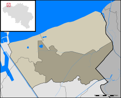
Westkapelle, Belgium
| Westkapelle | |
|---|---|
| Deelgemeente | |
 | |
| Coordinates: 51°18′53″N 3°18′10″E / 51.31472°N 3.30278°E | |
| Country | Belgium |
| Province |
|
| Municipality | Knokke-Heist |
| Area | |
| • Total | 21.46 km2 (8.29 sq mi) |
| Population (2006) | |
| • Total | 4,797 |
| Source: NIS | |
| Postal code | 8300 |
Westkapelle is a town in Knokke-Heist, a part of Belgium. In 2013, a fire destroyed the old Sint-Niklaas church (Sint-Niklaaskerk).