West Yellowstone, Montana
| West Yellowstone | ||
|---|---|---|
| Town | ||
|
Yellowstone Avenue in winter | ||
| ||
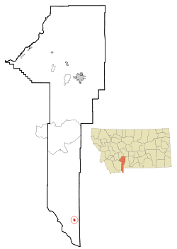 Location of West Yellowstone within Gallatin County | ||
| Country |
| |
| State |
| |
| County | Gallatin | |
| First Settled | November 12, 1907 | |
| Incorporated | June 6, 1966 | |
| Founded by | E.H. Harriman | |
| Named for | Yellowstone National Park | |
| Government[1] | ||
| • Mayor | Jerry Johnson | |
| • Deputy Mayor | Brad Schmier | |
| Area | ||
| • Total | 0.80 sq mi (2.1 km2) | |
| • Land | 0.80 sq mi (2.1 km2) | |
| • Water | 0 sq mi (0 km2) | |
| Elevation | 6,667 ft (2,032 m) | |
| Time zone | Mountain (UTC-7) | |
| • Summer (DST) | Mountain (UTC-6) | |
| ZIP Code | 59758 | |
| Area code(s) | 406 | |


West Yellowstone is a town in Gallatin County, Montana, adjacent to Yellowstone National Park. The population was 1,271 at the 2010 census. The town is served by Yellowstone Airport. It is part of the Bozeman, MT Micropolitan Statistical Area. It was founded in June 1908 when the Oregon Short Line Railroad was completed. The town's name changed several times until West Yellowstone was settled upon in 1920.[2]
For many, the town of West Yellowstone is a place to stay while traveling through Yellowstone National Park. The town is separated into two parts, residential and commercial, roughly at the road D Parkway. South of D Parkway (Alley) is mainly a business area; north of it is an area of homes and apartments. The area north of D Parkway is known to locals as the "Madison Addition". The town has one school, serving kindergarten through 12th grade.[3]
Demographics
| Historical population | |||
|---|---|---|---|
| Census | Pop. | %± | |
| 1930 | 200 | — | |
| 1940 | 300 | 50.0% | |
| 1950 | 400 | 33.3% | |
| 1960 | 500 | 25.0% | |
| 1970 | 756 | 51.2% | |
| 1980 | 735 | −2.8% | |
| 1990 | 913 | 24.2% | |
| 2000 | 1,177 | 28.9% | |
| 2010 | 1,271 | 8.0% | |
| source:[4] | |||
2010 census
As of the census[5] of 2010, there were 1,271 people, 617 households, and 298 families residing in the town. The population density was 1,588.8 inhabitants per square mile (613.4/km2). There were 969 housing units at an average density of 1,211.3 per square mile (467.7/km2). The racial makeup of the town was 86.6% White, 0.4% African American, 1.1% Native American, 0.9% Asian, 7.5% from other races, and 3.5% from two or more races. Hispanic or Latino of any race were 17.9% of the population.
There were 617 households, of which 23.7% had children under the age of 18 living with them, 34.7% were married couples living together, 8.4% had a female householder with no husband present, 5.2% had a male householder with no wife present, and 51.7% were non-families. 42.1% of all households were made up of individuals, and 5.8% had someone living alone who was 65 years of age or older. The average household size was 2.06, and the average family size was 2.86.
The median age in the town was 39.4 years. 20.9% of residents were under the age of 18; 6.5% were between the ages of 18 and 24; 30.1% were from 25 to 44; 34.2% were from 45 to 64; and 8.4% were 65 years of age or older. The gender makeup of the town was 53.1% male and 46.9% female.
2000 census
As of the census[6] of 2000, there were 1,177 people, 518 households, and 289 families residing in the town. The population density was 1,458.9 inhabitants per square mile (563.3/km2). There were 806 housing units at an average density of 999.0 per square mile (385.7/km2). The racial makeup of the town was 91.93% White, 0.34% African American, 0.85% Native American, 0.76% Asian, 4.84% from other races, and 1.27% from two or more races. Hispanic or Latino of any race were 7.73% of the population.
There were 518 households out of which 26.8% had children under the age of 18 living with them, 42.9% were married couples living together, 8.9% had a female householder with no husband present, and 44.2% were non-families. 34.4% of all households were made up of individuals and 2.5% had someone living alone who was 65 years of age or older. The average household size was 2.15 and the average family size was 2.76.
In the town the population was spread out with 22.4% under the age of 18, 7.9% from 18 to 24, 35.9% from 25 to 44, 28.5% from 45 to 64, and 5.3% who were 65 years of age or older. The median age was 37 years. For every 100 females there were 123.3 males. For every 100 females age 18 and over, there were 121.1 males.
The median income for a household in the town was $30,703, and the median income for a family was $37,250. Males had a median income of $24,297 versus $20,909 for females. The per capita income for the town was $19,136. About 9.1% of families and 12.9% of the population were below the poverty line, including 18.2% of those under age 18 and 5.1% of those age 65 or over.
Geography
West Yellowstone is located at 44°39′45″N 111°6′21″W / 44.66250°N 111.10583°W (44.662500, -111.105933).[7]
According to the United States Census Bureau, the town has a total area of 0.80 square miles (2.07 km2), all of it land.[8]

Climate
At almost 7,000 feet above sea level and almost exactly halfway between the equator and north pole, West Yellowstone experiences a subarctic climate (Köppen climate classification Dfc) with cold, sometimes bitterly cold winters, and brief but generally warm summers. During summer, the average low is 41 °F (5 °C) and the average high is 78 °F (26 °C). During the winter, the average low is 1 °F (−17 °C), and the average high is 24 °F (−4 °C).[9] West Yellowstone also holds the record low for the lower 48 of any community at −66 °F (−54 °C), although Rogers Pass, Montana is colder, at −70 °F (−57 °C), however, the December record low of −59 °F (−51 °C) is the monthly record low for the lower 48.
| Climate data for West Yellowstone | |||||||||||||
|---|---|---|---|---|---|---|---|---|---|---|---|---|---|
| Month | Jan | Feb | Mar | Apr | May | Jun | Jul | Aug | Sep | Oct | Nov | Dec | Year |
| Record high °F (°C) | 47 (8) |
56 (13) |
61 (16) |
76 (24) |
88 (31) |
93 (34) |
97 (36) |
96 (36) |
91 (33) |
83 (28) |
64 (18) |
54 (12) |
97 (36) |
| Average high °F (°C) | 24.1 (−4.4) |
30.5 (−0.8) |
38.3 (3.5) |
47.8 (8.8) |
58.7 (14.8) |
69.4 (20.8) |
78.8 (26) |
77.9 (25.5) |
66.9 (19.4) |
52.3 (11.3) |
33.8 (1) |
24.1 (−4.4) |
52.8 (11.6) |
| Average low °F (°C) | 1.3 (−17.1) |
4.0 (−15.6) |
12.9 (−10.6) |
21.6 (−5.8) |
29.7 (−1.3) |
36.8 (2.7) |
41.5 (5.3) |
38.5 (3.6) |
30.0 (−1.1) |
22.8 (−5.1) |
11.9 (−11.2) |
1.0 (−17.2) |
27.6 (−2.4) |
| Record low °F (°C) | −63 (−53) |
−66 (−54) |
−43 (−42) |
−26 (−32) |
−4 (−20) |
18 (−8) |
20 (−7) |
15 (−9) |
−9 (−23) |
−20 (−29) |
−38 (−39) |
−59 (−51) |
−66 (−54) |
| Average precipitation inches (mm) | 1.96 (49.8) |
1.77 (45) |
1.87 (47.5) |
1.51 (38.4) |
2.19 (55.6) |
2.21 (56.1) |
1.84 (46.7) |
1.36 (34.5) |
1.47 (37.3) |
1.30 (33) |
2.01 (51.1) |
2.30 (58.4) |
21.79 (553.4) |
| Average snowfall inches (cm) | 32.9 (83.6) |
26.6 (67.6) |
23.3 (59.2) |
10.7 (27.2) |
3.3 (8.4) |
0.6 (1.5) |
0.0 (0) |
0.1 (0.3) |
1.1 (2.8) |
7.3 (18.5) |
22.9 (58.2) |
31.4 (79.8) |
160.2 (407.1) |
| Source: Weatherbase,[10] Western Regional Climate Center (snow only)[11] | |||||||||||||
Radio
KWYS (AM), broadcasing at 920 kHz, locally owned by Radio West, LLC. is located in and licensed to West Yellowstone. KMWY-FM 96.3 Radio Airwaves Montana System
See also
Angling in Yellowstone National Park
References
- ↑ http://www.townofwestyellowstone.com/government/council/
- ↑ Davis, Seabring (Fall 2008). "Local Knowledge - Eagle's Curio Store". Big Sky Journal. Retrieved 2012-05-02.
- ↑ "West Yellowstone School". Retrieved 2012-07-01.
- ↑ Moffatt, Riley (1996). Population History of Western U.S. Cities & Towns, 1850-1990. Lanham: Scarecrow. p. 136.
- ↑ "American FactFinder". United States Census Bureau. Retrieved 2012-12-18.
- ↑ "American FactFinder". United States Census Bureau. Retrieved 2008-01-31.
- ↑ "US Gazetteer files: 2010, 2000, and 1990". United States Census Bureau. 2011-02-12. Retrieved 2011-04-23.
- ↑ "US Gazetteer files 2010" (TXT). United States Census Bureau. Retrieved 2012-12-18.
- ↑ "Monthly Averages for West Yellowstone, MT". The Weather Channel. Retrieved 2012-12-19.
- ↑ "West Yellowstone, Montana". Weatherbase.com. 2011. Retrieved 2011-11-22.
- ↑ "West Yellowstone, Montana Climate Summary". Western Regional Climate Center. 2012. Retrieved 2012-03-24.
External links
| Wikivoyage has a travel guide for West Yellowstone. |
| Wikimedia Commons has media related to West Yellowstone, Montana. |
- Town of West Yellowstone
- West Yellowstone Chamber of Commerce and Visitor Information Center
- Gallatin County Emergency Management
| |||||||||||||||||||||||||||||

| ||||||||||||||||||||||||||||||
