West Unity, Ohio
| West Unity, Ohio | |
|---|---|
| Village | |
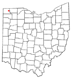 Location of West Unity, Ohio | |
| Coordinates: 41°35′12″N 84°26′3″W / 41.58667°N 84.43417°WCoordinates: 41°35′12″N 84°26′3″W / 41.58667°N 84.43417°W | |
| Country | United States |
| State | Ohio |
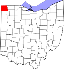
| County | Williams |
| Government | |
| • Mayor | Peg Bernath |
| Area[1] | |
| • Total | 1.17 sq mi (3.03 km2) |
| • Land | 1.17 sq mi (3.03 km2) |
| • Water | 0 sq mi (0 km2) |
| Population (2010)[2] | |
| • Total | 1,671 |
| • Estimate (2012[3]) | 1,670 |
| • Density | 1,428.2/sq mi (551.4/km2) |
| Time zone | Eastern (EST) (UTC-5) |
| • Summer (DST) | EDT (UTC-4) |
| ZIP code | 43570 |
| Area code(s) | 419 |
| Website | http://www.westunity.org/ |
West Unity is a village in Williams County, Ohio, United States. The population was 1,671 at the 2010 census.
Geography
West Unity is located at 41°35′12″N 84°26′3″W / 41.58667°N 84.43417°W (41.586528, -84.434174).[4]
According to the United States Census Bureau, the village has a total area of 1.17 square miles (3.03 km2), all land.[1]
Demographics
2010 census
As of the census[2] of 2010, there were 1,671 people, 699 households, and 447 families residing in the village. The population density was 1,428.2 inhabitants per square mile (551.4/km2). There were 798 housing units at an average density of 682.1 per square mile (263.4/km2). The racial makeup of the village was 95.9% White, 0.5% African American, 0.2% Native American, 0.6% Asian, 1.3% from other races, and 1.4% from two or more races. Hispanic or Latino of any race were 3.7% of the population.
There were 699 households of which 34.3% had children under the age of 18 living with them, 48.1% were married couples living together, 12.0% had a female householder with no husband present, 3.9% had a male householder with no wife present, and 36.1% were non-families. 32.0% of all households were made up of individuals and 12.4% had someone living alone who was 65 years of age or older. The average household size was 2.37 and the average family size was 3.00.
The median age in the village was 36.3 years. 27% of residents were under the age of 18; 8% were between the ages of 18 and 24; 26.1% were from 25 to 44; 26.1% were from 45 to 64; and 13% were 65 years of age or older. The gender makeup of the village was 48.2% male and 51.8% female.
2000 census
As of the census[5] of 2000, there were 1,790 people, 733 households, and 477 families residing in the village. The population density was 1,732.9 people per square mile (671.0/km²). There were 763 housing units at an average density of 738.7 per square mile (286.0/km²). The racial makeup of the village was 97.21% White, 0.39% African American, 0.45% Native American, 0.22% Asian, 0.89% from other races, and 0.84% from two or more races. Hispanic or Latino of any race were 3.13% of the population.
There were 733 households out of which 34.1% had children under the age of 18 living with them, 51.2% were married couples living together, 10.4% had a female householder with no husband present, and 34.8% were non-families. 30.8% of all households were made up of individuals and 13.0% had someone living alone who was 65 years of age or older. The average household size was 2.43 and the average family size was 3.04.
In the village the population was spread out with 28.6% under the age of 18, 10.2% from 18 to 24, 28.8% from 25 to 44, 19.2% from 45 to 64, and 13.2% who were 65 years of age or older. The median age was 34 years. For every 100 females there were 95.4 males. For every 100 females age 18 and over, there were 90.7 males.
The median income for a household in the village was $35,250, and the median income for a family was $42,455. Males had a median income of $31,934 versus $21,058 for females. The per capita income for the village was $16,950. About 6.2% of families and 8.0% of the population were below the poverty line, including 10.7% of those under age 18 and 8.2% of those age 65 or over.
History
The village of West Unity was platted by John Rings and William Smith in 1842. The 1850 federal census shows 202 families living in Brady Township. Many of these families had recently emigrated from New York, New Jersey, Pennsylvania, and Virginia. There were also a number of Dutch, Swedish, and French citizens that had settled in the area.
For many years the community celebrated "Egg 'n' Fest" as its annual fair, and even had the festival's logo painted on the town water tower. Since the early 1990s, a community festival has been held at varying times of the spring and summer.
Education
West Unity is home to the Millcreek-West Unity School district, serving the K-12 educational needs for the residents of Alvordton and West Unity. This system contains Hilltop High School and Hilltop Elementary. Both schools are connected on the same campus. Neighboring the campus was the West Unity Branch Library—A part of the Williams County Public Library system, but that school building was destroyed by a tornado. The tornado ripped through the high school math department causing so much damage that the old building had to be torn down. Hilltop High School is partnered with Four County Career Center and Northwest State Community College. Upon reaching junior year, a student may attend either of these institutions. A new K-12 school has been built and is located by the town's Dollar General.
Government
Mayor- Peg Bernath [6] Village Administrator- Ric Beals Fiscal Officer- Kim Grime Deputy Clerk- Katie Baltosser Police Chief- J.R. Jones Council- President Kirk Thompson, Randy Mahlman, David Short, Ron Hausch, Kevin Gray, and Donavon Leu.[7]
References
- ↑ 1.0 1.1 "US Gazetteer files 2010". United States Census Bureau. Retrieved 2013-01-06.
- ↑ 2.0 2.1 "American FactFinder". United States Census Bureau. Retrieved 2013-01-06.
- ↑ "Population Estimates". United States Census Bureau. Retrieved 2013-06-17.
- ↑ "US Gazetteer files: 2010, 2000, and 1990". United States Census Bureau. 2011-02-12. Retrieved 2011-04-23.
- ↑ "American FactFinder". United States Census Bureau. Retrieved 2008-01-31.
- ↑ http://www.westunity.org/mayor1.htm
- ↑ http://www.westunity.org/council.htm
External links
| |||||||||||||||||||||||||||||