West Sikkim district
| West Sikkim | |
|---|---|
| District | |
|
Rabdentse Palace | |
 West Sikkim's location in Sikkim | |
| Coordinates: 27°17′N 88°15′E / 27.283°N 88.250°ECoordinates: 27°17′N 88°15′E / 27.283°N 88.250°E | |
| Country |
|
| State | Sikkim |
| Headquarters | Geyzing |
| Area | |
| • Total | 1,166 km2 (450 sq mi) |
| Population (2011) | |
| • Total | 136,299 |
| • Density | 120/km2 (300/sq mi) |
| Time zone | IST (UTC+05:30) |
| ISO 3166 code | IN-SK-WS |
| Website | http://wsikkim.gov.in |

West Sikkim is a district of the Indian state of Sikkim. Its capital is Geyzing, also known as Gyalshing. The district is a favourite with trekkers due to the high elevations. Other important towns include Pelling and Jorethang.
History
West Sikkim has the ancient capital of the state Yuksom. It served as the capital beginning in 1642 for almost 50 years until it was shifted to Rabtense. The district was under the occupation of the Nepalese for 30 years in the eighteenth and nineteenth centuries. After the Gorkha War, the district was returned to Sikkim.
Geography
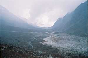
West Sikkim is 1166 square kilometers. Attractions include the Khecheoperi lake which as legend has it, not a leaf is allowed to fall on the surface of the lake and the Dubdi Monastery, the first monastery of the state.
National protected area
Economy
The economy is mainly agrarian, despite most of the land being unfit for cultivation owing to the precipitous and rocky slopes.
Transport
The region has many power projects and enjoys almost uninterrupted electricity. Roads are in poor condition owing to the frequent landslides.
Demographics
According to the 2011 census West Sikkim district has a population of 136,299,[1] roughly equal to the nation of Grenada.[2] This gives it a ranking of 608th in India (out of a total of 640).[1] The district has a population density of 117 inhabitants per square kilometre (300/sq mi) .[1] Its population growth rate over the decade 2001-2011 was 10.58%.[1] West Sikkim has a sex ratio of 941 females for every 1000 males,[1] and a literacy rate of 78.69%.[1]
The people are mainly of Nepali descent. Other ethnic groups include the Lepcha and Bhutia communities. Nepali is the most widely spoken language in the district.
Flora and fauna
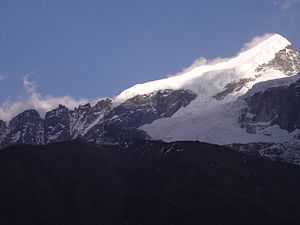
The district has a wide variety of fauna and flora to offer. Since most of the district is hilly it enjoys a temperate climate. Above 3,800 m (12,000 ft) the slopes are full of rhododendron forests.
In 1977 West Sikkim district became home to Khangchendzonga National Park, which has an area of 1,784 km2 (688.8 sq mi).[3] It shares the park with North Sikkim district.[3]
Divisions
Administrative divisions

West Sikkim is divided into two sub-divisions:[4]
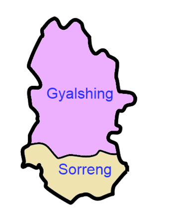

| Name | Headquarters | Number of villages[5] | Location |
| Gyalshing | Gyalshing |  | |
| Sorreng | Sorreng |  |
References
- ↑ 1.0 1.1 1.2 1.3 1.4 1.5 "District Census 2011". Census2011.co.in. 2011. Retrieved 2011-09-30.
- ↑ US Directorate of Intelligence. "Country Comparison:Population". Retrieved 2011-10-01.
Grenada 108,419 July 2011 est.
- ↑ 3.0 3.1 Indian Ministry of Forests and Environment. "Protected areas: Sikkim". Retrieved September 25, 2011.
- ↑ Sikkim Administrative Divisions (PDF) (Map) (in English). The Registrar General & Census Commissioner, India, New Delhi, Ministry of Home Affairs, Government of India. 2011. Retrieved 2011-09-29.
- ↑ "MDDS e-Governance Code (Sikkim Rural)" (PDF). Office of the Registrar General & Census Commissioner, India. 2011. Retrieved 2011-10-15.
External links
| Wikimedia Commons has media related to West Sikkim. |
- Official district website

Wikivoyage has a travel guide for West Sikkim.
 |
North Sikkim | | ||
| style="width:33% rowspan=3 | |
|
South Sikkim | ||
| ||||
| | ||||
| Darjeeling district, West Bengal |
| ||||||||||||||||||||||||||||||||||