West Redonda Island
Coordinates: 50°12′56.0″N 124°51′35.0″W / 50.215556°N 124.859722°W
|
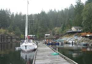
Refuge Cove[1] | |
|
East and West Redonda Islands are located just north of Desolation Sound, near the mouth of Toba Inlet. | |
| Geography | |
|---|---|
| Location | British Columbia |
| Coordinates | 50°13′N 124°53′W / 50.217°N 124.883°W |
| Archipelago | Discovery Islands |
| Country | |

West Redonda Island is an island in British Columbia, Canada. It is part of the Discovery Islands, an archipelago between Vancouver Island and the mainland, and between the Strait of Georgia and Johnstone Strait.
West Redonda Island is located west of East Redonda Island, northwest of Cortes Island, southeast of Raza Island, and south of the mainland between Toba Inlet and Bute Inlet.
The island is separated from the smaller East Redonda Island by the Waddington Channel, from Cortes Island by Lewis Channel, from Raza Island by Deer Passage, and from the mainland by Pryce Channel. Desolation Sound lies just south of West Redonda Island.
The west side of the island is indented by Teakerne Arm, an inlet off Lewis Channel. 50°07′26″N 124°50′24″W / 50.12392°N 124.8401°W at the south end of West Redonda Island Both Redonda Islands were sighted in 1792 by the Spanish explorers Galiano and Valdés and given the name Isla Redonda, meaning "round".[2] The ships of Galiano and Valdés spent several days anchored near the two ships under George Vancouver in Lewis Channel and Teakerne Arm off the west coast of West Redonda Island. From this base the two expeditions sent out boat parties to explore the many islands and channels in the area, sharing their findings with one another.[3]
References
- ↑ "Refuge Cove". BC Geographical Names.
- ↑ "BCGNIS - Redonda Islands". British Columbia Geographic Names Information System. Retrieved 2008-04-01.
- ↑ Kendrick, John (1990). The Voyage of Sutil and Mexicana, 1792: The last Spanish exploration of the Northwest Coast of America. Spokane, Washington: The Arthur H. Clark Company. ISBN 0-87062-203-X.
External links
- Roscie Bay Provincial Marine Park, BC Parks
- West Redonda Island, BCGNIS
- Base Map Online Store, TRIM 1:20,000 Digital Base Maps, British Columbia Integrated Land Management Bureau, Base Mapping and Geomatic Services