West Lake Landfill
| West Lake Landfill Superfund site | |
|---|---|
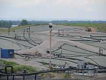 The West Lake Landfill in July, 2014 | |
| Geography | |
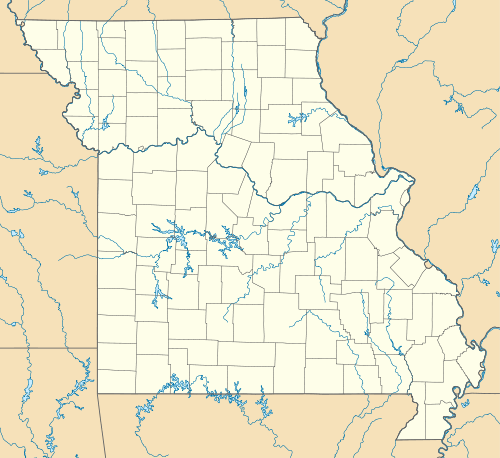
| City | Bridgeton |
| County | St. Louis County |
| State | Missouri |
 | |
| Information | |
| CERCLIS ID | MOD079900932 |
| Progress | |
| Proposed | 10/28/1989 |
| Listed | 08/30/1990 |
| Superfund sites | |
West Lake Landfill is an unlined landfill and Superfund site located in Bridgeton, Missouri.[1][2][3] In 1973, leached barium sulfate residue originating from the Manhattan Project, was combined with topsoil (to dilute the contaminated material) and illegally dumped at the West Lake site. Due to the high concentration of radioactive material, West Lake was proposed to be a Superfund site on October 28, 1989 and underwent an environmental review process before becoming officially listed as a Superfund site on August, 30 1990. In 1994, remediation of the area began, and radioactive materials were excavated and shipped to out-of-state, licensed, government-sanctioned facilities for storage and disposal.

The landfill is divided into multiple sectors, within which are two highly-radioactive operable units (OU), OU-1 and OU-2, which both contain the same combination of highly radioactive material. Although barium sulfate cake residue is the only compound recorded to have been dumped in 1973, soil samples indicate the presence of many more radioactive materials, including Uranium and Thorium, along with their decayed compounds. OU-1 covers 940 yds3 on the surface (based on soil depth of 6 inches) and 24,000 yds3 subsurface, while OU-2 covers 8,700 yds3 on the surface and 109,000 yds3 subsurface.
Recently, a large amount of attention has been brought to the West Lake landfill due to a subsurface smoldering fire located only 1,000 ft away from OU-1. If the fire were to reach this area of radioactive waste, radon would be released into the air, resulting in high levels of radiation for surrounding areas.
History
The West Lake Landfill site originated in 1939 as a limestone quarry operated by the Westlake Quarry Company.[3][4] Landfilling at the site began in the 1950s.[5] In 1973, B&K Construction Co., a company contracted by Cotter Corporation, dumped 8,700 tons of leached barium sulfate and 39,000 tons of soil at the landfill.[1][4][6] The leached barium sulfate was a byproduct of Mallinckrodt Chemical Works’ uranium enrichment program as a part of the Manhattan Project and later nuclear weapon production.[2]
The Nuclear Regulatory Commission discovered the disposal and investigated the site, publishing a report in 1977.[7]
In October 1990, the EPA placed the landfill on the National Priorities List, designating it as a Superfund site.[4] The EPA has listed four potentially responsible parties: the US Department of Energy; the Cotter Corporation; and Republic Services subsidiaries Bridgeton Landfill and Rock Road Industries.[1] EPA directed those parties to undertake investigations and evaluations consistent with CERCLA (Superfund) guidance.[2]
After decades of investigation, including multiple studies, public meetings, and public comment periods, the EPA selected a final site cleanup plan.[4] In 2008, the EPA announced that they would contain the contaminated sites by placing a multilayered cover over 40 acres of OU-1.[4][8] The EPA plan also required institutional controls and monitoring of the site.[4] After receiving additional comments from environmental groups and the general public, the EPA asked the potentially responsible parties to commission a study of alternative cleanup options.[1][6][8] The resulting supplemental feasibility study was released in 2011.[8]
In 2012, following consultation with the EPA National Remedy Review Board, the EPA asked the potentially responsible parties to gather more data and perform additional evaluations[6]
After conducting an aerial survey of the site and surrounding areas in 2013, the EPA reported that the radioactive waste remained contained within OU-1 and posed no safety risk to outlying areas.[9]
Current Situation
Smoldering Fire
On December 23, 2010, multiple gas extraction wells reported rising temperatures. Further investigation revealed elevated hydrogen and carbon monoxide and reduced methane levels in extracted gas, suggestive of a subsurface smoldering event (SSE). A subsurface smoldering event or fire occurs deep within a landfill and produces no visible flame or smoke - instead, this form of combustion is slow and low-temperature. The smoldering fire is located 1000 feet away from OU-1, raising fear about the consequences the county of St. Louis will face if the fire does reach the toxic material.

February 16, 2014 greater concern was raised from the public when a surface fire emerged, emitting heavy black smoke and a thick stench. The cause for the surface fire was a pipe break, which allowed oxygen underneath the cap and burned through a chunk of plastic cover. This fire, however, was unrelated to the subsurface smoldering fire, which has been ongoing for approximately 3 ½ years.
Although unrelated in this most recent event, state officials have raised concern that the smoldering fire may be next to break through the surface. Temperatures have been constantly rising, so much so that one temperature monitor, TMP-13, had readings above 200 degrees F approximately 9 feet below the surface between May and early June 2014. As the smoldering fire reaches depths of more than 150 feet, high temperatures in such shallow areas are cause for concern. However, excavating and attempting to put an end to the fire, which spans an area of at least 15 football fields, would be close to impossible.[10] The excavation would increase the probability of the fire breaking through the surface, due to an increased flow of oxygen.[11]
Isolation Barrier
Since the discovery of the smoldering fire, Republic Services ordered an isolation barrier be built in September of 2013, which will prevent smoldering sanitary waste from reaching the radioactive waste stored in OU-1. The EPA will oversee the construction of the barrier in the South Quarry section of the landfill. Further, landfill owners plan to install a cap over the North Quarry, create trenches to capture liquid and gas underneath the cap, in addition to improving techniques used to monitor gas.
EPA ROD Amendment
After thorough investigation, the EPA signed a Record of Decision (ROD) for OU-1 in May of 2008. This Amendment outlines the designated course of action for remediation, including the framework for a capping system designed to contain hazardous areas and plans for long-term monitoring of ground water. The EPA then continued to receive large amounts of feedback regarding the ROD, and in response required that potentially responsible parties conduct a Supplemental Feasibility Study (SFS) for OU-1. The full SFS was released to the public in December 2011 and raised questions of the feasibility of the previously proposed plan. Further sampling and testing was conducted throughout 2012 and 2013, including gamma scans of the surface of OU-1 to reveal the distribution of radiation. Edits to the ROD are ongoing, and alternatives to the partial excavation plan are being reconsidered.
Risks Associated with Hazardous Waste
Potential Health Risks
All compounds listed below have already been found, or are daughter isotopes to compounds found within the West Lake landfill.
Uranium 234, 235, and 238 that remains in the body targets the kidneys, leading to severe kidney damage.
Thorium 227, 228, 230, 231, 232, and 234 lead to an increased chance of lung and panaceas cancer, lung disease, DNA mutation, liver disease, and bone cancer. Although most thorium leaves the body through exhalation, some desposits have the potential to remain in the lungs or bones for many years.
Radium 223, 224, 226, and 228 causes fractured teeth, anemia, cataracts, cancer, and death. Inhaled radium gradually entered the bloodstream and travels to all parts of the body, usually targeting the bones.
Radon 219, 220, 222 has the potential to result in lung cancer as the radon has that is not exhaled becomes stored in fatty tissue and other organs.
Polonium 210, 212, 214, 215, 216, 218 causes bone cancer, damage to the spleen, kidneys, and liver, in addition to death. The compound Polonium 210 was notable used to kill Russian spy Alexander Litvinenko in 2006, and is thought to be responsible for the death of Palestinian leader Yasser Arafat, in 2004.
Lead 206, 207, 208, 210, 211, 212, and 214 have the potential to result in anemia, weakness of fingers and wrists, an increase of blood pressure, damage to the brain and kidneys, miscarriage, lower sperm production, and death. 99% of lead taken into the body of an adult will leave in the waste, while children retain 68% of lead they are exposed to.
Environmental Health Risks
Leaving the radioactive waste at the West Lake Landfill poses many environmental health risks, as the surrounding area is susceptible to natural disaster. In the case of an earthquake, the landfill is highly prone to landslides and liquefaction, which would exponentially increase the chance of groundwater contamination or radioactive materials directly seeping into the Missouri River.[12] Additionally, the smoldering fire approximately 1,000 ft from OU-1 poses a threat to people in the area through contaminated smoke and increased leachate production. A test conducted by the Department of Natural Resources displayed harmful compounds in the air downwind from the landfill, suggesting emissions from the fire have already begun to become present.[13] Further, the West Lake Landfill is located within the Missouri River flood plain. As the landfill is unlined, there is no layer to prevent radioactive materials from interacting with the water table, and leaves the possibility for radium to leak into groundwater.[14]
Management of the Landfill
The US Environmental Protection Agency (EPA) currently holds control over the West Lake Landfill.
EPA studies
The EPA has commissioned multiple studies and reports detailing the history, status and proposed remedies of OU-1.[15][16]
In April 2000, the EPA released a report entitled Investigation Report West Lake Landfill Operable Unit 1, which detailed the history and condition of the site.[17]
The EPA released a study on OU-1 in May 2006, which evaluated possible remedial options for OU-1.[18] The study also contained a chapter detailing the site’s condition as of 2006.[18]
In 2008, the EPA released its record of decision, which detailed the EPA’s proposed remedy of a multilayer landfill cover over the affected areas of OU-1.[19] The EPA commissioned a supplemental feasibility study following internal agency deliberation and consideration of comments provided by interested community members.[20][21][22][23][24]
The final EPA supplemental feasibility study was released in 2011.[20]
EPA Superfund vs. FUSRAP
The EPA currently holds power over West Lake Landfill, however there has been a recent movement for control to be shifted to the United States Army Corps of Engineers Formerly Utilized Sites Remedial Action Program (FUSRAP). FUSRAP was established in 1974 to clean up radioactive wastes resulting from early nuclear activity of the US Atomic Energy Commission.[25] FUSRAP uses independent government scientists to conduct site studies and evaluations. After thorough evaluations are conducted, the US Army Corps of Engineers (USACE) determines how to manage the radioactive waste.[25] Fiscally responsible parties are not able to legally challenge this decision.[25]
FUSRAP is currently in control of two on-going remediation projects within St. Louis, St. Louis Airport Site (SLAPS) and Hazelwood Interim Storage Site (HISS), both of which contain the same composition of radioactive waste as the West Lake Landfill.[26][27]
See also
- Hanford site
- Radioactive contamination
References
- ↑ 1.0 1.1 1.2 1.3 Jeffrey Tomich (May 29, 2013). "EPA says West Lake radiation is 'contained'". St. Louis Post-Dispatch. Retrieved September 1, 2013.
- ↑ 2.0 2.1 2.2 Steven Hsieh (May 10, 2013). "St. Louis Is Burning". Rolling Stone. Retrieved March 10, 2013.
- ↑ 3.0 3.1 Leisa Zigman (June 14, 2013). "Secrets buried beneath Westlake landfill". KSDK. Retrieved August 21, 2013.
- ↑ 4.0 4.1 4.2 4.3 4.4 4.5 U.S. Environmental Protection Agency (May 2008). "Record of Decision: West Lake Landfill Site Bridgeton, Missouri". Retrieved March 21, 2013.
- ↑ "West Lake Landfill". Missouri Department of Natural Resources. Retrieved September 27, 2013.
- ↑ 6.0 6.1 6.2 Jeffrey Tomich (January 18, 2013). "EPA continues testing at West Lake Landfill; critics unmoved". Retrieved June 2, 2013.
- ↑ "NPL Site Narrative for Westlake Landfill". United States Environmental Protection Agency. Retrieved September 27, 2013.
- ↑ 8.0 8.1 8.2 Jeffrey Tomich (March 14, 2012). "EPA weighs cleanup of nuclear waste at Bridgeton landfill". St. Louis Post-Dispatch. Retrieved September 26, 2012.
- ↑ "EPA: Radiation at West Lake Landfill Poses No Health Threat". May 29, 2013. Retrieved March 21, 2013.
- ↑ Lacapra, Véronique. "Confused About the Bridgeton and West Lake Landfill? Here's What You Should Know". St. Louis Public Radio. NPR. Retrieved 25 July 2014.
- ↑ Lacapra, Véronique. "Confused About the Bridgeton and West Lake Landfill? Here's What You Should Know". St. Louis Public Radio. NPR. Retrieved 25 July 2014.
- ↑ "Risks of Leaving Radioactive Waste at West Lake Landfill". Missouri Coalition for the Environment. June 19, 2014.
- ↑ "Risks of Leaving Radioactive Waste at West Lake Landfill". Missouri Coalition for the Environment. June 19, 2014.
- ↑ "Risks of Leaving Radioactive Waste at West Lake Landfill". Missouri Coalition for the Environment. June 19, 2014.
- ↑ "Region 7 Cleanup". Retrieved 2013-09-21.
- ↑ "West Lake Landfill Records". Retrieved 2013-09-21.
- ↑ "Remedial Investigation Report". Retrieved 2013-09-21.
- ↑ 18.0 18.1 "Feasibility Study". Retrieved 2013-09-21.
- ↑ "RECORD OF DECISION". Retrieved 2013-09-21.
- ↑ 20.0 20.1 "Supplemental Feasibility". Retrieved 2013-09-21.
- ↑ "EPA Weighs Cleanup". Retrieved 2013-09-21.
- ↑ "EPA Continues Testing".
- ↑ "Westlake Landfill". Retrieved 2013-09-21.
- ↑ Elizabeth Holland (2008-05-30). "EPA decides to build cover". St. Louis Post-Dispatch.
- ↑ 25.0 25.1 25.2 "Formerly Utilized Sites Remedial Action Program". US Army Corps of Engineers Formerly Utilized Sites Remedial Action Program. USACE. Retrieved 15 July 2014.
- ↑ "St. Louis Airport Site (SLAPS". US Army Corps of Engineers FUSRAP. USACE. Retrieved 15 July 2014.
- ↑ "Hazelwood Interim Storage Site (HISS)/Futura/Latty Ave Vicinity Properties". US Army Corps of Engineers FUSRAP. USACE. Retrieved 15 July 2014.
Coordinates: 38°45′57.59″N 90°26′38.42″W / 38.7659972°N 90.4440056°W