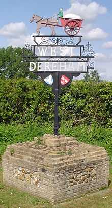
West Dereham
| West Dereham | |
 West Dereham St Andrew |
|
 West Dereham |
|
| Area | 13.51 km2 (5.22 sq mi) |
|---|---|
| Population | 440 |
| – density | 33/km2 (85/sq mi) |
| OS grid reference | TF 656 009 |
| Civil parish | West Dereham |
| District | King's Lynn and West Norfolk |
| Shire county | Norfolk |
| Region | East |
| Country | England |
| Sovereign state | United Kingdom |
| Post town | KING'S LYNN |
| Postcode district | PE33 |
| Police | Norfolk |
| Fire | Norfolk |
| Ambulance | East of England |
| EU Parliament | East of England |
Coordinates: 52°34′51″N 0°26′38″E / 52.58091°N 0.44382°E
West Dereham is a village and civil parish in the English county of Norfolk. It covers an area of 13.51 km2 (5.22 sq mi) and had a population of 440 in 176 households as of the 2001 census.[1] For the purposes of local government, it falls within the district of King's Lynn and West Norfolk.
It is situated some 4 miles (6.4 km) east of the town of Downham Market, 12 miles (19 km) south of the larger town of King's Lynn and 37 miles (60 km) west of the city of Norwich. The village should not be confused with the mid-Norfolk town of Dereham (sometimes also called East Dereham), which lies about 25 miles (40 km) away.[2]
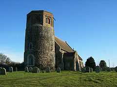
Church of St Andrew
The church of West Dereham St Andrew is one of 124 existing round-tower churches in Norfolk, and is a Grade I listed building.[3]
Notes
- ↑ Census population and household counts for unparished urban areas and all parishes. Office for National Statistics & Norfolk County Council (2001). Retrieved 20 June 2009.
- ↑ Ordnance Survey (1999). OS Explorer Map 236 - King's Lynn, Downham Market & Swaffham. ISBN 0-319-21867-8.
- ↑ "Images of England". English Heritage.
External links
| Wikimedia Commons has media related to West Dereham. |
- Map sources for West Dereham
- Information from Genuki Norfolk on West Dereham.
- Website with photos of West Dereham St Andrew, a round-tower church
- West Dereham Heritage Group page