Wellington City Council
 Wellington City Wellington City | |
| Territorial Authority | |
|---|---|
 | |
| Population: | 200,100 (June 2014 estimate)[1] |
| Land area: | 290.11 km² (112.01 sq mi) |
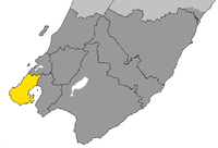
| Extent: | Extends north as far as Ohariu, Linden, Takapu Valley and Horokiwi. Bounded on the south and west by Cook Strait and the east by Wellington Harbour. |
| Mayor: | Celia Wade-Brown (since 2010) |
| Regional Council: | Wellington Regional Council |
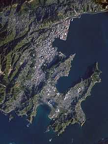
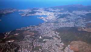
Wellington City Council is a territorial authority in the Wellington urban area of New Zealand. It is New Zealand's third-largest city by population, behind Auckland and Christchurch. Wellington city extends as far north as Linden, and includes the rural areas of Makara and Ohariu. It adjoins Porirua city in the north and Hutt city in the north-east.
Wellington attained city status in 1886. The settlement had become the capital of New Zealand in 1865, and since then has hosted New Zealand's Parliament and Government.
The city council has used the marketing slogan "Absolutely Positively Wellington" in an official capacity since the early 1990s.[2]
The Wellington City Council represents a population of 393,600,[1] and consists of a mayor and fourteen councillors elected from five wards (Northern, Onslow-Western, Lambton, Eastern, Southern) using the Single Transferable Vote system.[3]
Current mayor Celia Wade-Brown is not in favour of Wellington adopting a 'super city' type council like the one in Auckland, though is in favour of reducing the number of councils in the greater Wellington area from nine to "three or four".[4]
Mayor
One mayor is elected at large from the entire Wellington City Council area.
| Name | Affiliation (if any) | Notes | |
|---|---|---|---|
| Celia Wade-Brown | "A good choice for Wellington's future" |
Eastern ward
The Eastern ward returns three councillors to the Wellington City Council.
| Name | Affiliation (if any) | Notes | |
|---|---|---|---|
| Sarah Free | Greens | ||
| Ray Ahipene-Mercer | |||
| Simon (Swampy) Marsh |
Lambton Ward
The Lambton ward returns three councillors to the Wellington City Council.
| Name | Affiliation (if any) | Notes | |
|---|---|---|---|
| Nicola Young | |||
| Iona Pannett | Greens | ||
| Mark Peck | Labour | ||
Northern Ward
The Northern ward returns three councillors to the Wellington City Council.
| Name | Affiliation (if any) | Notes | |
|---|---|---|---|
| Justin Lester | |||
| Malcolm Sparrow | |||
| Helene Ritchie |
Onslow-Western Ward
The Onslow-Western ward returns three councillors to the Wellington City Council.
| Name | Affiliation (if any) | Notes | |
|---|---|---|---|
| Andy Foster | |||
| Simon Woolf | |||
| Jo Coughlan |
Southern Ward
The Southern ward is the only ward that returns two councillors to the Wellington City Council (all others returning three).
| Name | Affiliation (if any) | Notes | |
|---|---|---|---|
| Paul Eagle | Labour | ||
| David Lee | Greens |
Coat of Arms
The City of Wellington has a Coat of Arms. The Blazon is;
- Arms: Quarterly Gules and Azure, a Cross Or between; In the first quarter a Fleece Or; in the second quarter on Water barry wavy proper in base a Lymphad sail furled pennon and flags flying Argent; in the third quarter a Garb Or; in the fourth quarter five Plates in Saltire Argent.
- Crest: On a Mural Crown Argent a Dolphin Naiant Azure, Mantled Gules.
- Supporters: On the dexter side a Lion gorged with a Collar and Chain reflexed over the back Or, and on the sinister side a Moa proper.
- Motto: Suprema a Situ
Translation of the Blazon:
The shield is divided vertically and horizontally quarter of which the first and fourth are red and the remaining pair are blue. A golden cross is placed over the entire shield centrally between these quarters. The top left quarter contains a golden fleece (usually depicted as a whole sheep with a band around its middle). The second quarter is depicted as a silver sailing ship (lymphad) with its sails furled as it would be in port but with its flags flying, placed on waves in their natural colour. The third quarter contains a golden wheat sheaf, and the fourth has five silver discs arranged in a saltire.
The mural crown (a crown depicted as if made of stone walling) is common as a crest in city coats of arms. It is coloured silve, and from its top comes a swimming dolphin. Around the crest is mantling in red. The supporters on either side of the shield are a golden heraldic lion with a chained collar around its neck to the left, and a moa in its natural colouring on the right (the terms "sinister" and "dexter" relate to the shield from the holder's point of view, not the viewer's, thus dexter is the viewer's left and sinister is the viewer's right). The base on which the supporters stand is normally not emblazoned but is left to the artist to decide. The Motto may be translated as "Supreme by position".
Demographics
Wellington's demographics sets it apart from the rest of the country. According to the 2006 Census, Wellington has:
- The second-largest percentage of people in their twenties and thirties (37.3% compared to 27.4% nationally).
- The least number of people in their sixties (6.4%) and the second least number of people aged over sixty (12.2%).
Suburbs
Wellington city has roughly 60 officially-defined suburbs; one can group them by the wards used to elect the City Council. Some areas, while officially forming part of a larger suburb (or several suburbs), are considered by some to be separate communities. The officially-defined suburbs include:
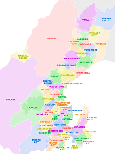
Northern Ward
- official: Broadmeadows; Churton Park; Glenside; Grenada; Grenada North; Horokiwi; Johnsonville; Khandallah; Newlands; Ohariu; Paparangi; Tawa; Takapu Valley; Woodridge
- informal: Greenacres; Redwood; Linden
Onslow-Western Ward
- official: Karori; Northland; Crofton Downs; Kaiwharawhara; Ngaio; Ngauranga; Makara; Makara Beach; Wadestown; Wilton.
- informal: Cashmere; Chartwell; Highland Park; Rangoon Heights; Te Kainga
Lambton Ward
- official: Brooklyn; Aro Valley; Kelburn; Mount Victoria; Oriental Bay; Te Aro; Thorndon; Highbury; Pipitea
Southern Ward
- official: Berhampore; Island Bay; Newtown; Vogeltown; Houghton Bay; Kingston; Mornington; Mount Cook; Owhiro Bay; Southgate
- informal: Kowhai Park
Eastern Ward
- official: Hataitai; Lyall Bay; Kilbirnie; Miramar; Seatoun; Breaker Bay; Karaka Bays; Maupuia; Melrose; Moa Point; Rongotai; Roseneath; Strathmore
- informal: Crawford; Seatoun Bays; Seatoun Heights; Miramar Heights; Strathmore Heights.
Communities of common interest
- Courtenay Place; Courtenay Quarter; Cuba Quarter; Lambton Quarter; The Waterfront Quarter
Positively Wellington Tourism, funded by the Wellington City Council, has designated the four inner-city "quarters" as marketing subdivisions to promote international and domestic tourism.
Educational facilities
Victoria University of Wellington, Wellington's oldest university, has its main campus in the hill suburb of Kelburn overlooking the centre of the city. It also has two downtown campuses and one in the western suburb of Karori. It originated as a constituent college of the University of New Zealand.
The senate of the University of New Zealand operated in Wellington until its dissolution in 1961.
A branch of Massey University operates in Wellington: it took over the site and some of the courses of the former Wellington Polytechnic. The campus is based at the former Dominion Museum, which has moved to Te Papa. The University of Otago also has a Wellington connection, as the Wellington School of Medicine and Health Sciences is a department of that university.
Wellington Institute of Technology serves Wellington and the neighbouring Hutt Valley. One of the largest polytechnics in the region, it dates from 1904.
Numerous primary and secondary educational institutions operate throughout the city, see List of schools in Wellington, New Zealand.
Wellington has a number of museums and galleries, including Te Papa, the City Gallery and the Museum of Wellington City & Sea. The Wellington Museums Trust runs the latter two, and other museums.
Sister-city relationships
- Sister cities[5]
-
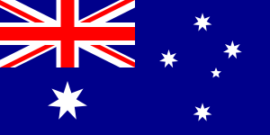 Sydney, New South Wales, Australia
 -
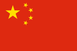 Beijing, People's Republic of China
 - Xiamen, Fujian, People's Republic of China
-
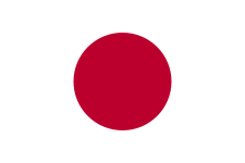 Sakai, Osaka, Japan
- Historical sister cities[6]
- Friendly cities[7]
- Tianjin, People's Republic of China
History
The City of Wellington has subsumed independent boroughs including:
- Melrose in 1903
- Onslow (Khandallah/Ngaio) in 1919
- Karori in 1920
- Miramar in 1921
- Johnsonville, formerly a Town Board, in 1953
- Tawa in 1989
Buildings
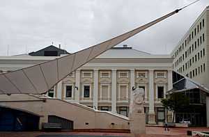
The Wellington City Council operates from a complex on Wakefield Street, with various extensions each representing a distinctive architectural period. The complex incorporates the Wellington Town Hall which opened in 1904, with the most recent extension completed in 1991 alongside the Wellington Central Library.
See also
References
- ↑ 1.0 1.1 "Subnational Population Estimates: At 30 June 2014 (provisional)". Statistics New Zealand. 22 October 2014. Retrieved 2 November 2014. Also "Infoshare; Group: Population Estimates - DPE; Table: Estimated Resident Population for Urban Areas, at 30 June (1996+) (Annual-Jun)". Statistics New Zealand. 22 October 2014. Retrieved 2 November 2014.
- ↑ Maclean, Chris (14 November 2012). "Branding Wellington". Te Ara. Ministry for Culture and Heritage. Retrieved 14 October 2013.
- ↑ "Overview – Elections 2010 – Wellington City Council". Retrieved 10 August 2010.
- ↑ "No 'super city' for Wellington – mayor". 3 News NZ. 28 January 2013.
- ↑ "Sister Cities – Overview". Wellington City Council. Retrieved 19 November 2014.
- ↑ "Historical Sister Cities". Wellington City Council. Retrieved 18 January 2014.
- ↑ "Friendly cities". Wellington City Council. Retrieved 18 January 2014.
- A Complete Guide To Heraldry by A.C. Fox-Davies 1909.
External links
| Wikivoyage has a travel guide for Wellington. |
| ||||||||||||||||||||||
| ||||||||||||||||||||||
Coordinates: 41°17′44″S 174°46′50″E / 41.29556°S 174.78056°E