Wazirpur Upazila
| Wazirpur উজিরপুর | |
|---|---|
| Upazila | |
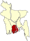
 Wazirpur Location in Bangladesh | |
| Coordinates: 22°48.7′N 90°14.7′E / 22.8117°N 90.2450°ECoordinates: 22°48.7′N 90°14.7′E / 22.8117°N 90.2450°E | |
| Country |
|
| Division | Barisal Division |
| District | Barisal District |
| Area | |
| • Total | 248.35 km2 (95.89 sq mi) |
| Population (1991) | |
| • Total | 227,115 |
| • Density | 914/km2 (2,370/sq mi) |
| Time zone | BST (UTC+6) |
| Website | Official Map of the Wazirpur Upazila |

Baitul Aman Mosque, located in Guthia, Wazirpur
Wazirpur (Bengali: উজিরপুর) is an Upazila of Barisal District in the Division of Barisal, Bangladesh.[1]
Geography
Wazirpur is located at 22°48′40″N 90°14′40″E / 22.8111°N 90.2444°E. It has 44,480 households and a total area of 248.35 km².
Demographics
According to the 1991 Bangladesh census, Wazirpur had a population of 227,115. Males constituted 50.8% of the population, and females 49.2%. The number of residents aged 18 or over was 114,254. Wazirpur has an average literacy rate of 47.7% (7+ years), compared to the national average of 32.4%. There are 22 colleges and 50 primary schools in Wazirpur.[2]
Administration
Wazirpur is divided into 9 unions/wards, 118 mauzas/mahallas, and 117 villages.
Education
There are many famous educational institution in this Upazila.
- Barakotha union institution
- Barakotha union degree college
- Malikanda mahmudiya alim madrasa
- Syed Azizul Haque Degree college
- Karfa Public Academy
Notable people
- Major M. A. Jalil,freedom fighter and sector commender.
- Md:Manjurul Karim Tanjil,Department of Botany,Dhaka College,Dhaka.
- H M Rafiqul Islam,owner of MAA Printing & packaging
See also
References
- ↑ Md. Mizanur Rahman (2012). "Wazirpur Upazila". In Sirajul Islam and Ahmed A. Jamal. Banglapedia: National Encyclopedia of Bangladesh (Second ed.). Asiatic Society of Bangladesh.
- ↑ "Population Census Wing, BBS.". Archived from the original on 2005-03-27. Retrieved November 10, 2006.
| |||||||||||||||||||||||||||||||||