Washington Square Historic District (Lowell, Massachusetts)
|
Washington Square Historic District | |
 | |
|
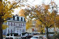
Nesmith Street (Rt. 38) near Kittredge Park | |
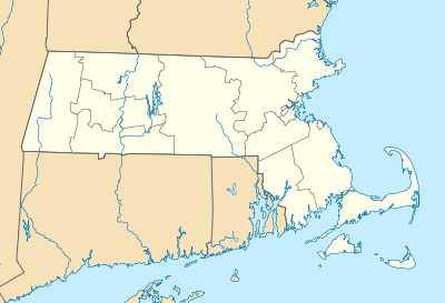 | |
| Location | Lowell, Massachusetts |
|---|---|
| Coordinates | 42°38′35″N 71°17′54″W / 42.64306°N 71.29833°WCoordinates: 42°38′35″N 71°17′54″W / 42.64306°N 71.29833°W |
| Built | 1831 |
| Architect | Wadsworth,Alexander |
| Architectural style | Greek Revival, Second Empire, Italianate |
| Governing body | Local |
| NRHP Reference # |
82001995 [1] (original)99001307 (increase) |
| Significant dates | |
| Added to NRHP | August 11, 1982 |
| Boundary increase | November 12, 1999 |
The Washington Square Historic District of Lowell, Massachusetts encompasses a historic subdivision laid out in 1832. The focal point of the subdivision is Kittridge Park, which lies on the eastern side of the district and was an original part of the subdivision plan developed by the Nesmith Brothers. The area which extends north, west and south from the park for a little more than one block, was developed mainly in the 1840s and 1850s, and consists of modest-sized houses on small lots (c. 5,000 square feet (460 m2)). Some houses were built after 1860, and only a very few postdate 1900. The district largely mirrors the area of the original subdivision, with only modern intrusions excepted. It is roughly bounded on the north by East Merrimack Street, on the east by Park Street, on the south by Andover Street, except for the block of Nesmith Street immediately to its south, and on the west by High Street, whose addresses are excluded from the district.[2]
The district was added to the National Register of Historic Places in 1982, and expanded slightly in 1999.[1]
See also
References
- ↑ 1.0 1.1 "National Register Information System". National Register of Historic Places. National Park Service. 2008-04-15.
- ↑ "NRHP nomination for Washington Square Historic District (1999 increase)". Commonwealth of Massachusetts. Retrieved 2014-04-03.
| |||||||||||||||||||||||||||||||||||||||||||||||||||||||
