Warwick railway station, Perth
| Warwick | |
|---|---|
| Transperth Trains • List of Perth railway stations | |
 | |
| Joondalup Line | |
| Location | |
| Street | Mitchell Freeway, Beach Road, Hawker Avenue |
| Suburb | Warwick |
| Distance from Perth | 13 km (8.1 mi) |
| General information | |
| Station code | JWK |
| Opened | 21 March 1993 |
| Fare zone | 2 |
| Station design | |
| Number of platforms | 2 |
| Platform architecture | 1 island |
| Station structure | Controlled station |
| Access by | Overhead bridge, pedestrian crossing, bus transfer |
| Transfers | |
| Train transfer | No |
| Bus transfer | Yes |
| Total number of bus stands | 8, 7 are currently in use |
| Total number of bus routes | 18 |
| Facilities | |
| Transit guard booth | Yes |
| Park 'n' Ride | Yes |
| Lock 'n' Ride | No, but Pay 'n' Display |
| Lifts | 1 |
| Escalators | 1 up, 1 down |
| Add Value Machines | Yes |
| Public telephones | Yes |
| Public toilets | Yes |
Coordinates: 31°50′40″S 115°47′47″E / 31.844571°S 115.796521°E Warwick railway station is a Transperth railway and bus interchange located 13 kilometres (8.1 mi) north-northwest of Perth railway station in Western Australia, on the Joondalup Line.
History
Prior to the commissioning of the site as a railway station, the location was originally a Bus Interchange known as the Warwick Bus Station. Opened in 1987,[1] it was similar in design and appearance to facilities constructed at Mirrabooka and Rockingham for the same purpose. It provided services connecting the Perth CBD to bus routes servicing the then rapidly expanding northern suburbs. The site also contains a privately operated day care centre which remains in operation to this day.[2]
The original bus station was connected to the adjoining Mitchell Freeway by a two-lane on/off ramp in both the north and south directions, constructed in the middle of the Mitchell Freeway reserve. It was constructed to service freeway express buses from Perth, services which were subsequently phased out with the opening of the railway station.[3] The on/off ramp was connected to the bus station via a bridge spanning the southbound lanes of the Freeway.[2] The bus station was positioned on land north of the connecting bridge between the Freeway East Embankment (Controlled by the Main Roads Department), Hawker Avenue, land occupied by the Warwick chapel of the Church of Jesus Christ of Latter-day Saints, and adjoining residential housing.[2]
Design and construction
At the time of the station's design, it was recognised by The Urban Rail Electrification Committee that the placement of bus services in close proximity or direct connection to rail infrastructure was of significant importance.[4] This was evidenced by the Kelmscott and Armadale Stations, and the then recently completed Cannington Station.[4]
Under the Northern Suburbs Transit System Project, construction on the station was scheduled to commence on 16 November 1991, with completion expected by the end of December 1992.[2] The Whitfords Station being of exactly the same design was scheduled for construction in synchronisation with the Warwick Station.[2]
The station was to include a number of facilities, including a bus concourse to connect with feeder bus services, information booths and offices for railway staff, amenities and services, as well as access services for mobility-impaired passengers in line with design requirements of the time.[2] Further to this, pieces of the Passenger Information Network installed at the station included previously unseen electronic displays on the upper bus decks designed to provide drivers with information so they could connect with appointed trains or communicate with bus depot control in the event of delays.[5] Passenger information systems across the network are currently being upgraded as part of the improvements being delivered under the New MetroRail Project.[6]
Car parking spaces were also included as part of the construction project, which included a significant number of on-grade parking bays on the eastern side of the station for commuter use.[2]
The design of the station also allowed for the possible extension of the upper bus deck in a southward direction towards Beach Road.[2] This extension would provide for five additional regular bus bays, as well as additional pedestrian access if required.[7]
As part of the construction of the new railway station the on/off ramps used for buses were demolished; however the original bridge over the southbound lanes still remains intact to this day. A pedestrian pathway was added to the bridge to enable pedestrian movements across to the easy side of the station from a new footbridge linking to Methuen Way, Duncraig.[2]
The most interesting part of the two stations was the upper bus deck. The deck was constructed of precast concrete that was formed off site, which was then transported to the site before being placed atop columns constructed as part of the stations foundations.[2] Precast concrete flooring was then put in place, held in specially formed ridges running the length of the beams.[8] This upper deck was the most expensive structural element of the station, and was the cause of significant attention and consideration as part of the design and construction process.[8]
The new station was opened on 21 March 1993 for the commencement of regular passenger services,[9] despite the station being officially opened on 20 December 1992 by the then Premier Dr. Carmen Lawrence.
Demolition and associated works
Once the new railway station including the bus concourse had opened, the old transfer station was demolished.[2] The costs of demolition for the existing station were not included as part of the construction budget for the new railway station.[10] The land resulting from the demolition of the transfer station was then converted into additional commuter car parking space, bringing the available number of bays up to 830.[2]
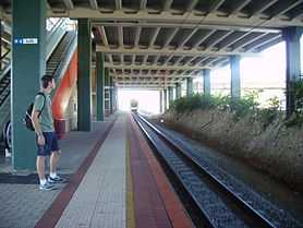
Platforms
Platforms currently in use are as follows:
| Stop no. | Platform | Line | Stopping pattern | Destination | Notes |
|---|---|---|---|---|---|
| [2800] Warwick station platforms | |||||
| 99831 | |
Joondalup | All, C, L | Perth underground | |
| 99832 | |
Joondalup | rowspan="Expression error: Missing operand for +." | All stations | Butler | |
| K, L | Clarkson | ||||
| W | Whitfords | W-pattern shuttle peak time weekdays only. | |||
Bus routes
| Route Number | Destination / Description | ||
| [12547] Stand 1 | |||
| 904 | Rail Replacement Service to Perth | ||
| [12548] Stand 2 | |||
| 344 | to Morley bus station via Alexander Heights and Ballajura | ||
| 371 | to Morley bus station via Balga and Mirrabooka | ||
| 447 | to Whitfords station via Cockman Road and Moolanda Boulevard | ||
| [12549] Stand 3 | |||
| 441 | to Whitfords station via Seacrest Drive | ||
| 442 | to Whitfords station via Waterford Drive | ||
| [12550] Stand 4 | |||
| 443 | to Whitfords station via Giles Avenue | ||
| 444 | to Whitfords station via Gibson Avenue | ||
| 904 | Rail Replacement Service to Clarkson | ||
| [12551] Stand 5 | |||
| 445 | to Whitfords station via Coolibah Drive and Kingsley Drive | ||
| 446 | to Whitfords station via Allenswood Road and Barridale Drive | ||
| [12552] Stand 6 | |||
| 423 | to Stirling station via Hillarys Boat Harbour and Karrinyup bus station | ||
| 450 | to Landsdale via Wanneroo Road and Kingsway Road | ||
| [12553] Stand 7 | |||
| 381 | to Fremantle station via Karrinyup and West Coast Highway | ||
| 387 | to Roe Street Bus Station via Balcatta Road and Wanneroo Road | ||
| 388 | to Roe Street Bus Station via Beach Road and Wanneroo Road | ||
| 449 | to Centro Warwick via Eglinton Crescent | ||
| [12554] Stand 8 | |||
| 425 | to Stirling station via Carine and Karrinyup bus station | ||
| 427 | to Stirling station via Erindale Road and Gwelup | ||
| 428 | to Stirling station via Natalie Way and Jones Street | ||
See also
- Swan Transit
- Path Transit
- Veolia Transdev
References
- ↑ Transperth (13 September 1987). Timetable - K8. Accessed at Battye Library, Perth.
- ↑ 2.0 2.1 2.2 2.3 2.4 2.5 2.6 2.7 2.8 2.9 2.10 2.11 Design Development; Northern Suburbs Transit System; Warwick Transfer Station for Perth Electric - Perth Urban Rail Development. Perth, Western Australia: Anthony Brand, Brand Dekyn and Hay - Architects. 1991. Accessed at Battye Library, Perth.
- ↑ Northern Suburbs Transit System; Perth to Joondalup Railway; Progress Summary - June 1991. Perth, Western Australia: The Urban Rail Electrification Committee, Government of Western Australia. 1991. Pg. 2. Accessed at J S Battye Library, Perth
- ↑ 4.0 4.1 Northern Suburbs Transit System; Perth to Joondalup Railway; Progress Summary - June 1991. Perth, Western Australia: The Urban Rail Electrification Committee, Government of Western Australia. 1991. Pg. 20. Accessed at J S Battye Library, Perth
- ↑ Northern Suburbs Transit System; Perth to Joondalup Railway; Progress Summary - June 1991. Perth, Western Australia: The Urban Rail Electrification Committee, Government of Western Australia. 1991. Accessed at J S Battye Library, Perth
- ↑ "Issue 14, September 2006" (PDF). OnTrack Magazine. Public Transport Authority, Government of Western Australia. Retrieved 2007-04-13. Pg. 8
- ↑ Design Development; Northern Suburbs Transit System; Warwick Transfer Station for Perth Electric - Perth Urban Rail Development. Perth, Western Australia: Anthony Brand, Brand Dekyn and Hay - Architects. 1991.Section 3.2, Accessed at J S Battye Library, Perth
- ↑ 8.0 8.1 Design Development; Northern Suburbs Transit System; Warwick Transfer Station for Perth Electric - Perth Urban Rail Development. Perth, Western Australia: Anthony Brand, Brand Dekyn and Hay - Architects. 1991.Section 4.1.6, Accessed at J S Battye Library, Perth
- ↑ Transperth (21 March 1993). Bus Timetable - J11. Accessed at J S Battye Library, Perth
- ↑ Design Development; Northern Suburbs Transit System; Warwick Transfer Station for Perth Electric - Perth Urban Rail Development. Perth, Western Australia: Anthony Brand, Brand Dekyn and Hay - Architects. 1991.Section 1.4, Accessed at J S Battye Library, Perth
Warwick
Zone 2
| Preceding station | Transperth Trains network | Following station | ||
|---|---|---|---|---|
Zone 2 towards Esplanade | Joondalup Line All, C, K, L | Zone 2 |
||
| Joondalup Line W | Zone 3 Terminus |
| ||||||||||||||||||||||||||||||||||||||||||
| ||||||||||||||||||||||||||||||