Walnut Grove, Alabama
| Walnut Grove, Alabama | |
|---|---|
| Town | |
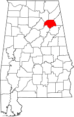
 Location in Etowah County and the state of Alabama | |
| Coordinates: 34°3′50″N 86°16′45″W / 34.06389°N 86.27917°WCoordinates: 34°3′50″N 86°16′45″W / 34.06389°N 86.27917°W | |
| Country | United States |
| State | Alabama |
| County | Etowah |
| Area | |
| • Total | 5 sq mi (13 km2) |
| • Land | 5 sq mi (13 km2) |
| • Water | 0 sq mi (0 km2) |
| Elevation | 863 ft (263 m) |
| Population (2000) | |
| • Total | 710 |
| • Density | 142/sq mi (54.6/km2) |
| Time zone | Central (CST) (UTC-6) |
| • Summer (DST) | CDT (UTC-5) |
| ZIP code | 35990 |
| Area code(s) | 205 |
| FIPS code | 01-79728 |
| GNIS feature ID | 0158099 |
Walnut Grove is a town in Etowah County, Alabama, United States. It is part of the Gadsden Metropolitan Statistical Area. At the 2000 census the population was 710.
History
Walnut Grove was located in Blount County before it was included in Baines County (now Etowah) in 1866. Walnut Grove was settled by the Murphree family (namesake of the entire Murphree Valley where the town is located) in 1813, the Morton family, and the Carnes family (namesake of the Carnes Chapel area near the ghost town of Bennettsville off of US 278) in 1823. Around 1825, the town was known as Thomas Crossroads, named after landowner Jordan D. Thomas. In 1848, the town was named Cornelius, after postmaster Harvey Cornelius. In 1849, it was renamed Walnut Grove. Walnut Grove was burned during the Civil War. Tradition has it that several women were "molested", and several men murdered. A Jim Berry was left to die, but survived and killed one of his assailants. He was not held liable. The first college preparatory school for males and females in northeast Alabama was established by act of Legislature in 1884. The Walnut Grove College ran for 15 years, and during the college's peak, the town had grown to have 13 stores, including a drug store with a soda fountain. The Walnut Grove College closed in 1899 as high schools were being established in Etowah County. The town was incorporated in 1886, with Colonel W.T Murphree as the first mayor. In 1917, the finest grade of magnesium was discovered near Silver Gap at Red Mountain. The magnesium was mined and refined by Bessemer Mills in Birmingham, and Eastman Corporation in Kingsport, Tennessee in the 1930s and 1940s.
Geography
Walnut Grove is located at 34°03′50″N 86°16′45″W / 34.063983°N 86.279254°W.[1]
According to the U.S. Census Bureau, the town has a total area of 5.0 square miles (13 km2), of which, 5.0 square miles (13 km2) of it is land and 0.04 square miles (0.10 km2) of it (0.40%) is water.
Demographics
| Historical population | |||
|---|---|---|---|
| Census | Pop. | %± | |
| 1900 | 251 | — | |
| 1910 | 264 | 5.2% | |
| 1920 | 167 | −36.7% | |
| 1930 | 216 | 29.3% | |
| 1940 | 206 | −4.6% | |
| 1950 | 222 | 7.8% | |
| 1960 | 237 | 6.8% | |
| 1970 | 224 | −5.5% | |
| 1980 | 510 | 127.7% | |
| 1990 | 717 | 40.6% | |
| 2000 | 710 | −1.0% | |
| 2010 | 698 | −1.7% | |
| Est. 2013 | 688 | −1.4% | |
| U.S. Decennial Census[2] 2013 Estimate[3] | |||
As of the census[4] of 2000, there were 710 people, 273 households, and 209 families residing in the town. The population density was 141.7 people per square mile (54.7/km²). There were 294 housing units at an average density of 58.7 per square mile (22.7/km²). The racial makeup of the town was 98.31% White, 0.14% Native American, 0.14% Asian, and 1.41% from two or more races. 0.42% of the population were Hispanic or Latino of any race.
There were 273 households out of which 39.9% had children under the age of 18 living with them, 57.9% were married couples living together, 13.2% had a female householder with no husband present, and 23.1% were non-families. 21.6% of all households were made up of individuals and 9.2% had someone living alone who was 65 years of age or older. The average household size was 2.60 and the average family size was 3.02.
In the town the population was spread out with 30.1% under the age of 18, 8.2% from 18 to 24, 27.7% from 25 to 44, 25.2% from 45 to 64, and 8.7% who were 65 years of age or older. The median age was 34 years. For every 100 females there were 94.0 males. For every 100 females age 18 and over, there were 90.0 males.
The median income for a household in the town was $26,688, and the median income for a family was $29,519. Males had a median income of $25,982 versus $17,279 for females. The per capita income for the town was $12,372. About 15.3% of families and 17.4% of the population were below the poverty line, including 19.9% of those under age 18 and 17.5% of those age 65 or over.
Climate
The climate in this area is characterized by hot, humid summers and generally mild to cool winters. According to the Köppen Climate Classification system, Walnut Grove has a humid subtropical climate, abbreviated "Cfa" on climate maps. [5]
References
- ↑ "US Gazetteer files: 2010, 2000, and 1990". United States Census Bureau. 2011-02-12. Retrieved 2011-04-23.
- ↑ "U.S. Decennial Census". Census.gov. Retrieved June 6, 2013.
- ↑ "Annual Estimates of the Resident Population: April 1, 2010 to July 1, 2013". Retrieved June 3, 2014.
- ↑ "American FactFinder". United States Census Bureau. Retrieved 2008-01-31.
- ↑ Climate Summary for Walnut Grove, Alabama
| |||||||||||||||||||||||||||||