Walker County, Alabama
| Walker County, Alabama | |
|---|---|
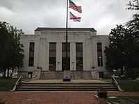 Walker County Courthouse in Jasper | |
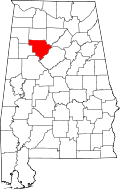 Location in the state of Alabama | |
 Alabama's location in the U.S. | |
| Founded | December 26, 1823[1] |
| Named for | John Williams Walker |
| Seat | Jasper |
| Largest city | Jasper |
| Area | |
| • Total | 805 sq mi (2,085 km2) |
| • Land | 791 sq mi (2,049 km2) |
| • Water | 14 sq mi (36 km2), 1.7% |
| Population | |
| • (2010) | 67,023 |
| • Density | 85/sq mi (33/km²) |
| Congressional district | 4th |
| Time zone | Central: UTC-6/-5 |
| Website |
www |
Walker County is a county in the U.S. state of Alabama.[1] As of the 2010 census, the population was 67,023.[2] Its county seat is Jasper.[3] Its name is in honor of John Williams Walker, a member of the United States Senate.[1]
Walker County is included in the Birmingham-Hoover, AL Metropolitan Statistical Area.
History
Walker County was established on December 26, 1823, and formed from sections of Marion and Tuscaloosa counties.[1] It was named after Senator John Walker, who represented Alabama in the U.S. Senate from 1819 to 1822.[1] Jasper is the county seat, named after William Jasper, a Red Stick War hero from South Carolina.[1]
National Register of Historic Places
Walker County has sites listed on the National Register of Historic Places. They include the Bankhead House, Boshell's Mill, the First United Methodist Church of Jasper, the Gilchrist House, the Jasper Downtown Historic District, the Stephenson House, and Walker County Hospital.[4]
Geography
According to the U.S. Census Bureau, the county has a total area of 805 square miles (2,080 km2), of which 791 square miles (2,050 km2) is land and 14 square miles (36 km2) (1.7%) is water.[5]
Adjacent counties
- Winston County (north)
- Cullman County (northeast)
- Blount County (east)
- Jefferson County (southeast)
- Tuscaloosa County (southwest)
- Fayette County (west)
- Marion County (northwest)
Transportation
Major highways
 U.S. Highway 78
 State Route 5
 State Route 13
 State Route 18
 State Route 69
 State Route 102
 State Route 118
 State Route 124
 State Route 195
 State Route 269
Walker County will be served by ![]() Interstate 22 when completed.
Interstate 22 when completed.
Rail
Demographics
| Historical population | |||
|---|---|---|---|
| Census | Pop. | %± | |
| 1830 | 2,202 | — | |
| 1840 | 4,032 | 83.1% | |
| 1850 | 5,124 | 27.1% | |
| 1860 | 7,980 | 55.7% | |
| 1870 | 6,543 | −18.0% | |
| 1880 | 9,479 | 44.9% | |
| 1890 | 16,078 | 69.6% | |
| 1900 | 25,162 | 56.5% | |
| 1910 | 37,013 | 47.1% | |
| 1920 | 50,593 | 36.7% | |
| 1930 | 59,445 | 17.5% | |
| 1940 | 64,201 | 8.0% | |
| 1950 | 63,769 | −0.7% | |
| 1960 | 54,211 | −15.0% | |
| 1970 | 56,246 | 3.8% | |
| 1980 | 68,660 | 22.1% | |
| 1990 | 67,670 | −1.4% | |
| 2000 | 70,713 | 4.5% | |
| 2010 | 67,023 | −5.2% | |
| Est. 2013 | 65,998 | −1.5% | |
| U.S. Decennial Census[6] 1790-1960[7] 1900-1990[8] 1990-2000[9] 2010-2013[2] | |||
As of the census[10] of 2000, there were 70,713 people, 28,364 households, and 20,478 families residing in the county. The population density was 89 people per square mile (34/km2). There were 32,417 housing units at an average density of 41 per square mile (16/km2). The racial makeup of the county was 92.15% White, 6.17% Black or African American, 0.28% Native American, 0.20% Asian, 0.02% Pacific Islander, 0.31% from other races, and 0.86% from two or more races. Nearly 0.86% of the population were Hispanic or Latino of any race.
In 2000 the largest reported ancestry groups in Walker County, AL were:
-
 American 27.7%
 -
 Irish 8.8%
 -
 English 6.8%
 - African American 6.17%
-
 German 3.9%
 -
 Scottish 1.4%
 -
 Scotch-Irish 1.4%
There were 28,364 households, out of which 30.70% had children under the age of 18 living with them; 56.30% were married couples living together, 11.90% had a female householder with no husband present, and 27.80% were non-families. 25.30% of all households were made up of individuals, and 11.20% had someone living alone who was 65 years of age or older. The average household size was 2.46, and the average family size was 2.93.
In the county, the population was spread out with 23.50% under the age of 18, 8.60% from 18 to 24, 28.00% from 25 to 44, 25.10% from 45 to 64, and 14.80% who were 65 years of age or older. The median age was 38 years. For every 100 females, there were 93.20 males. For every 100 females age 18 and over, there were 89.80 males.
The median income for a household in the county was $29,076, and the median income for a family was $35,221. Males had a median income of $31,242 versus $20,089 for females. The per capita income for the county was $15,546. About 13.20% of families and 16.50% of the population were below the poverty line, including 21.00% of those under age 18 and 17.40% of those age 65 or over.
Communities
Cities
- Carbon Hill
- Cordova
- Dora
- Jasper
- Sumiton (partly in Jefferson County)
Towns
Unincorporated communities
Places of interest
Walker County is home to the William B. Bankhead National Forest and Lewis Smith Lake, in addition to the Alabama Mining Museum.
See also
- National Register of Historic Places listings in Walker County, Alabama
- Properties on the Alabama Register of Landmarks and Heritage in Walker County, Alabama
References
- ↑ 1.0 1.1 1.2 1.3 1.4 1.5 "ACES Walker County Office" (links/history), Alabama Cooperative Extension System (ACES), 2007, webpage: ACES-Walker.
- ↑ 2.0 2.1 "State & County QuickFacts". United States Census Bureau. Retrieved May 17, 2014.
- ↑ "Find a County". National Association of Counties. Retrieved 2011-06-07.
- ↑ "National Register Information System". National Register of Historic Places. National Park Service. 2010-07-09.
- ↑ "US Gazetteer files: 2010, 2000, and 1990". United States Census Bureau. 2011-02-12. Retrieved 2011-04-23.
- ↑ "U.S. Decennial Census". United States Census Bureau. Retrieved May 17, 2014.
- ↑ "Historical Census Browser". University of Virginia Library. Retrieved May 17, 2014.
- ↑ "Population of Counties by Decennial Census: 1900 to 1990". United States Census Bureau. Retrieved May 17, 2014.
- ↑ "Census 2000 PHC-T-4. Ranking Tables for Counties: 1990 and 2000" (PDF). United States Census Bureau. Retrieved May 17, 2014.
- ↑ "American FactFinder". United States Census Bureau. Retrieved 2011-05-14.
External links
- Walker County map of roads/towns (map © 2007 Univ. of Alabama).
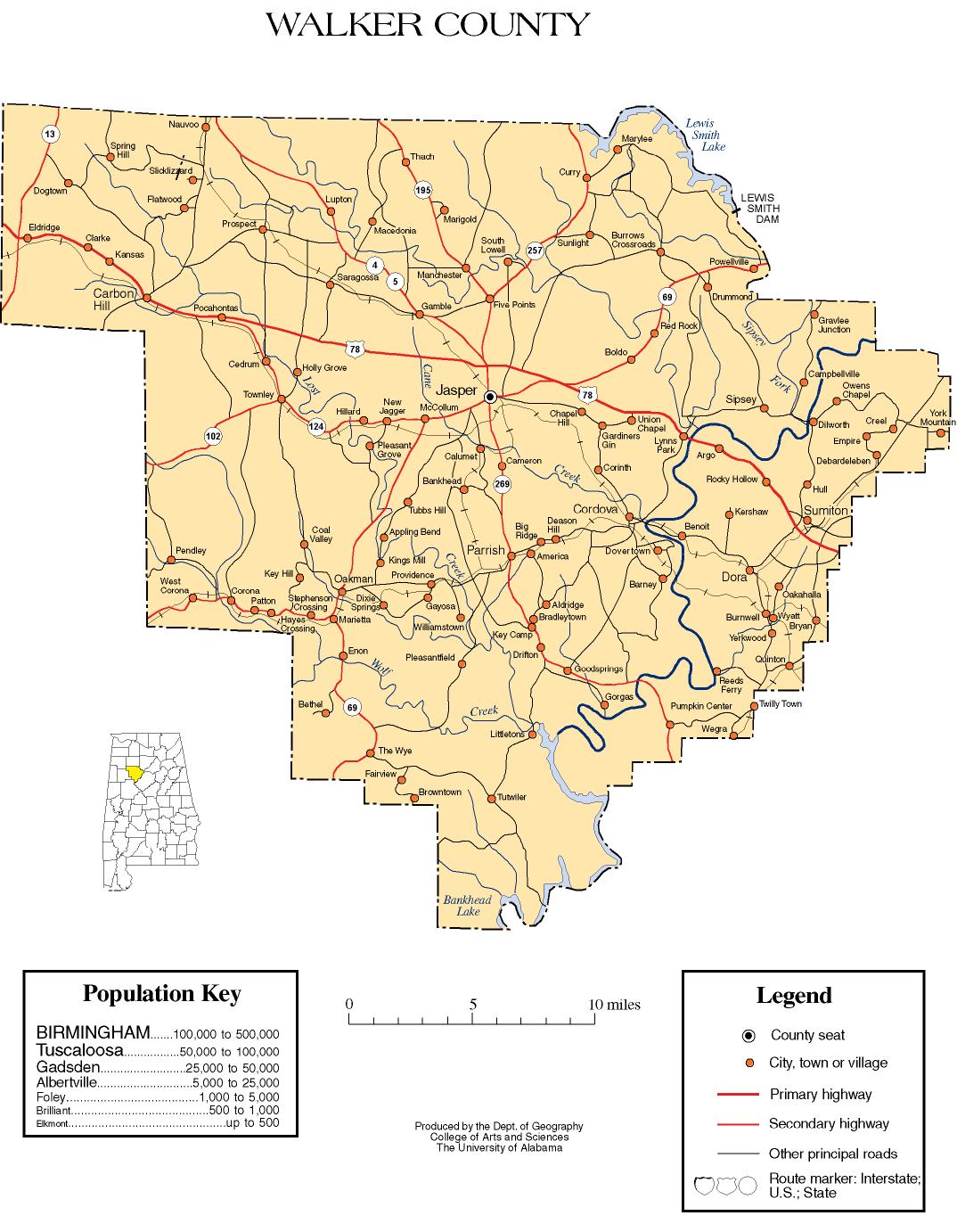
 |
Marion County | Winston County | Cullman County | |
| Fayette County | |
Blount County | ||
| ||||
| | ||||
| Tuscaloosa County | Jefferson County |
| |||||||||||||||||||||||||
| ||||||||||||||||||||||||||||||||||
Coordinates: 33°48′13″N 87°17′52″W / 33.80361°N 87.29778°W