Wakiso Town
| Wakiso Wakiso Municipality | |
|---|---|
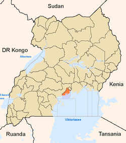
 Wakiso Location in Uganda | |
| Coordinates: 00°24′00″N 32°28′57″E / 0.40000°N 32.48250°E | |
| Country |
|
| Region | Central Uganda |
| District | Wakiso District |
| Elevation | 3,900 ft (1,200 m) |
| Population (2011 Estimate) | |
| • Total | 21,200 |
Wakiso is a metropolitan area in Central Uganda. It is the headquarters of Wakiso District, an administrative unit under the Uganda Ministry of Local Government.[1] The district is named after the town.
Location
Wakiso is located on the Kampala-Hoima Highway, approximately 20 kilometres (12 mi) northwest of Kampala, the capital of Uganda, and the largest city in that country.[2] The coordinates of the town are:00 24 00N, 32 28 48E (Latitude:0.4000; Longitude:32.4800).[3]
Climate
Köppen-Geiger climate classification system classifies its climate as tropical rainforest (Af).[4]
| Climate data for Wakiso | |||||||||||||
|---|---|---|---|---|---|---|---|---|---|---|---|---|---|
| Month | Jan | Feb | Mar | Apr | May | Jun | Jul | Aug | Sep | Oct | Nov | Dec | Year |
| Average high °C (°F) | 28.8 (83.8) |
28.7 (83.7) |
28.2 (82.8) |
27.2 (81) |
26.7 (80.1) |
26.5 (79.7) |
26.1 (79) |
26.5 (79.7) |
27.3 (81.1) |
27.7 (81.9) |
27.8 (82) |
27.7 (81.9) |
27.43 (81.39) |
| Daily mean °C (°F) | 22.3 (72.1) |
22.5 (72.5) |
22.5 (72.5) |
22.2 (72) |
21.9 (71.4) |
21.3 (70.3) |
20.8 (69.4) |
21 (70) |
21.5 (70.7) |
22 (72) |
22.1 (71.8) |
22.8 (73) |
21.91 (71.48) |
| Average low °C (°F) | 15.9 (60.6) |
16.3 (61.3) |
16.9 (62.4) |
17.2 (63) |
17.1 (62.8) |
16.2 (61.2) |
15.5 (59.9) |
15.6 (60.1) |
15.8 (60.4) |
16.4 (61.5) |
16.4 (61.5) |
16 (61) |
16.28 (61.31) |
| Average precipitation mm (inches) | 70 (2.76) |
87 (3.43) |
133 (5.24) |
204 (8.03) |
147 (5.79) |
77 (3.03) |
69 (2.72) |
97 (3.82) |
109 (4.29) |
133 (5.24) |
150 (5.91) |
101 (3.98) |
1,377 (54.24) |
| Source: Climate-Data.org (altitude: 1112m)[4] | |||||||||||||
Demographics
During the 2002 Uganda National Census, Wakiso Town's population was put at about 14,600. In 2010, the Uganda Bureau of Statistics (UBOS), estimated the population of the town at about 20,300. In 2011, UBOS estimated the mid-year population of Wakiso at 21,200.[5]
Points of interest
The following points of interest are found in Wakiso or close to the town's borders:
- The headquarters of Wakiso District Administration
- The offices of Wakiso Town Council
- A branch of Centenary Bank
- Wakiso Central Market
- Bunamwaya Stadium - A 5,000-seater stadium, home to Bunamwaya Football Club
- The Kampala-Hoima Highway - The highway passes through the town, in a northwest to southeast direction.
See also
References
- ↑ Joshua Kato, Juliet Lukwago (24 October 2007). "Challenges of Turning Wakiso". New Vision. Retrieved 23 April 2014.
- ↑ "Distance Between Kampala And Wakiso With Map". Gobefeed.com. Retrieved 23 April 2014.
- ↑ "Location of Wakiso At Google Maps". Google Maps. Retrieved 23 April 2014.
- ↑ 4.0 4.1 "Climate: Wakiso - Climate graph, Temperature graph, Climate table". Climate-Data.org. Retrieved 2013-12-07.
- ↑ "Estimated Populations of Major Ugandan Urban Centers In 2002, 2010 & 2011" (PDF). Uganda Bureau of Statistics. Retrieved 23 April 2014.