Wadi Musa
| Wadi Mousa وادي موسى "Valley of Moses" | |
|---|---|
| Town | |
|
Wadi Musa | |
 Wadi Mousa | |
| Coordinates: 30°19′12″N 35°28′43″E / 30.32000°N 35.47861°E | |
| Country | Jordan |
| Province | Ma'an Governorate |
| Elevation | 850 m (2,790 ft) |
| Time zone | GMT +2 |
| • Summer (DST) | +3 (UTC) |
| Area code(s) | +(962)3 |
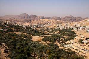
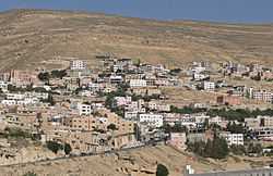
Wadi Musa, (Arabic: وادي موسى, literally ‘Valley of Moses’), is the name of a town located in the Ma'an Governorate in southern Jordan east of Petra at latitude 30.317N and longitude 35.483E.
It is the nearest town to the archaeological site of Petra and hosts many hotels and restaurants for tourists visiting this place. Approximately 2 kilometers from the main town, there is an important Bedouin settlement.
Demographics
The census of 2004 shows that the population of Petra Department, which includes Wadi Musa and 18 other villages, with Wadi Musa being its administrative center, had a total population of 23,840 inhabitants. The male to female ratio was 51.56 to 48.44, Jordanian citizens made up 93.5% of the population of Wadi Musa.[1] The estimated population of Wadi Musa in 2009 is 26,100.
Origin of the Name
Wadi Musa means ‘Valley of Moses’ in Arabic. It is said that the prophet Moses passed through the valley and struck water from the rock for his followers at the site of Ain Musa (‘Moses's water spring’ or ‘Moses's Well’).[2] The Nabateans built channels that carried water from this spring to the city of Petra. Wadi Musa was also nicknamed the ‘Guardian of Petra’. The "Tomb of Aaron", supposed burial site of Aaron, the brother of Moses, is on nearby Mount Hor.
Economy
The town is about 250 km from Amman, Jordan's capital, and 100 km north of the port city of Aqaba. With more than 50 hotels and many tourist restaurants, its economy is almost entirely tied to tourism.
The campus of the College of Archaeology, Tourism & Hotel Management of Al-Hussein Bin Talal University is located in Wadi Musa.
References
Gallery
-

Wadi Musa Valley
-

Petra Visitors Center
External links
 Media related to Wadi Musa at Wikimedia Commons
Coordinates: 30°19′11.96″N 35°28′42.37″E / 30.3199889°N 35.4784361°E
