Waaia
| Waaia Victoria | |||||||||||||
|---|---|---|---|---|---|---|---|---|---|---|---|---|---|
|
Waaia Hotel | |||||||||||||
 Waaia | |||||||||||||
| Coordinates | 36°03′0″S 145°21′0″E / 36.05000°S 145.35000°ECoordinates: 36°03′0″S 145°21′0″E / 36.05000°S 145.35000°E | ||||||||||||
| Population | 376 (2011 census)[1] | ||||||||||||
| Postcode(s) | 3637 | ||||||||||||
| Location | |||||||||||||
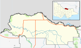
| LGA(s) | Shire of Moira | ||||||||||||
| State electorate(s) | Shepparton | ||||||||||||
| Federal Division(s) | Murray | ||||||||||||
| |||||||||||||

Waaia (/ˈweɪaɪ/ WAY-eye) is a town in northern Victoria, Australia in the Shire of Moira local government area, 228 kilometres (142 mi) north of the state capital, Melbourne. The area is home to mainly irrigated dairy farms. At the 2011 census, Waaia and the surrounding area had a population of 376.[1]
Waaia was established in the late 1880s to cater for the increasing rural population of the surrounding area and a Post Office opened on 17 December 1888.[2]
The town consists of a school (established 1890), a hotel and an Australian rules football ground (the town has a team in the Picola & District Football League), along with around 10 houses.
Waaia is home to an annual tractor pull, organised by the local community action group.[3]
References
- ↑ 1.0 1.1 Australian Bureau of Statistics (31 October 2012). "Waaia (State Suburb)". 2011 Census QuickStats. Retrieved 5 December 2014.
- ↑ Premier Postal History. "Post Office List". Retrieved 2008-04-11.
- ↑ "Waaia Tractor Pull". Waaia Action Group Inc. Retrieved 2007-06-16.
| ||||||
| Wikimedia Commons has media related to Waaia. |