Vogošća
| Vogošća | ||
|---|---|---|
| ||
 Location of Vogošća within Bosnia and Herzegovina. | ||
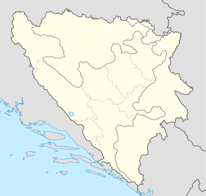 Vogošća Location of Vogošća | ||
| Coordinates: 45°54′N 18°21′E / 45.900°N 18.350°E | ||
| Country |
| |
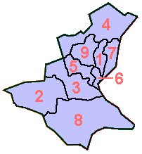
| Communities | 8 | |
| Government | ||
| Area | ||
| • Total | 71,7 km2 (277 sq mi) | |
| Population (2014 census) | ||
| • Total | 32,500 | |
| • Density | 453/km2 (1,170/sq mi) | |
| Time zone | CET (UTC+1) | |
| • Summer (DST) | CEST (UTC+2) | |
| Area code(s) | +387 33 | |
| Website | http://www.vogosca.ba | |

Vogošća is a secondary suburb and municipality of Sarajevo, Sarajevo Canton, the capital of Bosnia, located about 6 kilometers north of the city center and covering some 72 km².
Demographics
1971
According to 1971 population census there were 14,402 residents.
- 6,728 Serbs (46.71%)
- 5,938 Bosniaks (41.23%)
- 1,186 Croats (8.23%)
- 247 Yugoslavs (1.71%)
- 303 Others (2.12%)
1991
According to 1991 population census there were 24,647 residents.
- 12,499 Bosniaks (50.71%)
- 8,813 Serbs (35.75%)
- 1,071 Croats (4.34%)
- 1,730 Yugoslavs (7.01%)
- 534 Others (2.19%)
History
Vogošća greatly prospered during the 1980s, as part of Sarajevo’s great boom in the latter half of the 20th century. It grew to prominence in large part due to its automobile manufacturing industry, having deals with German and Swedish companies, including Volkswagen Group. By the late 1980s, it was the second most industrious and productive municipality in former Yugoslavia.
Vogošća was heavily damaged during the exodus of the Serbs who controlled that territory during the war. The Dayton Agreement provided Vogošća to be a part of the Federation of Bosnia and Herzegovina. Today, Vogošća is rebuilding and its industries are on the rebound thanks to aid and funds.
Communities and neighborhoods in Vogošća
- Vogošća I
- Vogošća II
• Blagovac • Budišići • Donja Vogošća • Garež • Gora • Grahovište • Hotonj • Kamenica • Kobilja Glava • Kremeš • Krivoglavci • Ljubina - Poturovići • Nebočaj • Perca • Semizovac • Svrake • Tihovići • Uglješići • Ugorsko • Vrapče
References
- Official results from the book: Ethnic composition of SR Bosnia-Herzegovina population, by municipalities and settlements, 1991. census, Zavod za statistiku Bosne i Hercegovine - Bilten no.234, Sarajevo 1991.
External links

| ||||||||
| ||||||||||||||||||||||||||||||||||||||||||||||||||||||||||||||
Coordinates: 43°54′N 18°21′E / 43.900°N 18.350°E
| Wikimedia Commons has media related to Vogošća. |