Vista Center, New Jersey
| Vista Center, New Jersey | |
|---|---|
| Census designated place | |
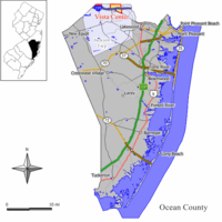 Map of Vista Center highlighted within Ocean County. Inset: Location of Ocean County in New Jersey. | |
| Coordinates: 40°09′30″N 74°19′27″W / 40.158303°N 74.324246°WCoordinates: 40°09′30″N 74°19′27″W / 40.158303°N 74.324246°W | |
| Country |
|
| State |
|
| County | Ocean |
| Township | Jackson |
| Area[1] | |
| • Total | 3.427 sq mi (8.877 km2) |
| • Land | 3.388 sq mi (8.775 km2) |
| • Water | 0.039 sq mi (0.102 km2) 1.15% |
| Elevation[2] | 118 ft (36 m) |
| Population (2010 census)[3] | |
| • Total | 2,095 |
| • Density | 618.3/sq mi (238.7/km2) |
| Time zone | Eastern (EST) (UTC-5) |
| • Summer (DST) | Eastern (EDT) (UTC-4) |
| Area code(s) | 732 |
| FIPS code | 3476107[1][4] |
| GNIS feature ID | 02390441[1][5] |
Vista Center is an unincorporated community and census designated place (CDP) located within Jackson Township, in Ocean County, New Jersey, United States.[6][7][8] As of the 2010 United States Census, the CDP's population was 3,689.[3]
Geography
According to the United States Census Bureau, the CDP had a total area of 3.427 square miles (8.877 km2), of which, 3.388 square miles (8.775 km2) of it was land and 0.039 square miles (0.102 km2) of it (1.15%) was water.[1][9]
Demographics
| Historical population | |||
|---|---|---|---|
| Census | Pop. | %± | |
| 2000 | 541 | — | |
| 2010 | 2,095 | 287.2% | |
| Sources: 2000-2010[8] 2000[10] 2010[3] | |||
Census 2010
At the 2010 United States Census, there were 2,095 people, 875 households, and 742.9 families residing in the CDP. The population density was 618.3 per square mile (238.7/km2). There were 948 housing units at an average density of 279.8 per square mile (108.0/km2). The racial makeup of the CDP was 93.60% (1,961) White, 3.29% (69) Black or African American, 0.10% (2) Native American, 2.58% (54) Asian, 0.00% (0) Pacific Islander, 0.24% (5) from other races, and 0.19% (4) from two or more races. Hispanics or Latinos of any race were 5.25% (110) of the population.[3]
There were 875 households, of which 14.2% had children under the age of 18 living with them, 79.8% were married couples living together, 3.9% had a female householder with no husband present, and 15.1% were non-families. 11.2% of all households were made up of individuals, and 4.9% had someone living alone who was 65 years of age or older. The average household size was 2.39 and the average family size was 2.57.[3]
In the CDP, 12.1% of the population were under the age of 18, 3.9% from 18 to 24, 13.4% from 25 to 44, 38.5% from 45 to 64, and 32.1% who were 65 years of age or older. The median age was 59.7 years. For every 100 females there were 96.3 males. For every 100 females age 18 and over, there were 93.5 males.[3]
Census 2000
As of the 2000 United States Census[4] there were 541 people, 170 households, and 143 families residing in the CDP. The population density was 60.5/km² (156.7/mi²). There were 173 housing units at an average density of 19.4/km² (50.1/mi²). The racial makeup of the CDP was 91.31% White, 4.44% African American, 0.18% Native American, 1.48% Asian, 0.55% from other races, and 2.03% from two or more races. Hispanic or Latino of any race were 6.28% of the population.[10]
There were 170 households out of which 45.3% had children under the age of 18 living with them, 72.9% were married couples living together, 7.1% had a female householder with no husband present, and 15.3% were non-families. 8.2% of all households were made up of individuals and 3.5% had someone living alone who was 65 years of age or older. The average household size was 3.18 and the average family size was 3.42.[10]
In the CDP the population was spread out with 28.8% under the age of 18, 7.6% from 18 to 24, 36.4% from 25 to 44, 21.4% from 45 to 64, and 5.7% who were 65 years of age or older. The median age was 36 years. For every 100 females there were 103.4 males. For every 100 females age 18 and over, there were 100.5 males.[10]
The median income for a household in the CDP was $100,337, and the median income for a family was $101,125. Males had a median income of $50,156 versus $25,938 for females. The per capita income for the CDP was $29,620. None of the families and 1.1% of the population were living below the poverty line, including no under eighteens and none of those over 64.[10]
References
- ↑ 1.0 1.1 1.2 1.3 Gazetteer of New Jersey Places, United States Census Bureau. Accessed June 13, 2013.
- ↑ U.S. Geological Survey Geographic Names Information System: Vista Center Census Designated Place, Geographic Names Information System. Accessed January 6, 2013.
- ↑ 3.0 3.1 3.2 3.3 3.4 3.5 DP-1 - Profile of General Population and Housing Characteristics: 2010 Demographic Profile Data for Vista Center CDP, New Jersey, United States Census Bureau. Accessed January 6, 2013.
- ↑ 4.0 4.1 American FactFinder, United States Census Bureau. Accessed September 4, 2014.
- ↑ US Board on Geographic Names, United States Geological Survey. Accessed September 4, 2014.
- ↑ GCT-PH1 - Population, Housing Units, Area, and Density: 2010 - County -- County Subdivision and Place from the 2010 Census Summary File 1 for Ocean County, New Jersey, United States Census Bureau. Accessed January 4, 2013.
- ↑ 2006-2010 American Community Survey Geography for New Jersey, United States Census Bureau. Accessed January 4, 2013.
- ↑ 8.0 8.1 New Jersey: 2010 - Population and Housing Unit Counts - 2010 Census of Population and Housing (CPH-2-32), United States Census Bureau, August 2012. Accessed January 4, 2013.
- ↑ US Gazetteer files: 2010, 2000, and 1990, United States Census Bureau. Accessed September 4, 2014.
- ↑ 10.0 10.1 10.2 10.3 10.4 DP-1 - Profile of General Demographic Characteristics: 2000 from the Census 2000 Summary File 1 (SF 1) 100-Percent Data for Vista Center CDP, New Jersey, United States Census Bureau. Accessed January 6, 2013.
