Virgin Mountains
| Virgin Mountains | |
|---|---|
|
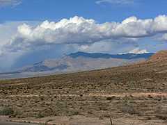
Virgin Mountains seen from the Northshore Drive along Lake Mead | |
| Highest point | |
| Peak | Virgin Peak |
| Elevation | 7,946 ft (2,422 m) [1] |
| Coordinates | 36°36′10″N 114°06′42″W / 36.60278°N 114.11167°WCoordinates: 36°36′10″N 114°06′42″W / 36.60278°N 114.11167°W |
| Dimensions | |
| Area | 116 sq mi (300 km2) |
| Geography | |
| Country | United States |
| States | Nevada and Arizona |
The Virgin Mountains are a mountain range of the northeastern Mojave Desert, located in Clark County, southeastern Nevada and Mohave County, northwestern Arizona.
Geography
Virgin Peak, at 7,946 feet (2,422 m) in elevation, is the highest point in the range. The range is northeast of Lake Mead, and around 15 miles (24 km) south of the Nevada town of Mesquite.
Hydrologically, the range is located in the Lower Colorado—Lake Mead watershed. (USGS Huc 1501),[2]
91.6% of the range is managed by the Bureau of Land Management, with a section of the Virgin Peak area designated within the BLM Virgin Mountain Natural Area.[3]
Natural history
The range has many species of lizards, as well as the Panamint rattlesnake and glossy snake. Trees found in the range include Single-leaf pinyon pine (Pinus monophylla), Arizona cypress (Cupressus arizonica), White fir (Abies concolor), Douglas fir (Pseudotsuga menziesii), and Utah juniper (Juniperus osteosperma), and Rocky Mountain juniper (Juniperus scopulorum).
See also
- Virgin Valley
- Virgin River
- Virgin River Gorge
- Virgin River Narrows
- South Virgin Mountains
References
- ↑ "Query Form For The United States And Its Territories". U.S. Board on Geographic Names. Retrieved 2010-05-18.
- "Virgin Peak (844592)". Geographic Names Information System. United States Geological Survey. Retrieved 2010-06-02.
- ↑ "Boundary Descriptions and Names of Regions, Subregions, Accounting Units and Cataloging Units". USGS.gov. Retrieved 2010-06-02.
- ↑ Bureau of Land Management: Virgin Mountain Natural Area
External links
| Wikimedia Commons has media related to Virgin Mountains. |