Villaviciosa, Abra
| Villaviciosa | |
|---|---|
| Municipality | |
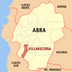 Map of Abra showing the location of Villaviciosa | |
.svg.png) Villaviciosa Location within the Philippines | |
| Coordinates: 17°26′N 120°38′E / 17.433°N 120.633°ECoordinates: 17°26′N 120°38′E / 17.433°N 120.633°E | |
| Country | Philippines |
| Region | Cordillera Administrative Region (CAR) |
| Province | Abra |
| District | Lone District of Abra |
| Barangays | 8 |
| Government[1] | |
| • Mayor | Marjorie L. Lagen |
| Area[2] | |
| • Total | 102.93 km2 (39.74 sq mi) |
| Population (2010)[3] | |
| • Total | 5,377 |
| • Density | 52/km2 (140/sq mi) |
| Time zone | PST (UTC+8) |
| ZIP code | 2811 |
| Dialing code | 74 |
| Income class | 5th class municipality |
Villaviciosa is a fifth class municipality in the province of Abra, Philippines. According to the 2010 census, it has a population of 5,377 people.[3]
Geography
The Municipality is geographically located in the southern portion of the Province of Abra. It is bounded in the northwest by San Isidro and Bucay on the north, in the east by Manabo and Luba, on the south by San Emilio, Ilocos Sur, and on the west by Pilar.
Villaviciosa is accessible from Benguet Province by land transportation through the Abra-Ilocos Sur Road, the more frequently used route. From the nearby Province of Ilocos Sur, it is also accessible through the Candon via San Emilio to Luba-Tamac, Villaviciosa Road and the Sta. Maria-Burgos, Ilocos Sur via Pilar-Villaviciosa Road.
Barangays
Villaviciosa is politically subdivided into 8 barangays.[2]
| Barangay | Population (2007) |
Population (2010)[3] |
|---|---|---|
| Ap-apaya | |
|
| Bol-lilising | |
|
| Cal-lao | |
|
| Lap-lapog | |
|
| Lumaba | |
|
| Poblacion | |
|
| Tamac | |
|
| Tuquib | |
|
Demographics
| Population census of Villaviciosa | ||
|---|---|---|
| Year | Pop. | ±% p.a. |
| 1990 | 4,612 | — |
| 1995 | 4,634 | +0.09% |
| 2000 | 4,877 | +1.10% |
| 2007 | 5,147 | +0.75% |
| 2010 | 5,377 | +1.60% |
| Source: National Statistics Office[3] | ||
References
- ↑ "Official City/Municipal 2013 Election Results". Intramuros, Manila, Philippines: Commission on Elections (COMELEC). 11 September 2013. Retrieved 30 December 2013.
- ↑ 2.0 2.1 "Province: ABRA". PSGC Interactive. Makati City, Philippines: National Statistical Coordination Board. Retrieved 30 December 2013.
- ↑ 3.0 3.1 3.2 3.3 "Total Population by Province, City, Municipality and Barangay: as of May 1, 2010". 2010 Census of Population and Housing. National Statistics Office. Retrieved 30 December 2013.
External links
 |
San Isidro | |
Bucay | |
| Pilar | |
Manabo Luba | ||
| ||||
| | ||||
| San Emilio, Ilocos Sur |
| ||||||||||||||