Villanders
| Villanders | |
|---|---|
| Comune | |
| Gemeinde Villanders Comune di Villandro | |
|
View from NE | |
 Villanders Location of Villanders in Italy | |
| Coordinates: 46°38′N 11°32′E / 46.633°N 11.533°ECoordinates: 46°38′N 11°32′E / 46.633°N 11.533°E | |
| Country | Italy |
| Region | Trentino-Alto Adige/Südtirol |
| Province | South Tyrol (BZ) |
| Frazioni | St. Stefan (Santo Stefano), St. Moritz (San Maurizio) , St. Valentin (San Valentino) |
| Government | |
| • Mayor | Walter Baumgartner |
| Area | |
| • Total | 44 km2 (17 sq mi) |
| Elevation | 880 m (2,890 ft) |
| Population (Nov. 2010) | |
| • Total | 1,912 |
| • Density | 43/km2 (110/sq mi) |
| Demonym |
German: Villanderser Italian: Villandresi |
| Time zone | CET (UTC+1) |
| • Summer (DST) | CEST (UTC+2) |
| Postal code | 39043 |
| Dialing code | 0472 |
| Website | Official website |

Villanders (Italian: Villandro) is a village and comune in South Tyrol in northern Italy.
Geography
Villanders lies on the Villanderer Berg (Mountain of Villanders), at the top of which lies the Totensee (Lake of death). The village is bordered by Barbian, Klausen, Lajen, Ritten and Sarntal.
.png)
Map of South Tyrol showing Villanders
History
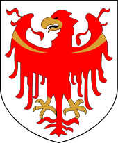
Coat-of-arms
The emblem is party per fess of azure and gules, in the first three points of argent, in the second a fess dancetty of argent. It is the arms of the local Lords of Villanders and Pardell. The emblem was granted in 1966.[1]
Society
Linguistic distribution
According to the 2011 census, 98.46% of the population speak German, 1.15% Italian and 0.38% Ladin as first language.[2]
Notes and references
- ↑ Heraldry of the World: Villander
- ↑ "Volkszählung 2011/Censimento della popolazione 2011". astat info (Provincial Statistics Institute of the Autonomous Province of South Tyrol) (38): 6–7. June 2012. Retrieved 2012-06-14.
External links
![]() Media related to Villanders at Wikimedia Commons
Media related to Villanders at Wikimedia Commons