Viewpark
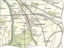
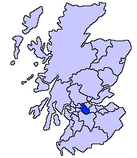
Viewpark is a small urban development north-east of Uddingston in North Lanarkshire, Scotland. Viewpark is adjacent to Tannochside, and is 2 kilometres (1.2 mi) west of Bellshill. Viewpark is often considered a district of Uddingston despite falling under the jurisdiction of a separate local authority. It has a population of 15,841 as of 2014 [1]
Viewpark was originally built to house miners and was erected quickly. The older houses were originally called the "olde Rows. Viewpark then grew steadily to support housing demand in the area which was thriving with Industry at the time with companies such as the Mining and Ranco plus the Caterpillar Tractor Co opening its doors in 1959 creating a boom in the population of the area which is known as Viewpark today.
1956 and the main thoroughfare in Viewpark, Laburnum Road, often referred to as "The Burma Road", in reference to its length, was well underway in its construction. That same year, the local council set up what has now become Burnhead Bowling Club, along with an adjacent tennis court. A new church was built, Burnhead Parish Church, on Laburnum Road, opposite its junction with Burnhead Street.
Located near the older housing within Viewpark is the Glen, also known locally as the "Viewpark Glen"[2] which expands across Uddingston, Bothwell, Hamilton, Coatbridge and Motherwell. Within the Glen lies famous roman ruins such as a roman bridge as well as tombs dating centuries old further into the area.[3]
The demolition of the miners homes, referred to as The Miners Rows, in Tannochside, which released land for the erection of the Caterpillar Tractor Co. led to an influx of displaced families into the Viewpark area. However, no one was complaining, gone was the "hole in the wall bed", and in its place, a brand new home, with separate bedrooms, kitchen areas, and indoor bathing and toilet facilities. A modern wonder indeed! A similar fate befell the Miners Rows at Cockhill, located due east of Laburnum Road. That land has now been utilised as a football field, with a shopping area on the north side of Old Edinburgh Road. Kerrs Farm at Cockhill, also disappeared, and that land, which extended between Laburnum Road and the new bypass road, the A725, was used to create Righead Industrial Estate.
Viewpark was home to Celtic Football Clubs most famous player, Jimmy 'Jinky' Johnstone [4] who lived near the old St.Columbas Primary School on Old Edinburgh Road, which has since been knocked down to make way for private housing.
A shopping complex was added, aptly located in Market Place, just off Burnhead Street, and the old rose gardens are now long gone, replaced by the Community Centre, a Sports Complex, and a Medical Centre.
As of 2014, plans have been put in place with the local council to construct an ASDA food store across the road from John Paul Primary School, near the Viewpark Glen, where the newer modern school which combined and accommodates the pupils of St.Columbus and St.[5] Gabriels Primary School.
Thorniewood United, a junior football club, is based in the area.
References
- ↑ http://www.scrol.gov.uk/scrol/browser/profile.jsp?profile=Population&mainArea=viewpark&mainLevel=Locality
- ↑ http://www.archiuk.com/cgi-bin/web-archi.pl?PlacenameFromPlacenameFinder=Viewpark&CountyFromPlacenameFinder=Strathclyde&distance=10000&ARCHIFormNGRLetter=NS&ARCHIFormNGR_x=70&ARCHIFormNGR_y=61&info2search4=placename_search
- ↑ http://www.dailyrecord.co.uk/news/local-news/pictures-kids-families-protest-save-3253656
- ↑ http://www.scotsman.com/jimmy-johnstone-1-1811780
- ↑ http://news.stv.tv/west-central/240877-15m-asda-to-bring-200-jobs-to-viewpark-in-north-lanarkshire/
Coordinates: 55°49′52″N 4°03′15″W / 55.83111°N 4.05417°W