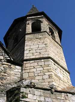
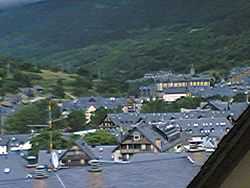
Vielha e Mijaran
| Vielha e Mijaran | |
|---|---|
| Municipality | |
 | |
 Vielha e Mijaran Location in Catalonia | |
| Coordinates: 42°42′15″N 0°47′46″E / 42.70417°N 0.79611°E | |
| Country |
|
| Community |
|
| Province | Lleida |
| Comarca | Val d'Aran |
| Government | |
| • Mayor | Joan Pau Perdices Pla (CDA) |
| Area | |
| • Total | 211.74 km2 (81.75 sq mi) |
| Elevation | 980 m (3,220 ft) |
| Population (2009) | |
| • Total | 5,710 |
| • Density | 27/km2 (70/sq mi) |
| Time zone | CET (UTC+1) |
| • Summer (DST) | CEST (UTC+2) |
| Postal code | 25530 |
| Climate | Cfb |
| Wikimedia Commons has media related to Vielha e Mijaran. |
Vielha e Mijaran (Occitan pronunciation: [biˈeʎa e miʒaˈɾan]) is a municipality in the comarca of the Val d'Aran in Catalonia, Spain. It was created in 1970 by the merger of the municipalities of Arròs e Vila, Betlan, Escunhau, Gausac, Vielha and Vilac: the former municipalities retain some privileges as "decentralised municipal entities" (entitats municipals descentralitzades, EMD),[1] as does the village of Betren. Mijaran literally means "Middle Valley" in Aranese, as the inhabited part of the municipality is situated in the valley of the Garonne (Garona). The Noguera Ribagorçana has its source on the territory of the municipality, on the opposite side of the watershed. The ajuntament (town hall) is in Vielha, spelled Viella in Catalan and Spanish, which is also the capital of the comarca.
The municipality is linked to France and to the rest of Catalonia (via the Vielha tunnel) by the N-230 road. The C-28 (old name: C-142) road continues up the valley to Naut Aran, and on over the Port de la Bonaigua (2,072 m) to the comarca of Pallars Sobirà. This road, the higher stretches of which are impassable in winter, was the only route between the Val d'Aran and the rest of Spain before the opening of the Vielha tunnel in 1948.
Subdivisions
The municipality is composed of thirteen distinct settlements. Populations are given as of 2001:
- Arròs (95)
- Aubèrt (104), in the EMD of Aubèrt e Betlan
- Betlan (24), on the left bank of the Garonne
- Betren (376), on the left bank of the Garonne
- Casarilh (64), in the EMD of Escunhau e Casarilh, on the left bank of the Garonne
- Casau (87), inhabited in Roman times
- Escunhau (89)
- Gausac (555)
- Mont (25), on the right bank of the Garonne at the foot of the Es Cròdos range
- Montcorbau (17), on the right bank of the Garonne
- Vielha (2,620)
- Vila (30)
- Vilac (147)

Sister cities
References
- ↑ Entitats municipals descentralitzades are governed by the Llei Municipal i de Règim Local de Catalunya (8/1987 de 15 d'abril de 1987). They correspond to entidades locales menores in the rest of Spain (known as entitats locals menors in the Valencian Community and the Balearic Islands).
Sources
- Panareda Clopés, Josep Maria; Rios Calvet, Jaume; Rabella Vives, Josep Maria (1989). Guia de Catalunya, Barcelona:Caixa de Catalunya. ISBN 84-87135-01-3 (Spanish). ISBN 84-87135-02-1 (Catalan).
External links
- Official website
- Information from the Generalitat de Catalunya
- Information from the Institut d'Estadística de Catalunya
 |
Vilamòs | Canejan |  | |
| Es Bòrdes | |
Naut Aran | ||
| ||||
| | ||||
| Bagnères-de-Luchon (France) Benasque (Aragon) |
Montanuy (Aragon) | Vilaller |
| ||||||||