Vicente López, Buenos Aires
| Vicente López | |
|---|---|
|
Partial view of Vicente López | |
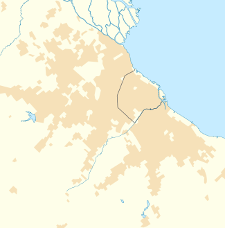 Vicente López Location in Greater Buenos Aires (conurban) | |
| Coordinates: 34°32′S 58°28.5′W / 34.533°S 58.4750°WCoordinates: 34°32′S 58°28.5′W / 34.533°S 58.4750°W | |
| Country |
|
| Province |
|
| Partido | Vicente López |
| Founded | 1905 |
| Elevation | 4 m (13 ft) |
| Population (2010 census [INDEC]) | |
| • Total | 360,078 |
| CPA Base | B 1602 |
| Area code(s) | +54 11 |

Vicente López is a partially residential neighbourhood in Partido of Vicente López of Buenos Aires Province in Argentina, it forms part of the Buenos Aires Conurban agglomeration. It currently has about 360,000 inhabitants and is bordered by Paraná Street to the north, Constituyentes Avenue to the west, the General Paz Highway to the south and the Rio de la Plata to the east.
The most important commercial street is Libertador Avenue ,Avenue Maipú & Avenue Mitre. The section of avenue Del Libertador that belongs to Vicente López is mostly specialized in luxury car dealers and marine motors, as this avenue has easy access from some of the wealthiest neighbourhoods in the Greater Buenos Aires metro area (such as AcassusoProvince of Buenos Aires, San Isidro and Olivos).


External links
- Municipal information: Municipal Affairs Federal Institute (IFAM), Municipal Affairs Secretariat, Ministry of Interior, Argentina. (Spanish)
- (Spanish) Municipal website
- (Spanish) Twitter website
- (Spanish) Facebook website