Veur
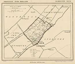
Map of Veur from 1867.
Veur is a former municipality in the Dutch province of South Holland. It covered the northwestern part of the current town of Leidschendam.
Veur was a separate municipality between 1817 and 1938, when it merges with Stompwijk to form the new municipality of Leidschendam.[1]
References
- ↑ Ad van der Meer and Onno Boonstra, "Repertorium van Nederlandse gemeenten", KNAW, 2006.
External links
- J. Kuyper, Gemeente Atlas van Nederland, 1865-1870, "Veur". Map of the former municipality in 1868.