Verruyes
| Verruyes | |
|---|---|
|
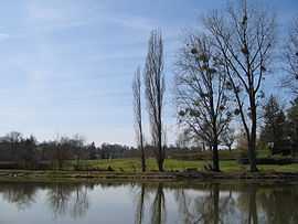
The lake in Verruyes | |
 Verruyes | |
|
Location within Poitou-Charentes region  Verruyes | |
| Coordinates: 46°31′01″N 0°17′18″W / 46.5169°N 0.2883°WCoordinates: 46°31′01″N 0°17′18″W / 46.5169°N 0.2883°W | |
| Country | France |
| Region | Poitou-Charentes |
| Department | Deux-Sèvres |
| Arrondissement | Parthenay |
| Canton | Mazières-en-Gâtine |
| Government | |
| • Mayor (2008–2014) | Nadine Mineau |
| Area1 | 26.24 km2 (10.13 sq mi) |
| Population (2006)2 | 922 |
| • Density | 35/km2 (91/sq mi) |
| INSEE/Postal code | 79345 / 79310 |
| Elevation |
115–224 m (377–735 ft) (avg. 185 m or 607 ft) |
|
1 French Land Register data, which excludes lakes, ponds, glaciers > 1 km² (0.386 sq mi or 247 acres) and river estuaries. 2 Population without double counting: residents of multiple communes (e.g., students and military personnel) only counted once. | |
Verruyes is a commune in the Deux-Sèvres department in western France.
See also
References
| Wikimedia Commons has media related to Verruyes. |