Vernon Township, Hancock County, Indiana
| Vernon Township | |
|---|---|
| Township | |
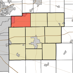 Location in Hancock County | |
| Coordinates: 39°54′25″N 85°52′17″W / 39.90694°N 85.87139°WCoordinates: 39°54′25″N 85°52′17″W / 39.90694°N 85.87139°W | |
| Country | United States |
| State | Indiana |
| County | Hancock |
| Government | |
| • Type | Indiana township |
| Area | |
| • Total | 31.33 sq mi (81.1 km2) |
| • Land | 31.26 sq mi (81.0 km2) |
| • Water | 0.07 sq mi (0.2 km2) 0.22% |
| Elevation | 863 ft (263 m) |
| Population (2010) | |
| • Total | 11,005 |
| • Density | 352.1/sq mi (135.9/km2) |
| GNIS feature ID | 0453955 |
Vernon Township is one of nine townships in Hancock County, Indiana, United States. As of the 2010 census, its population was 11,005 and it contained 4,322 housing units.[1]
History
Vernon Township was organized in 1836.[2] It was named after Mount Vernon, the plantation home of President George Washington.[3]
Geography
According to the 2010 census, the township has a total area of 31.33 square miles (81.1 km2), of which 31.26 square miles (81.0 km2) (or 99.78%) is land and 0.07 square miles (0.18 km2) (or 0.22%) is water.[1]
Cities and towns
Unincorporated towns
- Colonial Village
- Denny Corner
- Eastgate
- Helmcrest
- Woodbury
(This list is based on USGS data and may include former settlements.)
Adjacent townships
- Green Township, Madison County (northeast)
- Green Township (east)
- Center Township (southeast)
- Buck Creek Township (south)
- Lawrence Township, Marion County (west)
- Fall Creek Township, Hamilton County (northwest)
Cemeteries
Vernon Township contains four cemeteries: Gillium-Chappel, McCordsville, Cauldwell-Brokaw, and the Caudell-Simmons
Major highways
-
 U.S. Route 36
 -
 Indiana State Road 13
 -
 Indiana State Road 67
 -
 Indiana State Road 234
 -
 Indiana State Road 238 Now called Southeastern Parkway
References
- ↑ 1.0 1.1 "Population, Housing Units, Area, and Density: 2010 - County -- County Subdivision and Place -- 2010 Census Summary File 1". United States Census. Retrieved 2013-05-10.
- ↑ Richman, George J. (1916). History of Hancock County, Indiana: Its People, Industries and Institutions. Wm. Mitchell Printing Company. p. 783.
- ↑ Binford, John H. (1882). History of Hancock County, Indiana: From Its Earliest Settlement by the "pale Face," in 1818, Down to 1882. King & Binford. p. 311.
External links
| |||||||||||||||||||||||||||||