Verneuil-en-Bourbonnais
| Verneuil-en-Bourbonnais | ||
|---|---|---|
|
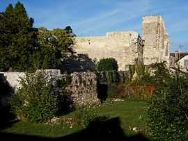
Ruins of the chateau | ||
| ||
 Verneuil-en-Bourbonnais | ||
|
Location within Auvergne region  Verneuil-en-Bourbonnais | ||
| Coordinates: 46°20′51″N 3°15′09″E / 46.3475°N 3.2525°ECoordinates: 46°20′51″N 3°15′09″E / 46.3475°N 3.2525°E | ||
| Country | France | |
| Region | Auvergne | |
| Department | Allier | |
| Arrondissement | Moulins | |
| Canton | Saint-Pourçain-sur-Sioule | |
| Intercommunality | Pays Saint-Pourcinois | |
| Government | ||
| • Mayor (2008–2014) | Gérard Chegut | |
| Area1 | 14.14 km2 (5.46 sq mi) | |
| Population (2008)2 | 245 | |
| • Density | 17/km2 (45/sq mi) | |
| INSEE/Postal code | 03307 / 03500 | |
| Elevation | 234–356 m (768–1,168 ft) | |
|
1 French Land Register data, which excludes lakes, ponds, glaciers > 1 km² (0.386 sq mi or 247 acres) and river estuaries. 2 Population without double counting: residents of multiple communes (e.g., students and military personnel) only counted once. | ||

Verneuil-en-Bourbonnais is a commune in the Allier department in Auvergne in central France.
Population
| Historical population | ||
|---|---|---|
| Year | Pop. | ±% |
| 1962 | 259 | — |
| 1968 | 329 | +27.0% |
| 1975 | 290 | −11.9% |
| 1982 | 250 | −13.8% |
| 1990 | 280 | +12.0% |
| 1999 | 283 | +1.1% |
| 2008 | 245 | −13.4% |
See also
References
| Wikimedia Commons has media related to Verneuil-en-Bourbonnais. |