Valapattanam
| Valapattanam | |
|---|---|
| city | |
|
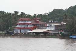
Muthappan Temple on the banks of the Valapattanam river | |
 Valapattanam Location in Kerala, India | |
| Coordinates: 11°54′N 75°22′E / 11.9°N 75.37°ECoordinates: 11°54′N 75°22′E / 11.9°N 75.37°E | |
| Country |
|
| State | Kerala |
| District | Kannur |
| Elevation | 6 m (20 ft) |
| Population (2001) | |
| • Total | 8,369 |
| Languages | |
| • Official | Malayalam, English |
| Time zone | IST (UTC+5:30) |
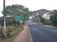
Valapattanam is a small town in the Kannur district, located in the Indian state of Kerala. It is also the smallest panchayath in kerala.Its area is 2.04 sqr Km. It is about 7 km north of Kannur. Valapattanam is an important Muslim settlement area in Kannur. Valapattanam is known for its communal harmony. On one side Kalarivathukkal Temple is located and on the other bank there is "Kakkulangara Mosque". The long vision of the social leaders and people on the whole has made Valapattanam a land of communal harmony.
This town is also known as Balyapattanam. This town is in the on the banks of Valapattanam river. This town is well known for its wood-based industries and timber trade. Centuries back Valapattanam River (puzha) was the main ship route for trading and Valapattanam was the main town, because of this the town got this name. "Valya pattanam" means "big town" in Malayalam language though it is the smallest panchayath in Kerala.
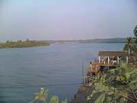
The port of Azhikkal is located nearby. In the bank of Valapattanam river you see Western India Plywoods Ltd., the largest wood-based industry in the country and which was the biggest plywood factory in Asia till few years back. The famous Muthappan temple is in the bank of Valapattanam river.
History
This town is named after its historical founder Vallabha II of the Mooshika dynasty (Kolathiri family) and was originally known as Vallabha-Pattanam [1] and served as the capital of the Mooshika dynasty during the medieval ages. The fourteenth-century narrative of Ibn Battuta refers to the ruler of Ezhimala as residing at Baliapatanam [2] and offers a clue that by this time, the centre of the political authority had shifted from Ezhimala to Baliapatanam. In the sixteenth century AD, a Portuguese official Duarte Barbosa also mentions Baliapatanam (Baliapatam in European records) as the residence of the ‘king of Cannanore’.
Valapattanam is a strong bastion of the UDF and its ally IUML. It is part the Azhkkodu Legislative assembly constituency where K.M. Shaji of UDF won in the 2011 assembly elections.
Geography
Valapattanam is located at 11°54′N 75°22′E / 11.9°N 75.37°E.[3] It has an average elevation of 6 metres (19 feet).Valapattanam is a strong bastion of Indian Union Muslim League
Valapattnam is an important tourist destination in Kannur district.
Demographics
As of 2001 India census,[4] Valapattanam had a population of 8369. Males constitute 50% of the population and females 50%. Valapattanam has an average literacy rate of 81%, higher than the national average of 59.5%: male literacy is 83%, and female literacy is 79%. In Valapattanam, 14% of the population is under 6 years of age.
Images
-
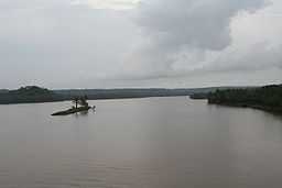
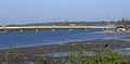
A view of Valapattanam river from Parassinikkadavu Bridge.
-
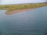
thumb|Mangroves on the banks of Valapattanam River.
-
thumb|A view of Valapattanam river from the bridge built across it.
-
Valapattanam bridge from train
Valapattanam Punchayat is rated among the best panchayats in Kerala.The development activities of the panchayat has been commended by both the district and state authorities,as well as the public at large.
See also
- Muthappan temple
- Sree Muthappan
- Kannur
References
- ↑ Ezhimala: the abode of the Naval Academy by Murkot Ramunny in 1993, Northern Book Centre, New Delhi
- ↑ The Rehla of Ibn Battuta (India, Maldive Islands and Ceylon), tr. and commentary by Mahdi Husain (Baroda: Oriental Institute, 1953), 186
- ↑ Falling Rain Genomics, Inc - Valapattanam
- ↑ "Census of India 2001: Data from the 2001 Census, including cities, villages and towns (Provisional)". Census Commission of India. Archived from the original on 2004-06-16. Retrieved 2008-11-01.