Vakarel Saddle

Vakarel Saddle (Bulgarian: Вакарелска седловина, ‘Vakarelska Sedlovina’ \va-ka-'rel-ska se-dlo-vi-'na\) is a crescent-shaped ice-covered saddle of elevation 1800 m in Imeon Range on Smith Island in the South Shetland Islands, Antarctica bounded by Antim Peak to the east-northeast, and Evlogi Peak to the southwest, and overlooking Chuprene Glacier to the northwest. The feature is named after the settlement of Vakarel in western Bulgaria.
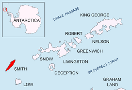
Location
The midpoint of the saddle is located at 62°59′07.5″S 62°31′49.5″W / 62.985417°S 62.530417°WCoordinates: 62°59′07.5″S 62°31′49.5″W / 62.985417°S 62.530417°W, which is 710 m southwest of Antim Peak, 5.59 km south by east of Markeli Point, 1.56 km northeast of Mount Foster, and 4.84 km north of Ivan Asen Point (Bulgarian mapping in 2009).
Map
- L.L. Ivanov. Antarctica: Livingston Island and Greenwich, Robert, Snow and Smith Islands. Scale 1:120000 topographic map. Troyan: Manfred Wörner Foundation, 2009. ISBN 978-954-92032-6-4
References
- SCAR Composite Antarctic Gazetteer
- Bulgarian Antarctic Gazetteer. Antarctic Place-names Commission of Bulgaria.
This article includes information from the Antarctic Place-names Commission of Bulgaria which is used with permission.