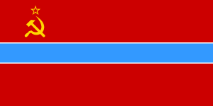
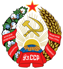
Uzbek Soviet Socialist Republic
| Uzbek Soviet Socialist Republic | ||||||
| Узбекская Советская Социалистическая Республика Ўзбекистон Совет Социалистик Республикаси | ||||||
| ||||||
| ||||||
| Motto Butun dunyo proletarlari, birlashingiz! Бутун дунё пролетарлари, бирлашингиз! "Workers of the world, unite!" | ||||||
| Anthem Anthem of the Uzbek Soviet Socialist Republic | ||||||
 Location of the Uzbek SSR within the Soviet Union. | ||||||
| Capital | Samarkand (1924–1930) Tashkent (1930–1991) | |||||
| Languages | Uzbek, Russian | |||||
| Government | Soviet Socialist Republic | |||||
| First Secretary | ||||||
| - | 1925–1927 (first) | Vladimir Ivanov | ||||
| - | 1989–1991 (last) | Islam Karimov | ||||
| Head of government | ||||||
| - | 1924–1937 (first) | Fayzulla Khodzhayev | ||||
| - | 1990–1990 (last) | Shukrullo Mirsaidov | ||||
| Legislature | Supreme Soviet | |||||
| History | ||||||
| - | Established | 27 October 1924 | ||||
| - | Disestablished | 25 December 1991 | ||||
| Area | ||||||
| - | 1989 | 447,400 km² (172,742 sq mi) | ||||
| Population | ||||||
| - | 1989 est. | 19,906,000 | ||||
| Density | 44.5 /km² (115.2 /sq mi) | |||||
| Calling code | +7 36/37/436 | |||||
| Today part of | | |||||
The Uzbek Soviet Socialist Republic (Uzbek: Ўзбекистон Совет Социалистик Республикаси, Oʻzbekiston Sovet Sotsialistik Respublikasi; Russian: Узбекская Советская Социалистическая Республика, Uzbekskaya Sovetskaya Sotsialisticheskaya Respublika), also known as the Uzbek SSR, was one of the republics of the Soviet Union. It was created in 1924. In December 1991, it became independent as the Republic of Uzbekistan.
History
In 1925, the borders of political units in Central Asia were changed along ethnic lines determined by Vladimir Lenin’s Commissar for Nationalities, Joseph Stalin. The Turkestan ASSR, the Bukharan People's Republic, and the Khorezm People's Republic were abolished and their territories were divided into eventually five separate Soviet Socialist Republics, one of which was the Uzbek Soviet Socialist Republic (Uzbek SSR), created on 27 October 1924. The next year the Uzbek SSR became one of the republics of the Union of Soviet Socialist Republics (Soviet Union).
The Uzbek SSR included the Tajik ASSR until 1929, when the Tajik ASSR was upgraded to an equal status. In 1930, the Uzbek SSR capital was relocated from Samarkand to Tashkent. In 1936, the Uzbek SSR was enlarged with the addition of the Karakalpak ASSR taken from the Kazakh SSR in the last stages of the national delimitation in the Soviet Union. Further bits and pieces of territory were transferred several times between the Kazakh SSR and the Uzbek SSR after World War II.
In 1928, the collectivization of land into state farms was initiated, which lasted until the late 1930s.
In 1937–38, during the Great Purge, a number of alleged nationalists were executed, including Faizullah Khojaev, the first prime minister.

During World War II, many industries were relocated to the Uzbek SSR from vulnerable locations in western regions of the USSR to keep them safe. Large numbers of Russians, Ukrainians and other nationalities accompanied the factories, altering the demographics of the republic. The demographics situation was further aggravated by Stalin’s relocation of some ethnic groups suspected of collaboration with the Axis powers from other parts of the USSR to the Uzbek SSR. This included large numbers of ethnic Koreans, Crimean Tatars, and Chechens.
During the Soviet period, Islam became a focal point for the antireligious drives of Communist authorities. The government closed most mosques, and religious schools became anti-religious museums. On the positive side was the virtual elimination of illiteracy, even in rural areas. Only a small percentage of the population was literate before 1917; this percentage increased to nearly 100 percent under the Soviets.
Another major development, one with future catastrophic impact, was the drive initiated in the early 1960s to substantially increase cotton production in the republic. This drive led to overzealous irrigation withdrawals of irrigation water from the Amu Darya and the subsequent Aral Sea ecological disaster.
The Communist Party was the only legal party in the Uzbek SSR until 1990. The first secretary, or head, of the Communist Party of Uzbekistan was consistently an Uzbek. Long-time leader of the Uzbek SSR was Sharof Rashidov, head of the Communist Party of Uzbekistan from 1959 to 1983. Islam Karimov, leader of the Communist Party of Uzbekistan since 1989 and subsequently head of that party's reincarnation, the People's Democratic Party (PDP), became president of the Uzbek SSR in 1990.
On 1 September 1991, the Uzbek SSR was renamed Republic of Uzbekistan, formally remaining a part of the Soviet Union until 26 December 1991. With the final collapse of the Soviet Union, the Uzbek SSR became the independent nation of Uzbekistan. Karimov has been its President ever since.
Geography
Climate
Uzbekistan experiences such climatic features of continental subtropical regions as extended, dry, torrid summers, cool, moist falls, and mild winters with little snow. On the plains and in the low foothill regions, winters last from ½ to two months in the extreme south to five months in the extreme north (Ustiurt Plateau). The average January temperature is approximately –8 °C (Churuk weather station on the Ustiurt Plateau); the average is 2.8 °C in Termez and 3.6”C in Sherabad, both of which are in the extreme south. The lowest temperature in winter is –37 °C (Churuk). The average July temperature approaches 26 °C in the northern regions and exceeds 30 °C in the south; at elevations of 3,000 m, the July average is approximately 10 °C, in places exceeding 15 °C–16 °C. The maximum temperature on the plains and in the foothill regions is 42 °C. During the summer, the daytime temperature of the soil surface reaches 60 °C, climbing to 70 °C in the deserts.
The plains receive the least amount of precipitation, only 80–90 mm a year. To the east and south, the quantity of precipitation increases with elevation; the increase is at first slow, but as the mountains are approached it becomes more rapid. In places, the yearly total in the mountains exceeds 890–1,000 mm. More than 70 percent of the precipitation falls in winter (as rain and snow) and spring. A snow cover forms nearly every year, but on the plains and in the foothills it lasts only a few days. Its thickness varies from several cm in the west (plains and foothills) to 60–80 cm in the east (foothills and moutains); in some mountainous regions it exceeds 100 cm. In winter, the prevailing winds on the plains are northeasterly, easterly, and southeasterly; in summer, northwesterly, northerly, and northeasterly winds predominate. Mountain and valley winds and katabatic winds arise in the mountains. Glaciation. There are small glaciers in Uzbekistan on the upper course of the Kashkadar’ia (Severtsova, Batyrbai) and in the drainage basin of the Pskem River (47 glaciers). The glaciers on the upper Naryn and Karadar’ia rivers (headstreams of the Syr Daria), the numerous glaciers of the Alai and Turkestan ranges, and the thick glaciers of the Pamirs provide much of the water for Uzbekistan’s rivers.
Rivers and lakes
The distribution of rivers in Uzbekistan is extremely uneven. The region of plains has few rivers. Debouching onto the plains, the rivers lose their waters to irrigation, seepage, and evaporation; gradually drying up, they often terminate in alluvial deposits. The mountains are drained by a well-developed network of streams. The total capacity of the streams is 7.1 million kilowatts (kW), and the potential exists to produce 107 billion kilowatt-hours (kW-hr) annually. All of the rivers in Uzbekistan are part of the drainage basins of the Amu Darya and Syr Darya. Most of the rivers are fed by snow and glaciers, with maximum discharge in June. Each year, the drainage basin of the Amu Darya delivers 79 cu km of water to the plains, a figure representing one-half of the total discharge from the mountainous region of Middle Asia. Of this amount, 6 cu km (8 percent of the total discharge from the drainage basin of the Amu Darya) comes from the mountainous region of Uzbekistan. The most important river of Uzbekistan is the Syr Darya. Its annual discharge is 38 cu km, of which approximately 4 cu km (10 percent) comes from sources within Uzbekistan. Most of the tributaries of the Syr Darya do not actually reach the river because they lose their water to irrigation. Lakes are located primarily in the valleys and deltas of the larger rivers and along the periphery of irrigated oases. The largest lake is the Aral Sea. Lakes created as reservoirs include the Kattakurgan, Kairakkum, Chardara, Kuiumazar, Kasansai, Ti-uiabuguz (“Tashkent Sea”), and Charvak.
Soil
Sandy soils predominate in the Kyzylkum Desert. In the interior, on the alluvial cones and degraded landmasses, there are gray-brown soils, with takyrs and takyr soils in the basins. The sierozems found in the foothills and low mountains include light sierozems (from 250 to 400 m), conventional sierozems (400–700 m), and dark sierozems (700–1,200 m). Higher up, on mountains of medium height (1,200–2,800 m), there are cinnamon-colored and brown mountain-forest soils, and at elevations greater than 2,800 m, there are light brown meadow-steppe soils. Among these automorphic soils, hydromorphic soils, such as solonchaks, meadow soils, meadow-bog soils, and bog soils, are encountered in poorly drained piedmont plains and river valleys, as are such semihydromorhic soils (with certain attributes of automorphic and hydromorphic soils) as sierozem-meadow and desert-meadow soils. Irrigated soils make up a distinct type.[1]
Subdivisions
List of changes
- 1924-10-27 creation of Uzbek Soviet Socialist Republic
- 1929-10-15 Tajik Autonomous Soviet Socialist Republic[2] and a region around Khujand/Khodzhent split off and become the Tajik Soviet Socialist Republic
- 1936-12-05 Karakalpak Autonomous Soviet Socialist Republic was joined to the Uzbek SSR
- 1963-02-16 Syr Darya Oblast (center: Gulistan) is formed. "In 1973 a large part of the oblast’s territory was transferred to the newly formed Dzhizak Oblast"[3]
- 1973-12-29: Dzhizak Oblast split from Samarkand Oblast,[4] Ru WP: Dzhizak is formed
- ca. 1981: Navoiy Oblast split from Bukhara Oblast[5]
- 1982-04-20 Ru WP Navoiy Oblast is formed
1927


- Khorezm Okrug (cap: Khiva)
- Kanimekh Raion (cap.: Kanimekh)
- Bukhara
- Zeravshan Okrug (cap: Kermine)
- Kashka-Darin Okrug (cap: Bek-Budi)
- Samarkand
- Surkhan-Darshin Okrug (cap: Shirabad)
- Tashkent
- Khotshent
- Fergan Okrug (capital: Kokand)
- Andizhan
- Tajik ASSR
- Dushanbe
- Gorno-Badakhshan Autonomous Oblast (cap:Khoror)
1936
Constitution of the USSR:
ARTICLE 26. The Uzbek Soviet Socialist Republic consists of the Bukhara, Samarkand, Tashkent, Ferghana, and Khorezm Regions, and the Kara-Kalpak Autonomous Soviet Socialist Republic.[6]
1938

- Karakalpak Autonomous Soviet Socialist Republic (Nukus)
- Khorezm Oblast (cap: Urentsh)
- Bukhara Oblast
- Surkhan-Darshin Okrug (today: Surxondaryo Province)
- Samarkand Oblast (today: Samarkand Province, Jizzakh Province, Sirdaryo Province)
- Tashkent Oblast
- Fergana Oblast (capital: Fergana, today: Namangan Province, Andijan Province, Fergana Province)
1989

- Karakalpak ASSR
- Khorezm Oblast
- Bukhara Oblast
- Samarkand Oblast
- Kashkadar Oblast
- Surkhadar Oblast
- Dzhizak Oblast
- Syrdar Oblast
- Tashkent Oblast
- Andizhan Oblast
- Namangan Oblast
- Fergana Oblast
1991
References
- ↑ "Uzbek Soviet Socialist Republic". Great Soviet Encyclopedia.
- ↑ Uzbekistan Regions. Statoids.com.
- ↑ Syr Darya Oblast definition of Syr Darya Oblast in the Free Online Encyclopedia. Encyclopedia2.thefreedictionary.com.
- ↑ Uzbekistan Regions. Statoids.com.
- ↑ Uzbekistan Regions. Statoids.com.
- ↑ 1936 Constitution of the USSR, Part I. Departments.bucknell.edu.
External links
- Uzbekistan; Another Big Leap Forward by Afif Alimov
| |||||||||||||||||||||||||


